(Heli) Hiking Around Mt. Cook & Tasman Glacier
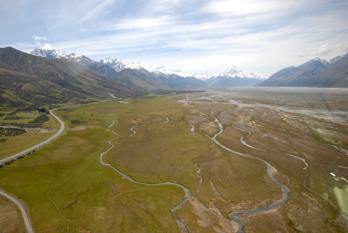
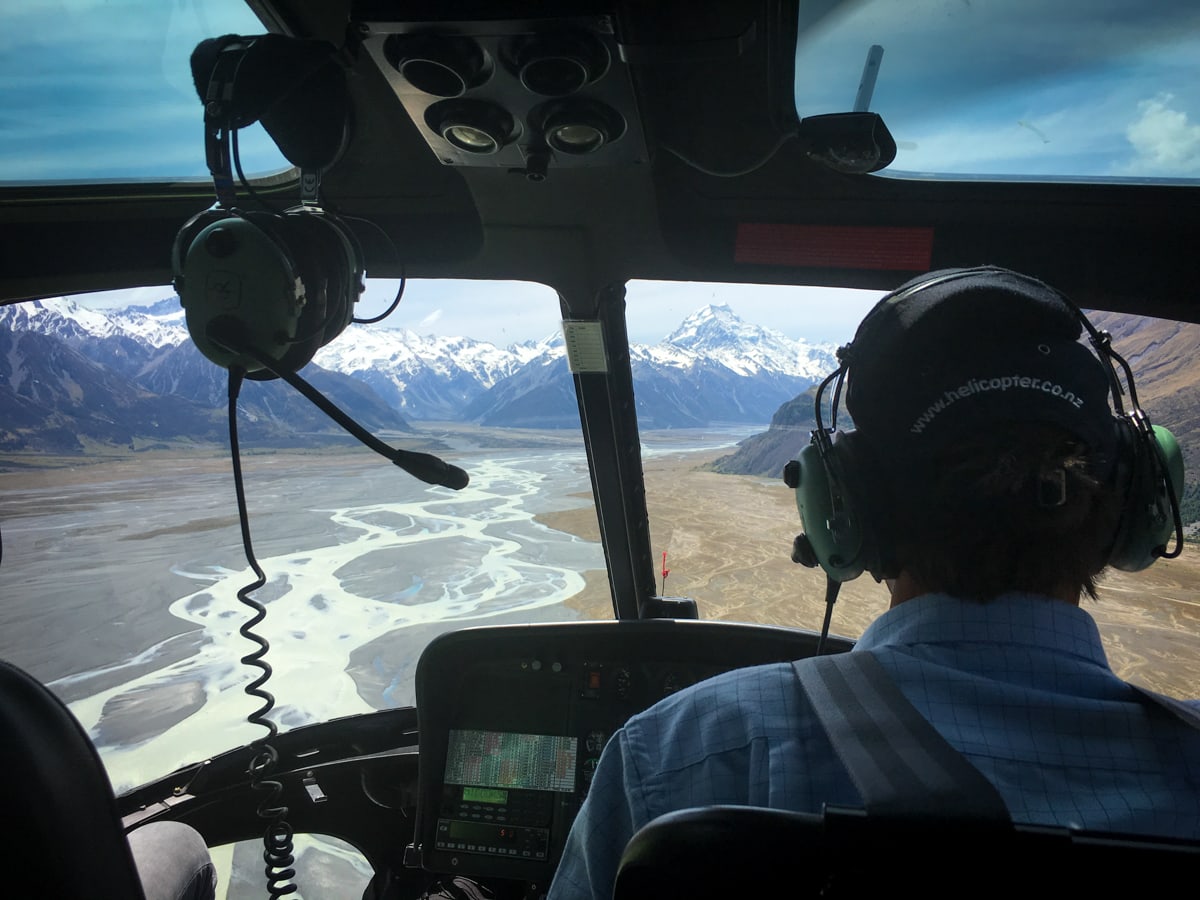
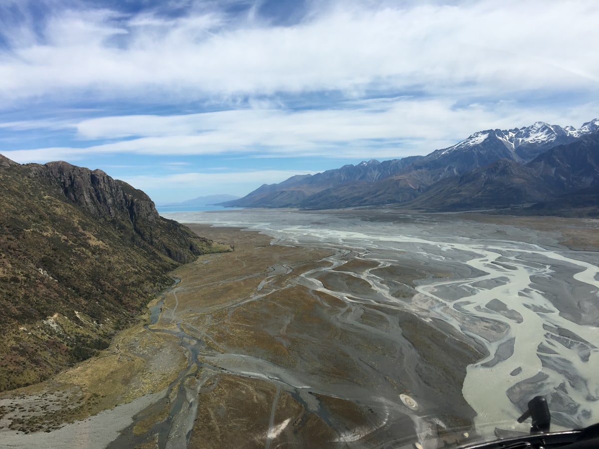
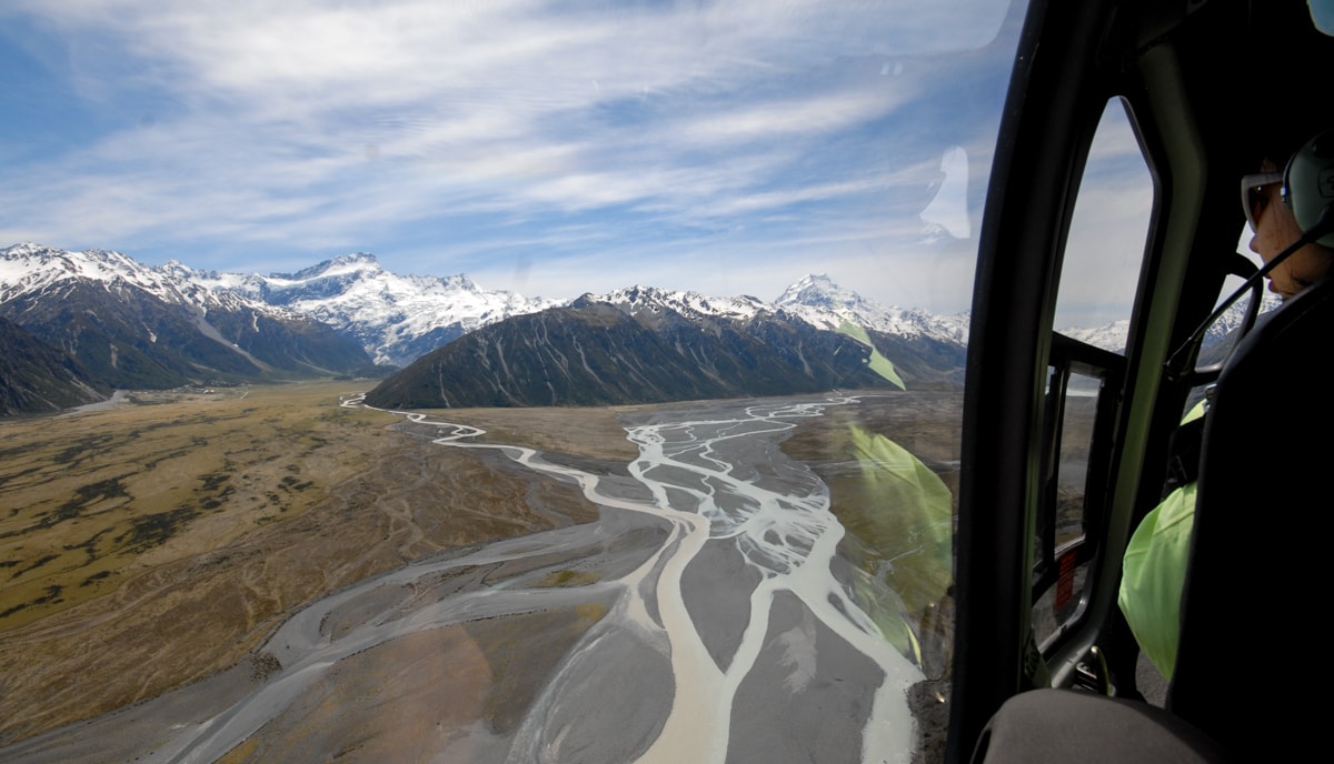
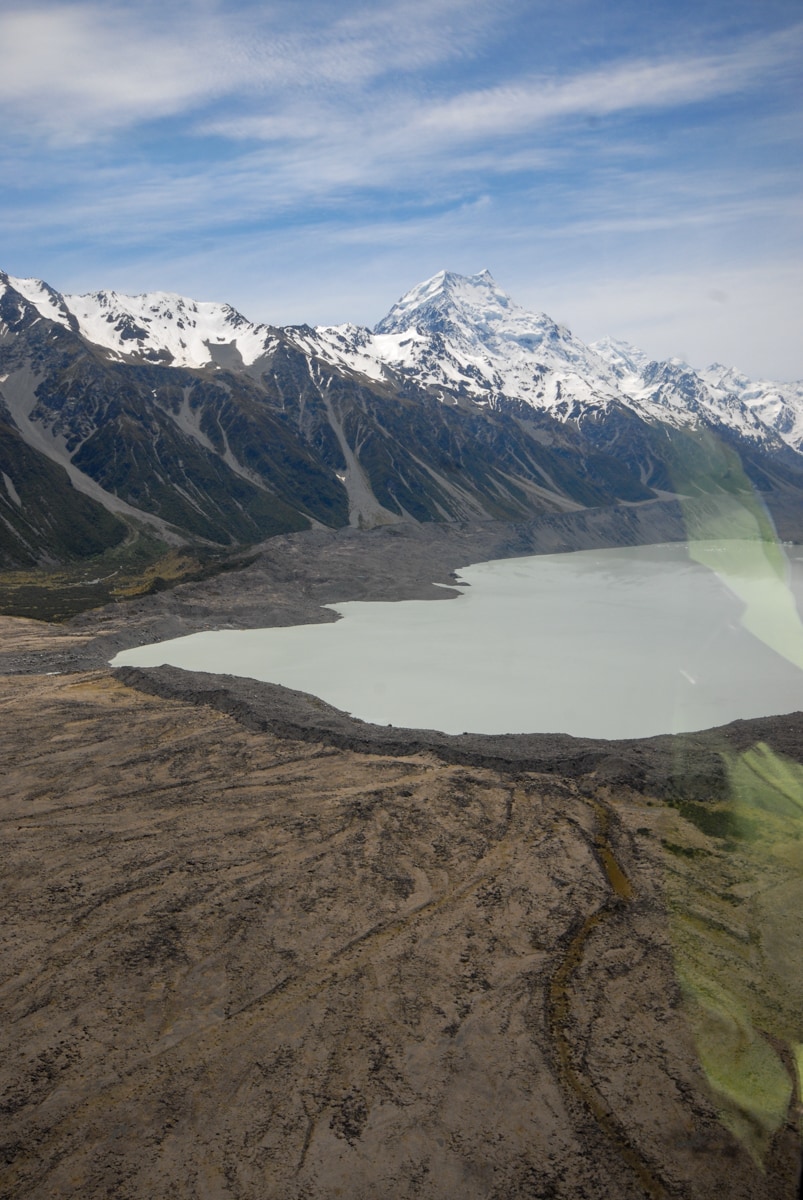
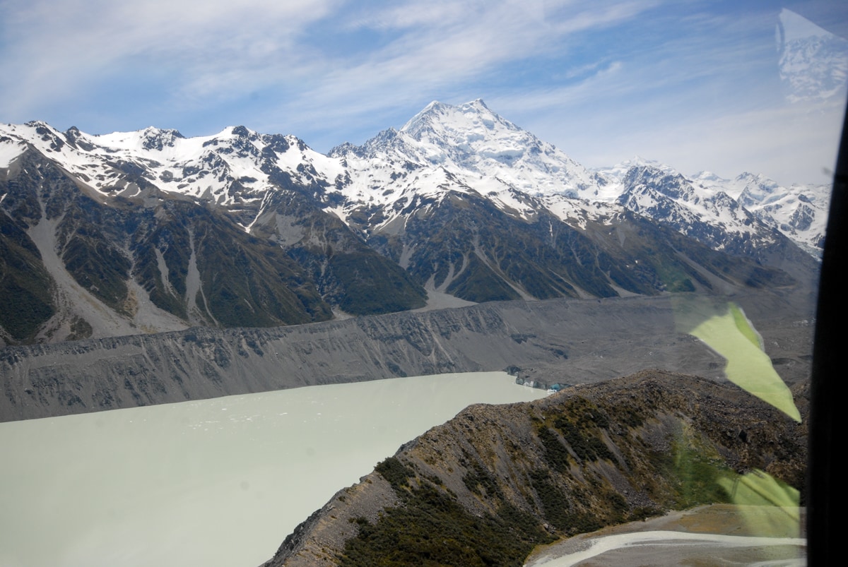
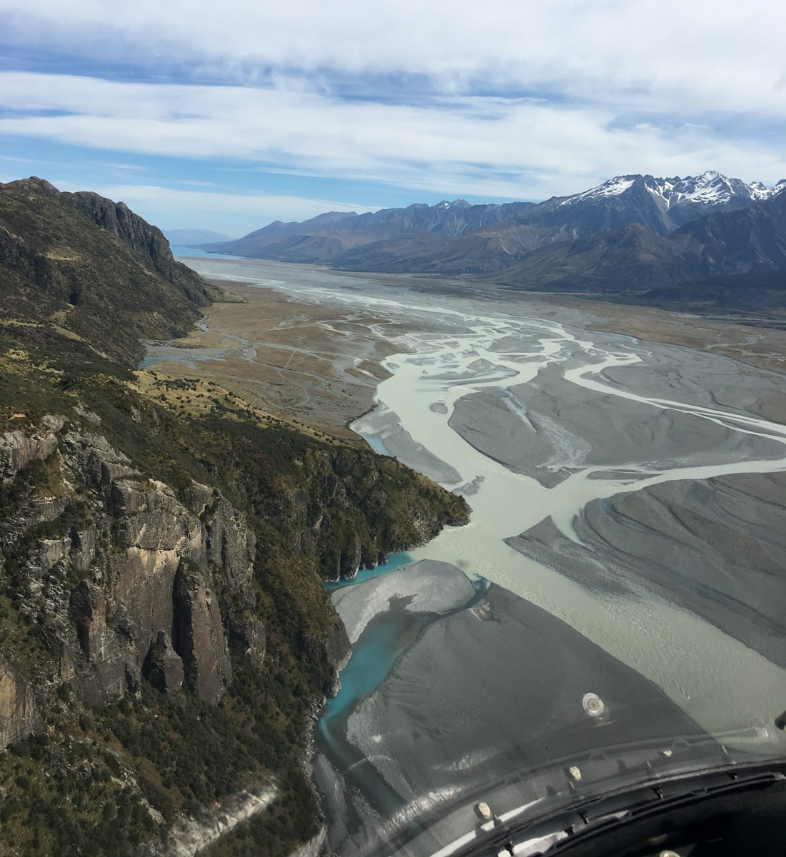
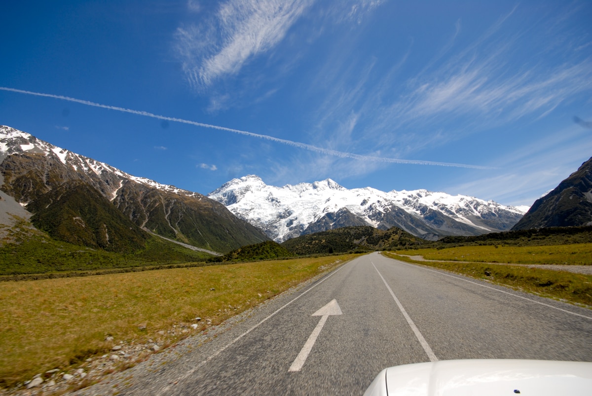
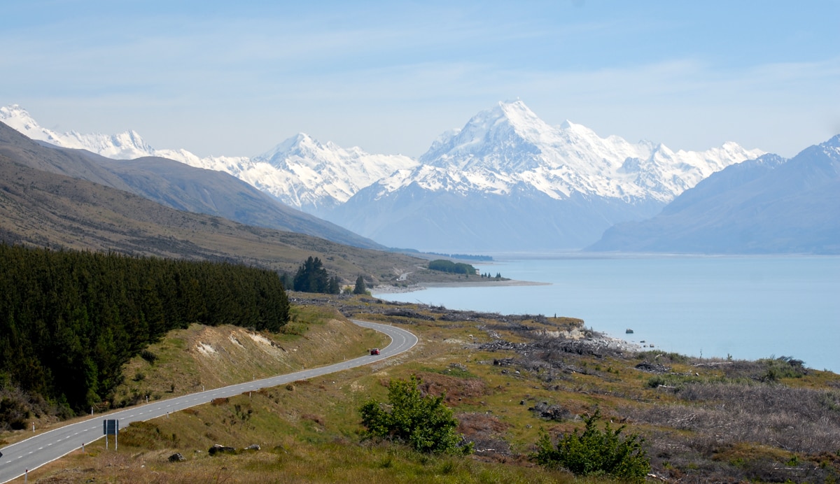
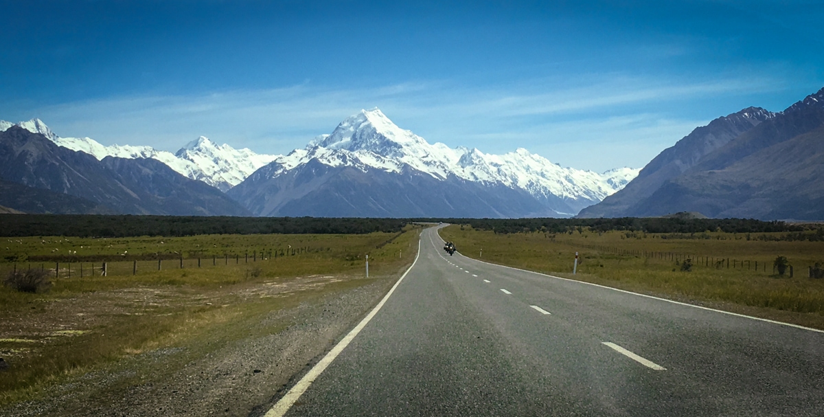
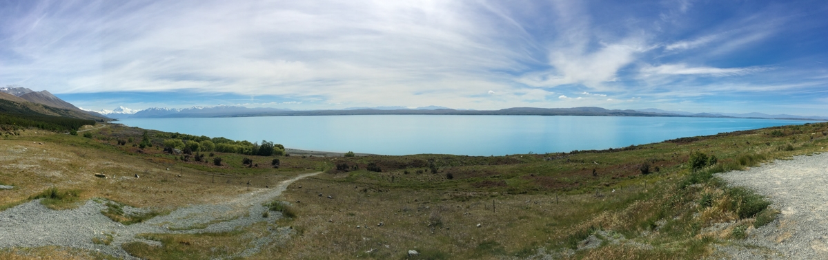
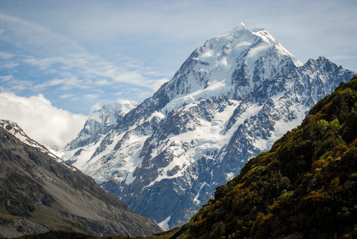
While there certainly aren’t as many helicopters as sheep in NZ, down in the South Island it still feels like we’ve been driving past helicopter flight signs at least daily. All the glacially carved scenery lends itself to flight tours, both because it’s super beautiful by air (see below – oh yea) and because it’s often difficult to access on the ground. The area around Mt. Cook, NZ’s highest mountain, is a perfect example: a long valley is straddled on both sides by mountain chains that rise abruptly from the valley floor.
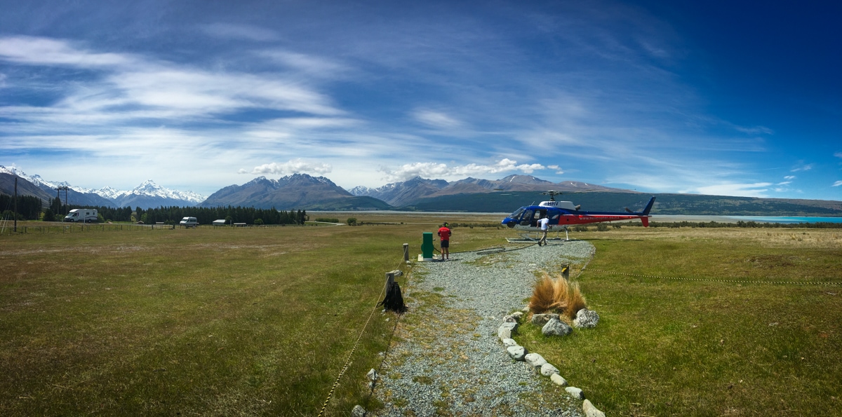
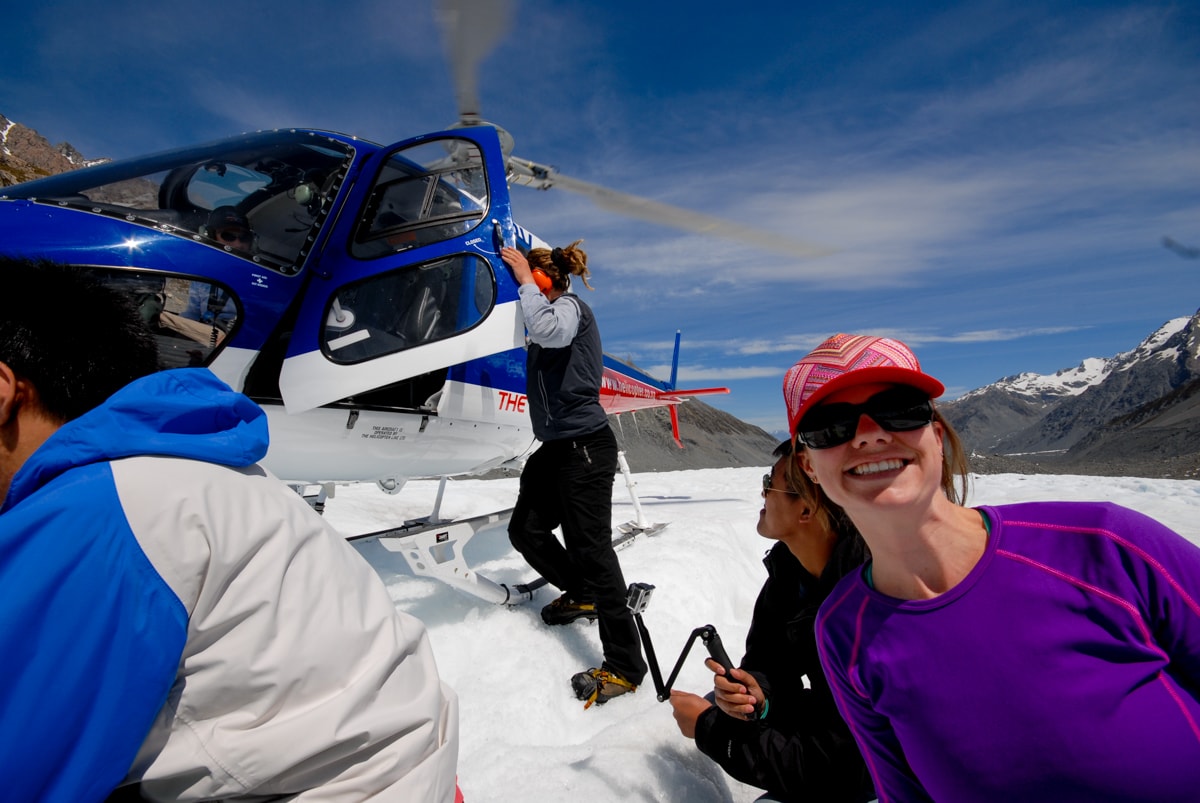
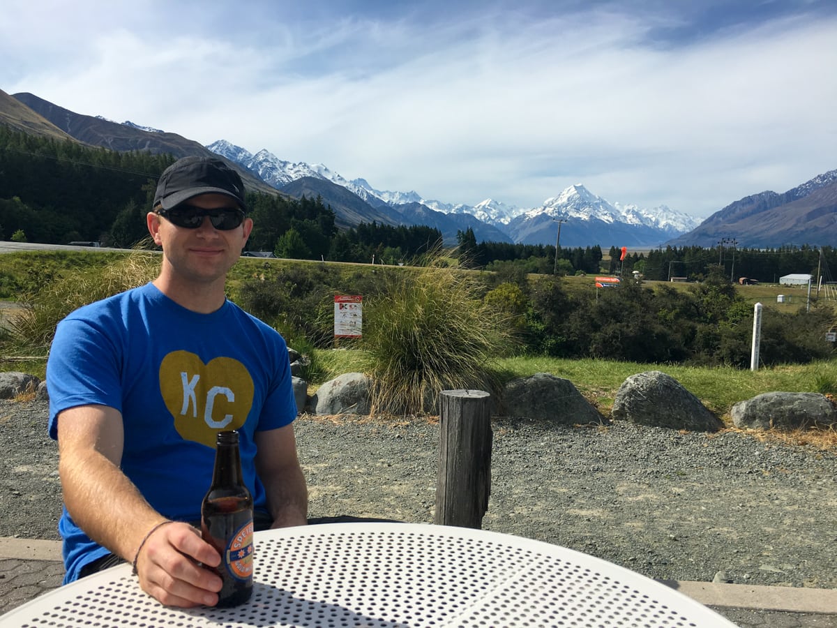
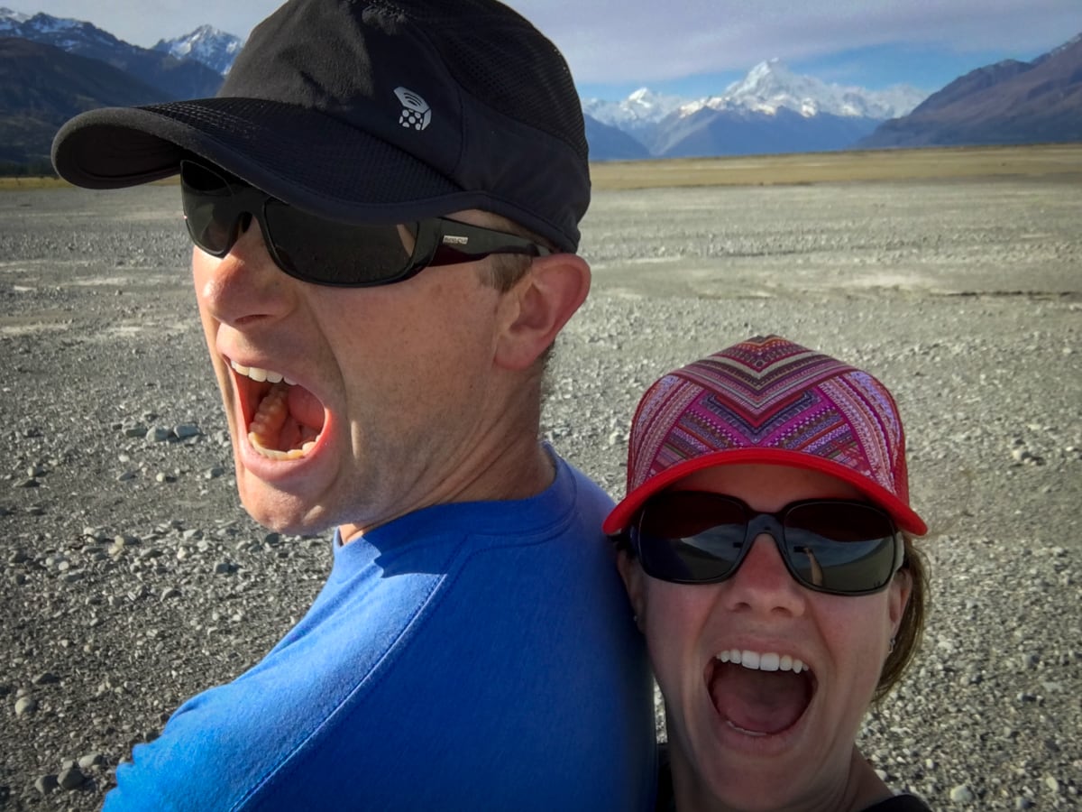
We’ve known from the start of our trip that we wanted to visit Mt. Cook, and since our West Coast deluge we knew that we’d need to pick a fair weather day to do so. While we watched the weather forecast from Wanaka, we were simultaneously trying to figure out the best time to reschedule a glacier heli hike that we’d missed due to weather while driving past the Franz Josef Glacier on the West Coast. (Definition time: a glacier heli hike is a round trip helicopter ride up onto a glacier where a glacier guide meets you for a couple hour hike on the ice.) We ended up combining these plans by booking a heli hike on Tasman Glacier while visiting Mt. Cook!
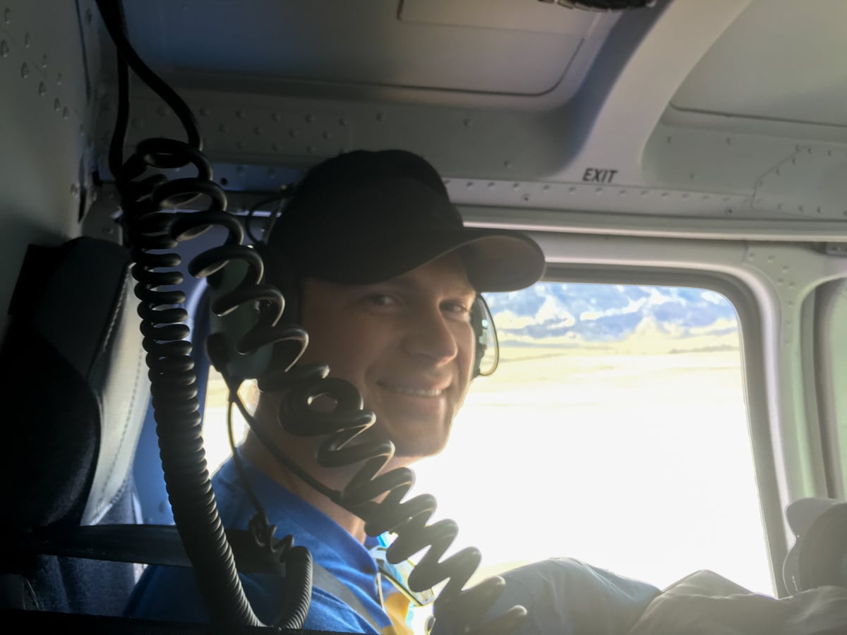
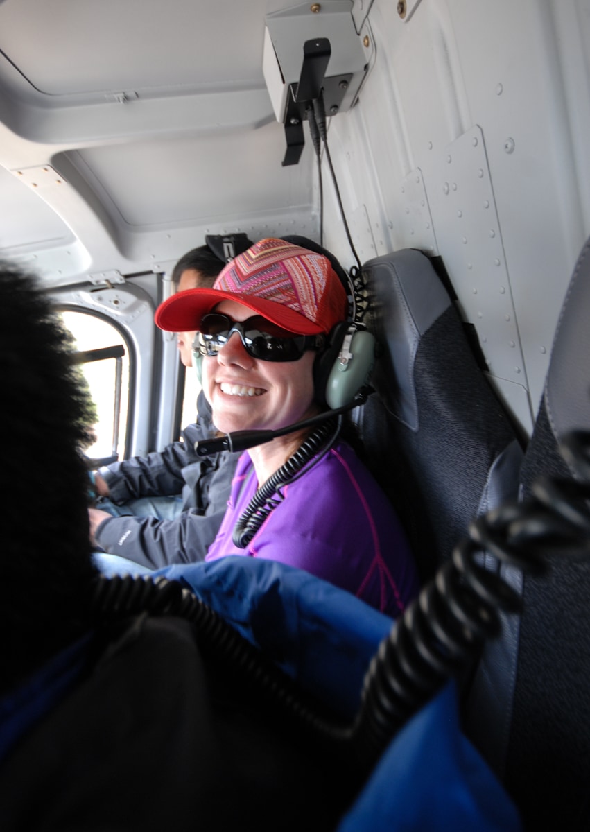
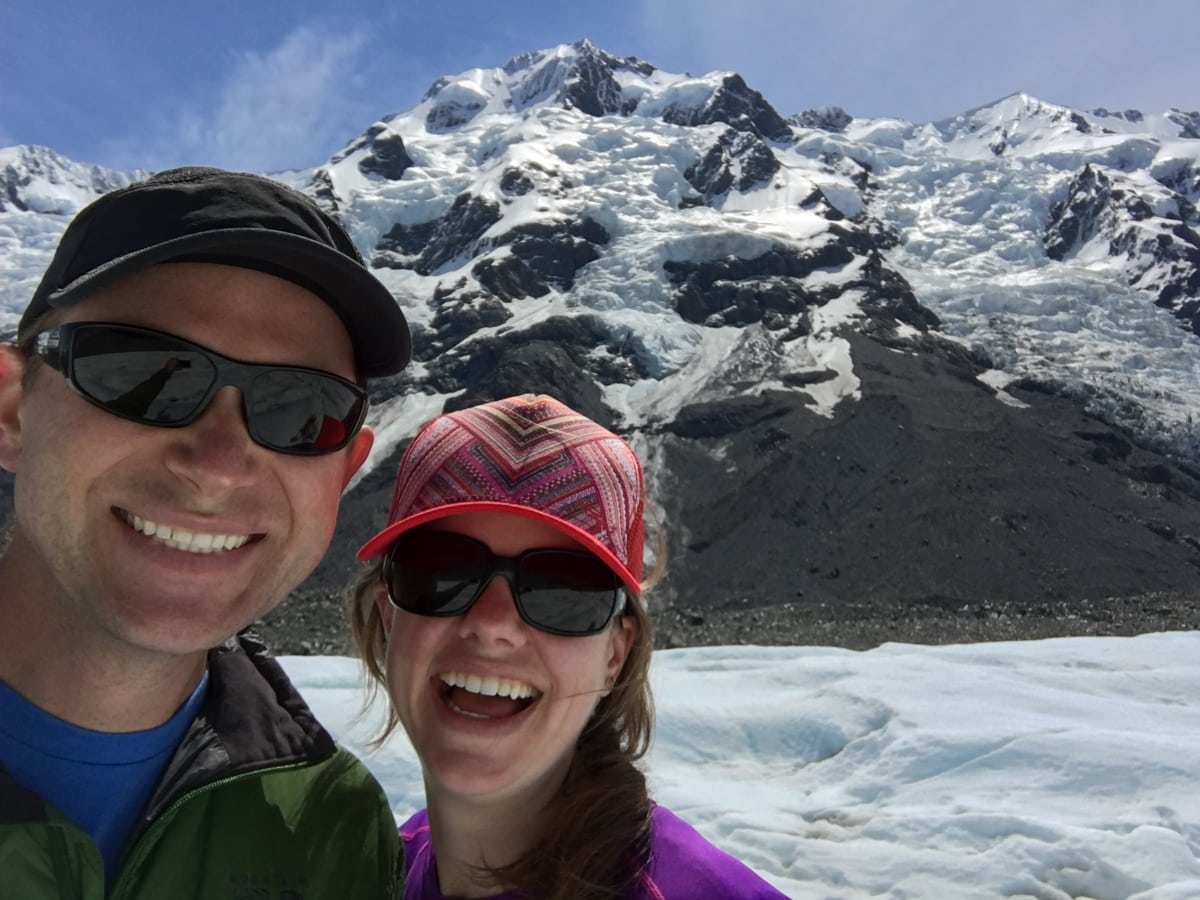
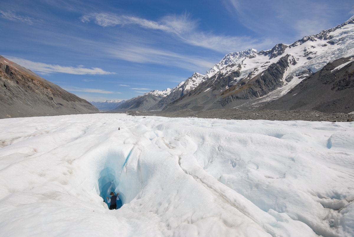
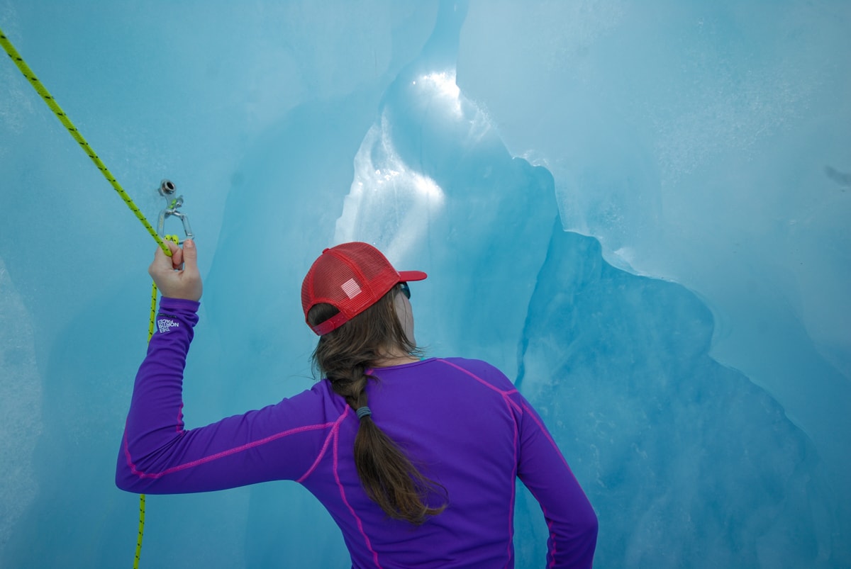
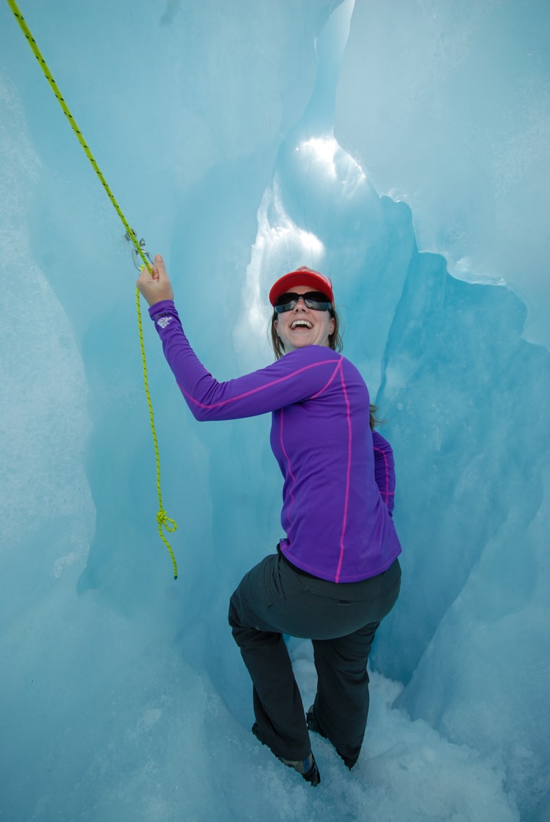
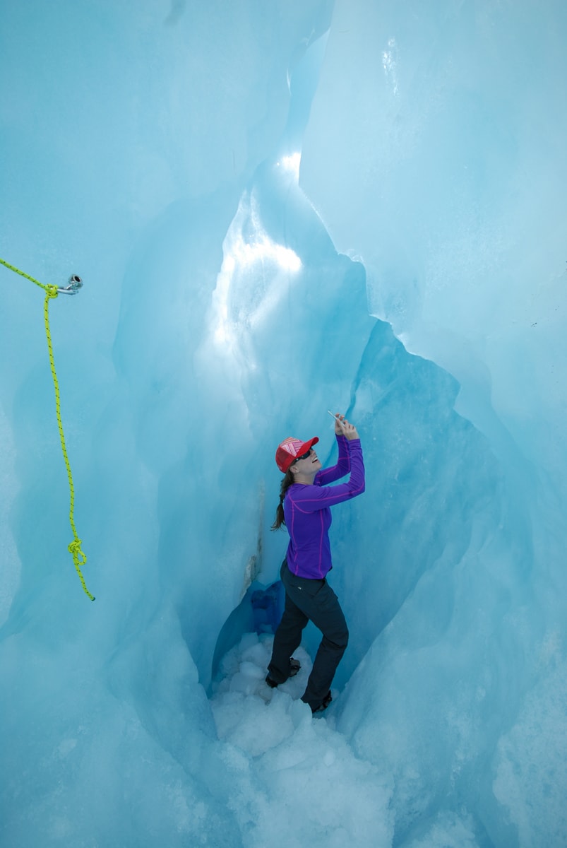
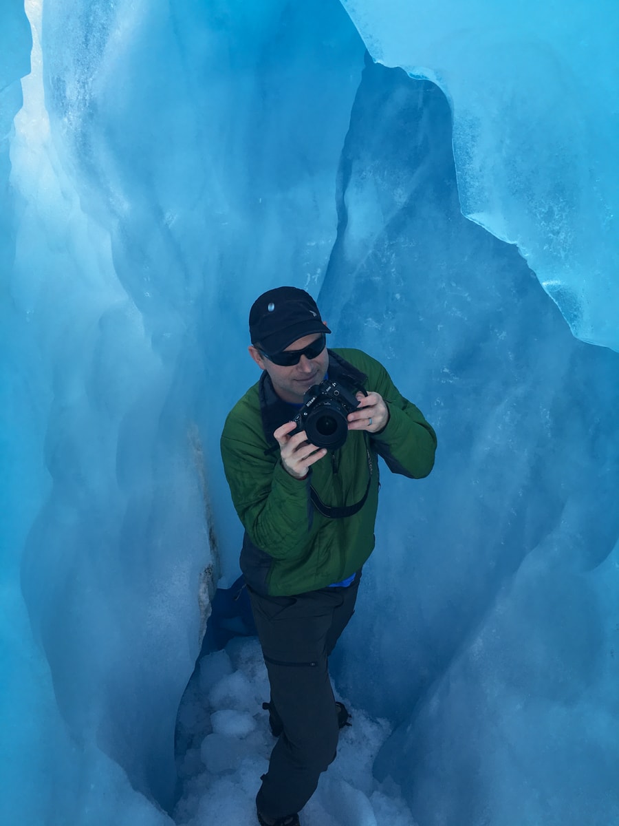
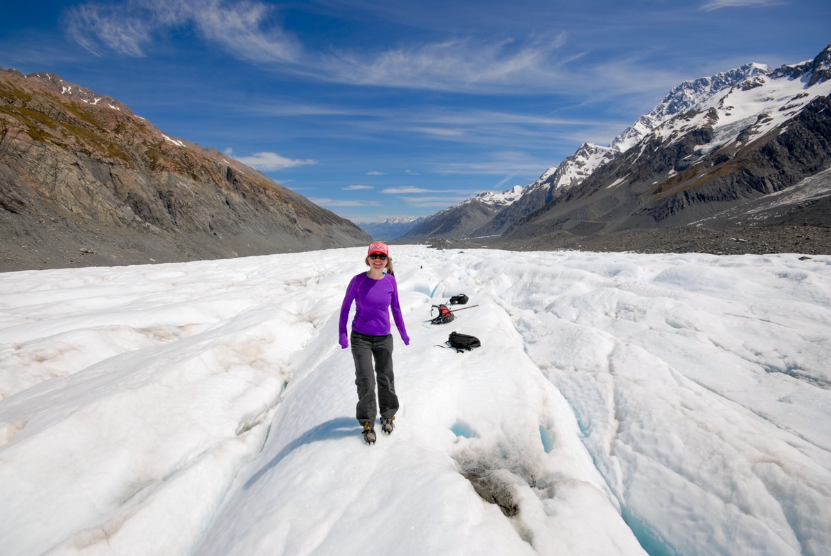
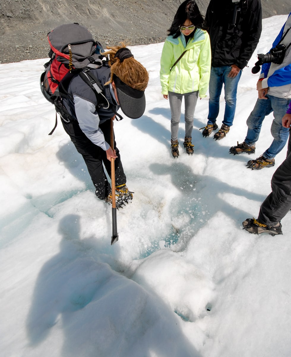
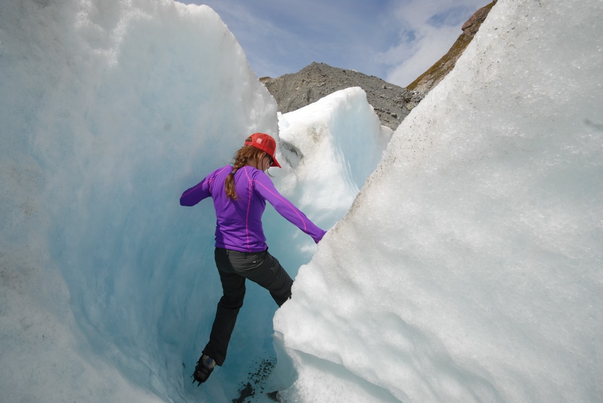
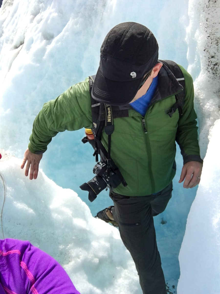
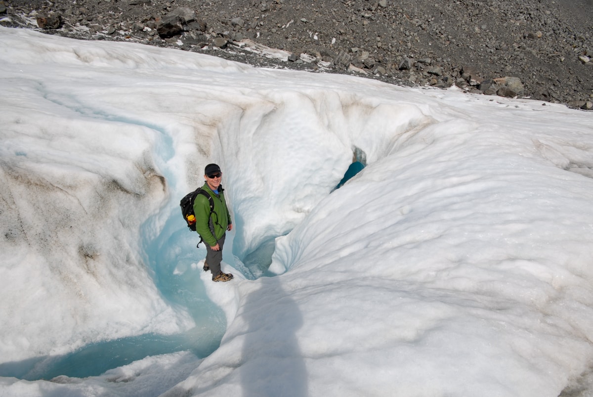
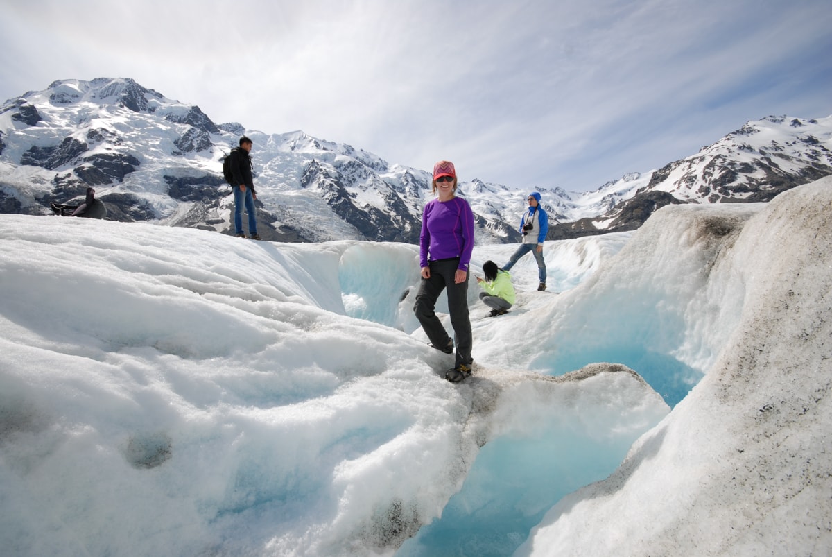
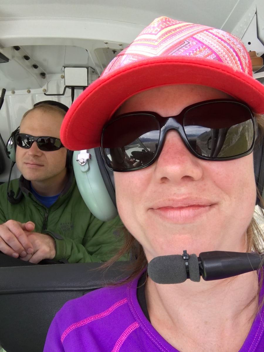
After being sized up for crampons and putting on tons of sunscreen, we jumped in a helicopter (awesome), took off (way better than the Star Wars flight simulator at Disney World), and flew up the Tasman Valley towards Mt. Cook and the Tasman Glacier. We met our guide, Anna, on the ice, and had an awesome two hours of low-key glacier travel and exploration.
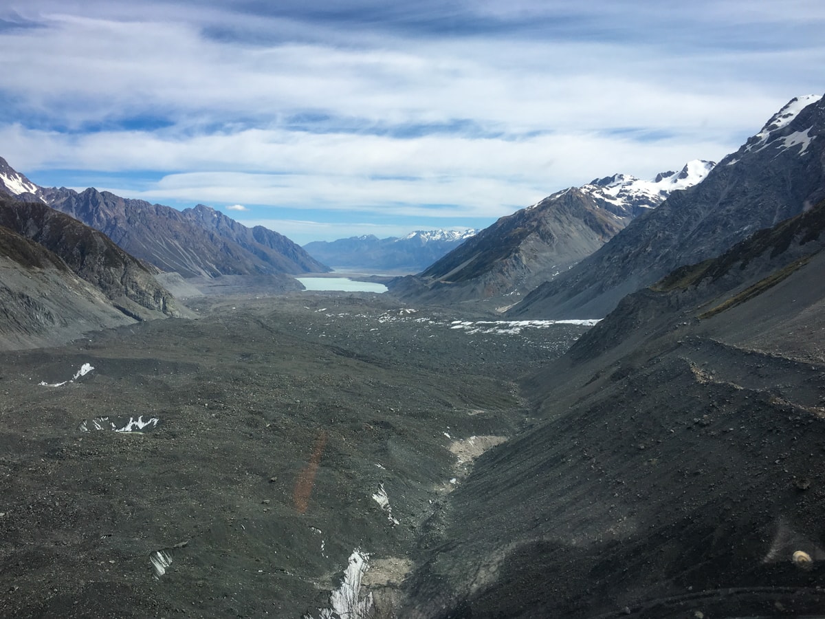
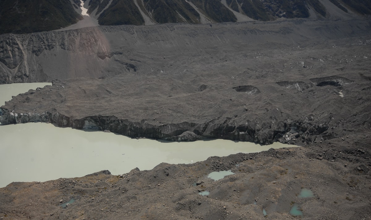
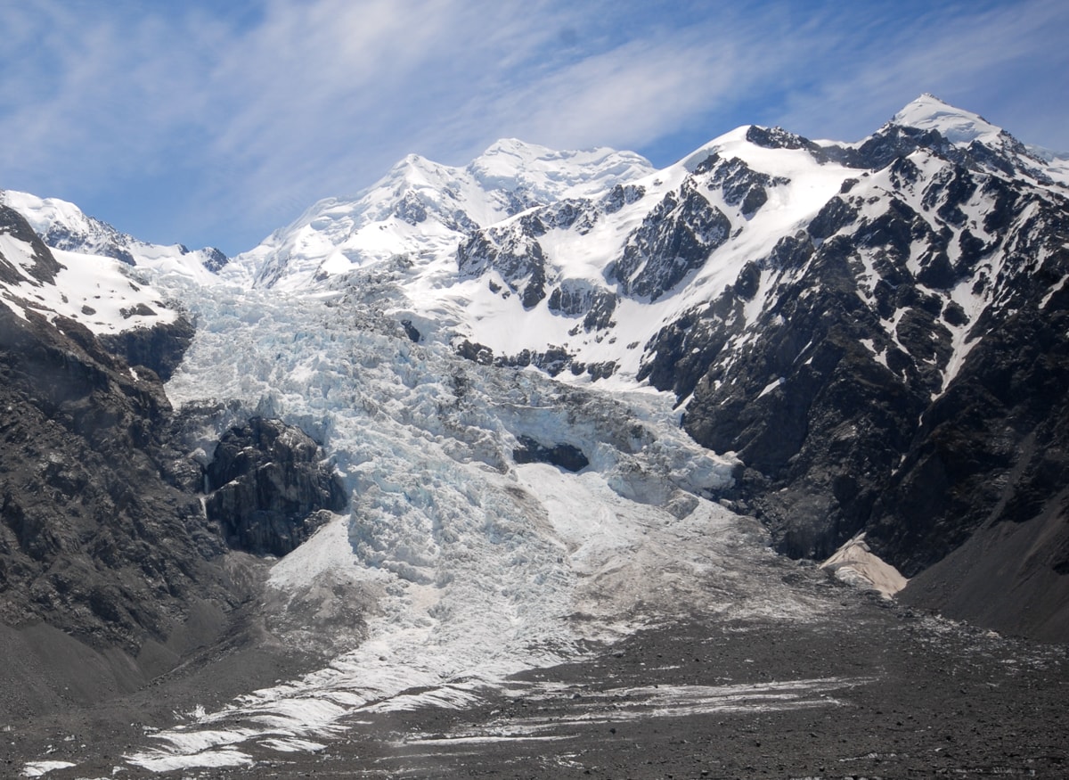
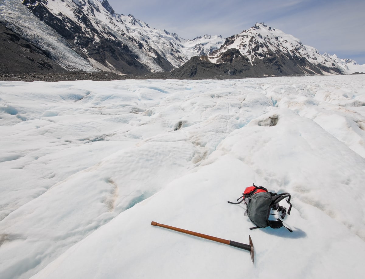
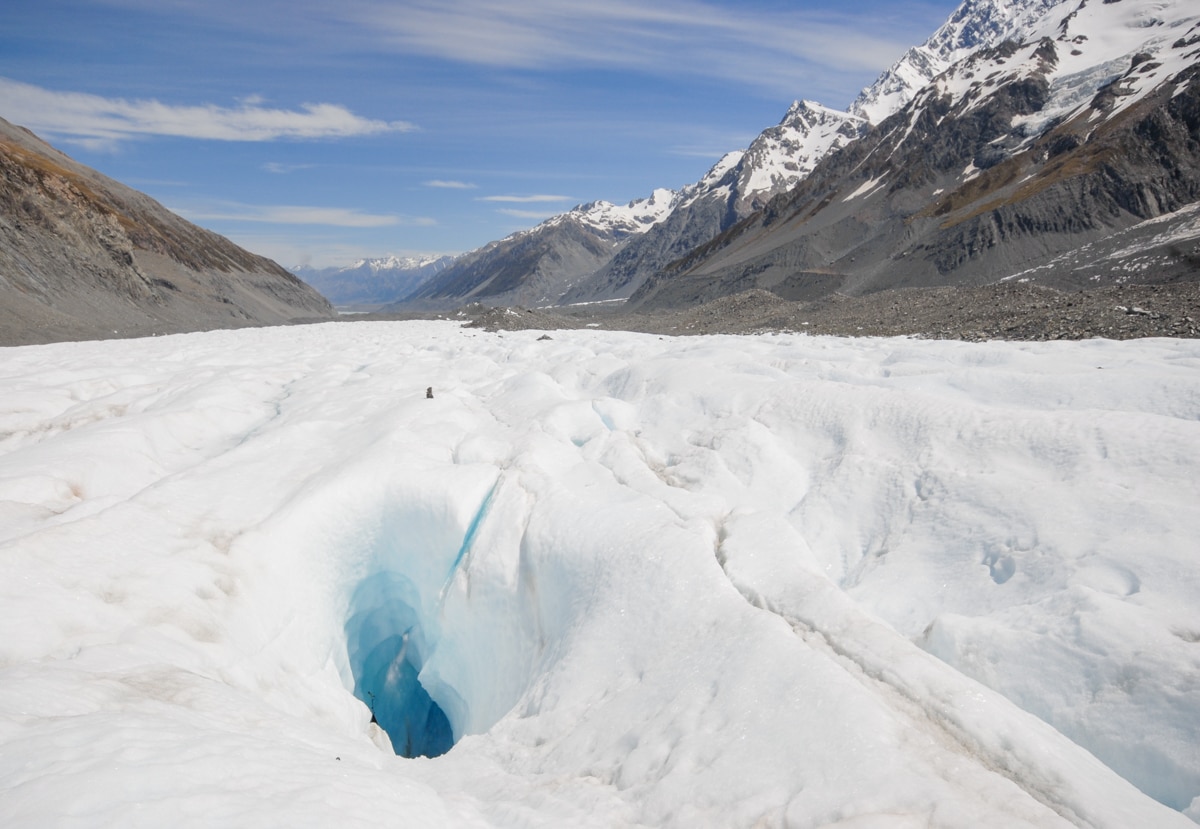
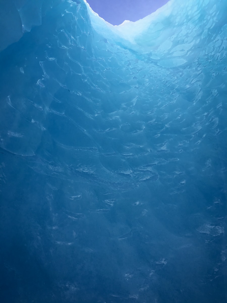
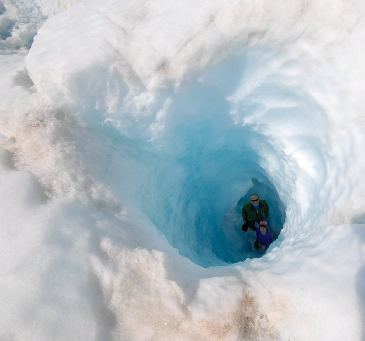
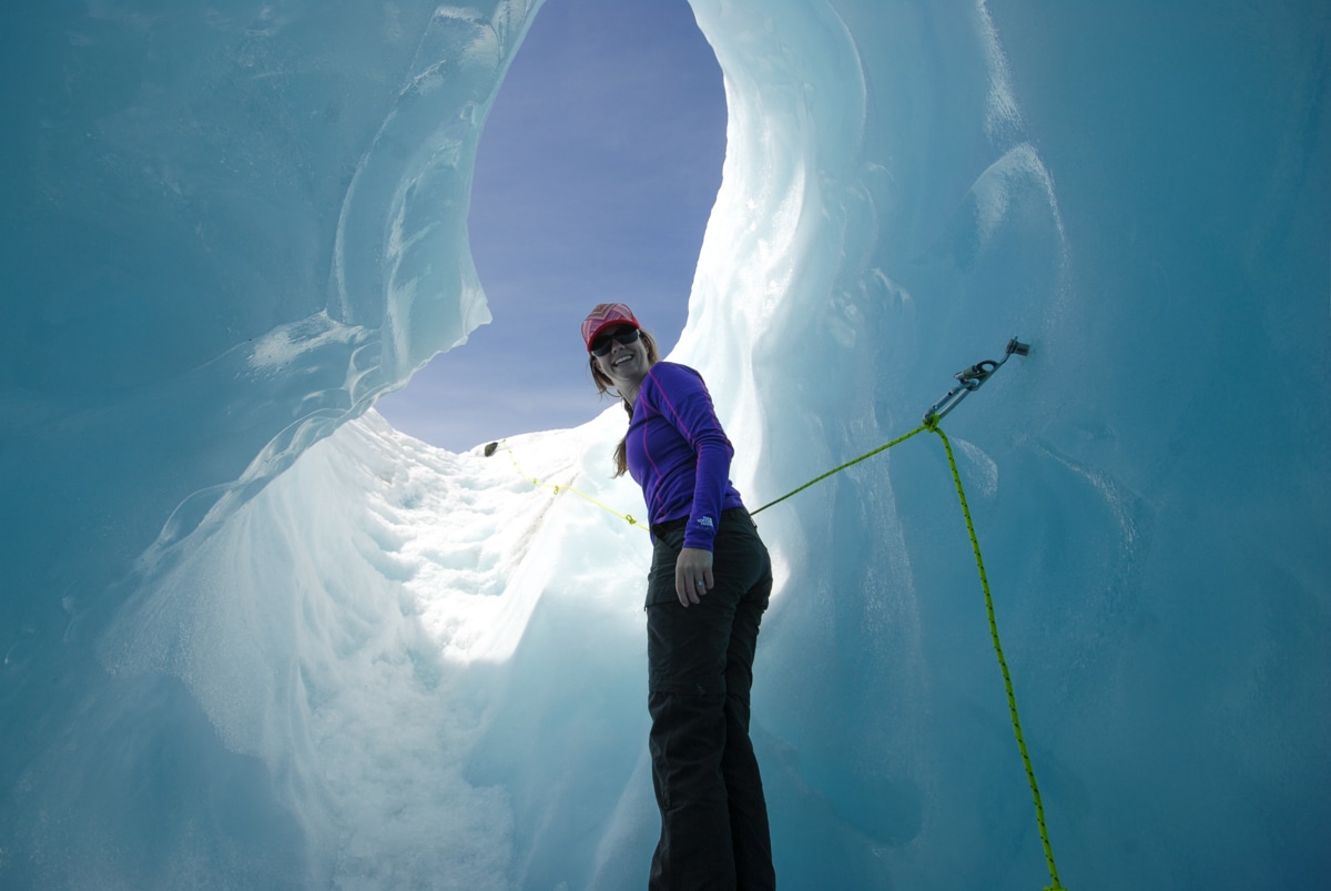
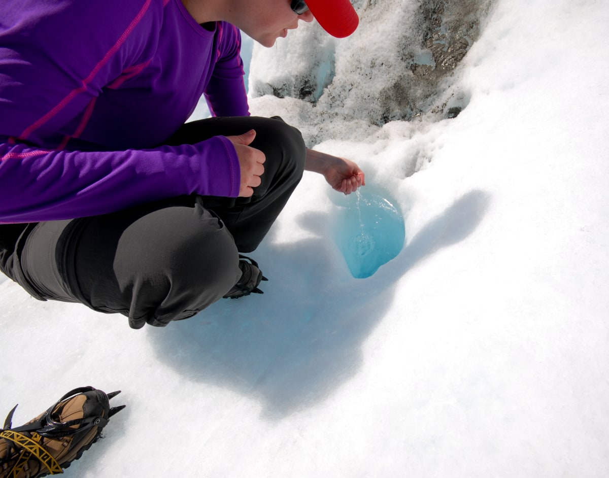
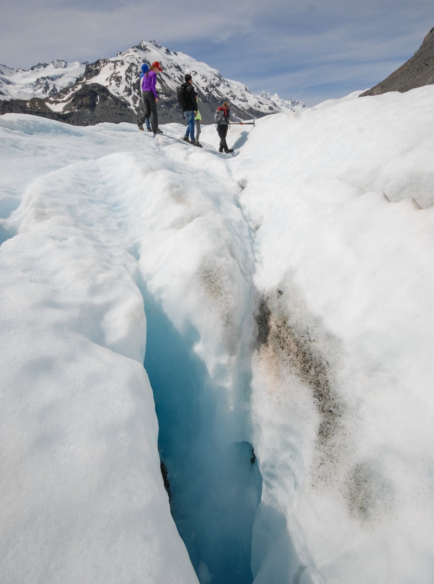
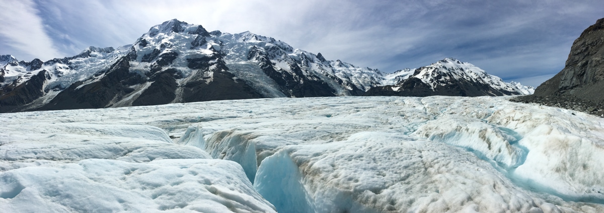
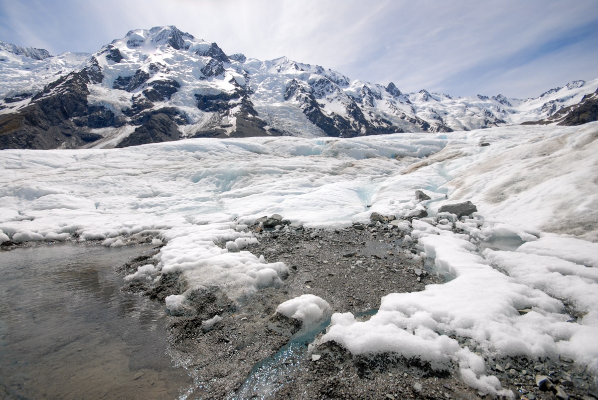
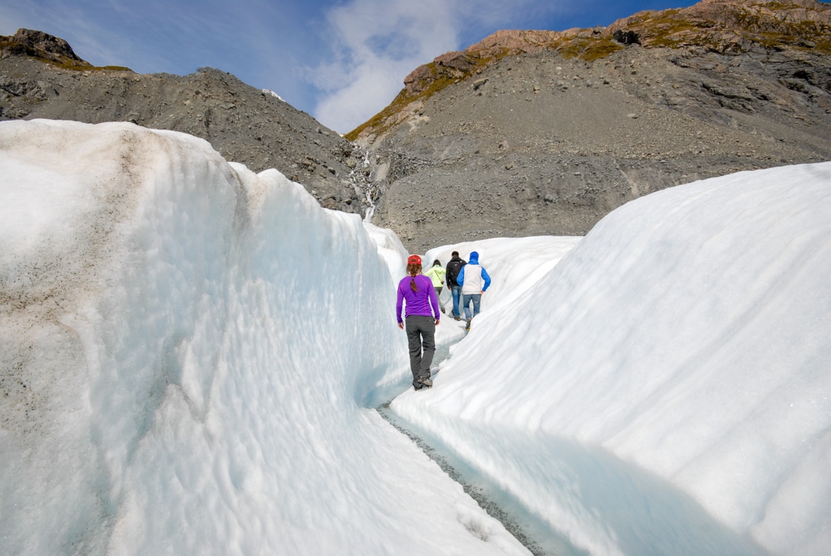
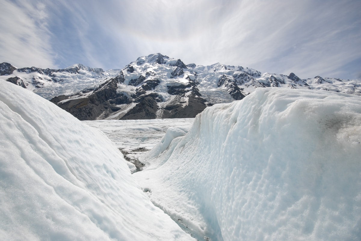
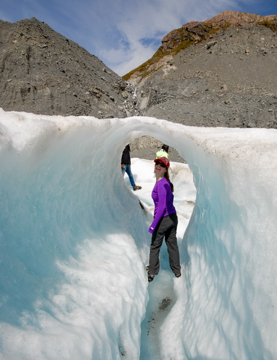
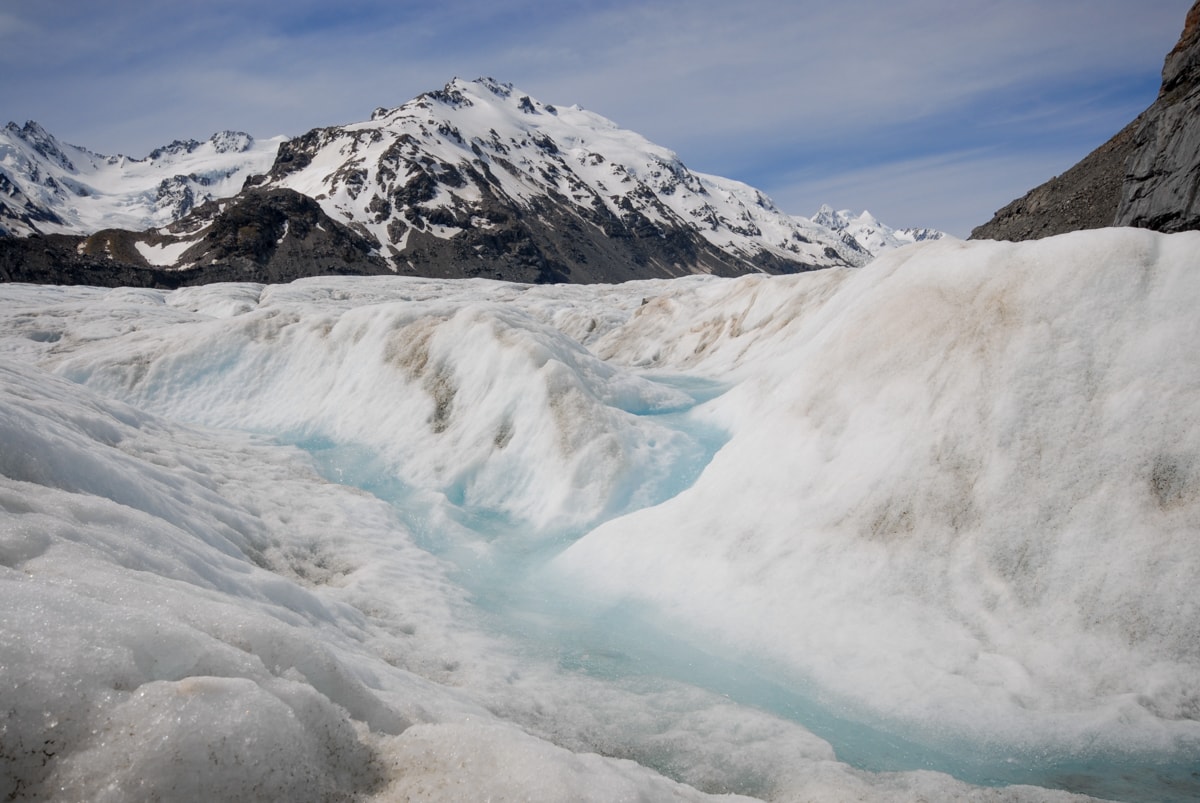
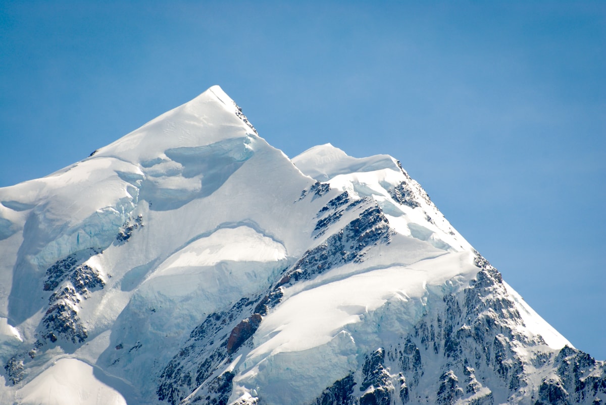
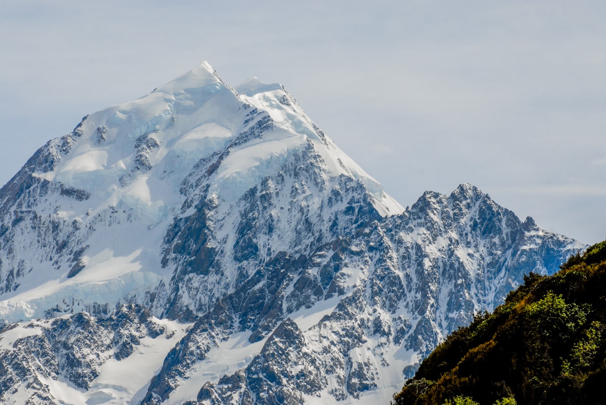
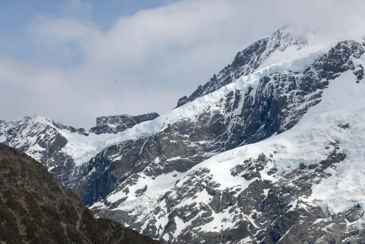
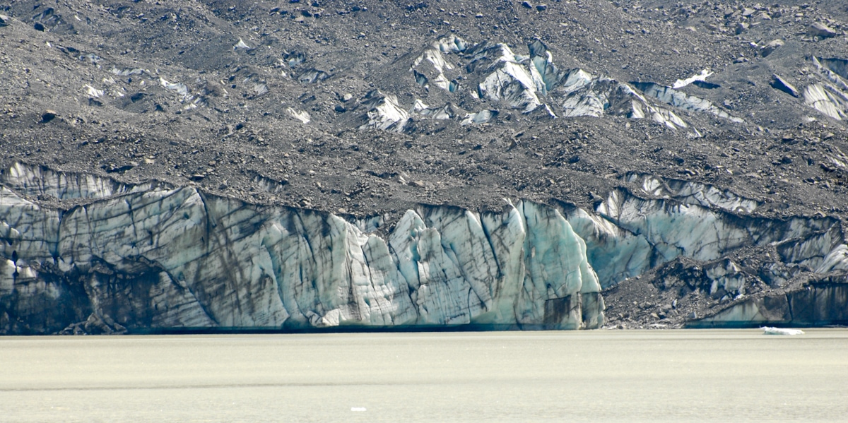
Highlights included: 1) walking down into a huge hole in the ice and seeing the blue, compacted ice underneath the white surface, 2) crossing around a couple of medium sized crevasses, 3) watching and listening to a bunch of snow fall way down a vertical hole that had formed into the glacier, 4) walking through a person-height-deep gorge cut into the ice by a meltwater stream, and eventually walking under a little snow arch to get out of the ‘gorge’, 5) checking out the impressive views of all the glaciers (at least six) falling off the eastern face of the Mt. Cook massif, 6) seeing some waterfalls that fell into huge holes down into the glacier (one that our guide called a ‘man-eater’ and wouldn’t let us get within a few feet of), 7) learning fun facts about glaciers and random thoughts about being a glacier guide from Anna.
Our favorite comment of hers came during a discussion of how quickly the ice features change, which is quickly, given that the ice on the surface of the Tasman Glacier can descend (while crunching, cracking, melting, and compressing of course) up to 3 meters over a 24 hour period. Apparently lots of folks look to this kind of glacier heli hike to hopefully be shown an ice cave, which are both rare in that area and likely to be dangerous to enter even if one did develop. She said that her typical response to the ice cave question is “Don’t say the ‘c’ word!”, followed by a discussion of glacial dynamics – basically that “glaciers are like bars of chocolate”. We also really enjoyed the concept of plastic deformation, which “occurs when the ice itself flows as a viscous solid”. There’s so much ice sitting on top of and exerting pressure on the ice below, that the ice below starts to flow (verrrry slowly) almost like liquid would. This is also the reason why crevasses tend to only form in the top 50 meters of the ice sheet – because below that point, the ice is under enough pressure that it becomes less brittle and will ‘bend’ (kind of) instead of break over obstacles. Awesome. I should have done geology in school.
Wrapping up, we headed back to the helicopter for the return ride, where we got a close up aerial tour of the impressive Hochstetter Icefall on the way back.
Bonus! Because I like maps, and because the geography in the area was just so cool, here’s a map showing the locations of Mt. Cook, the Tasman and Franz Josef glaciers, and the Hooker Valley (more on this below).
Ok, on to Post Part 2.
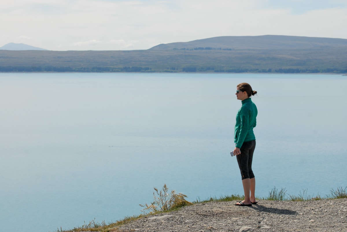
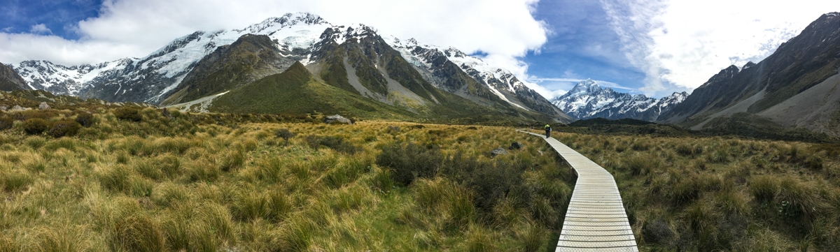
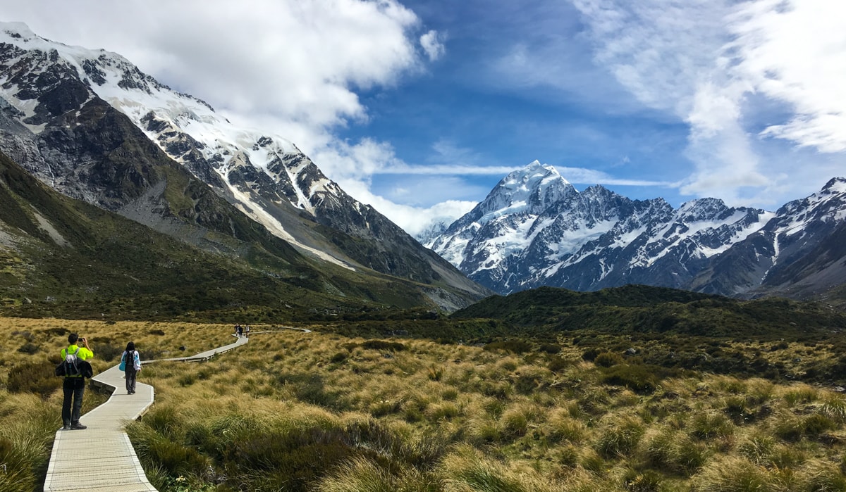
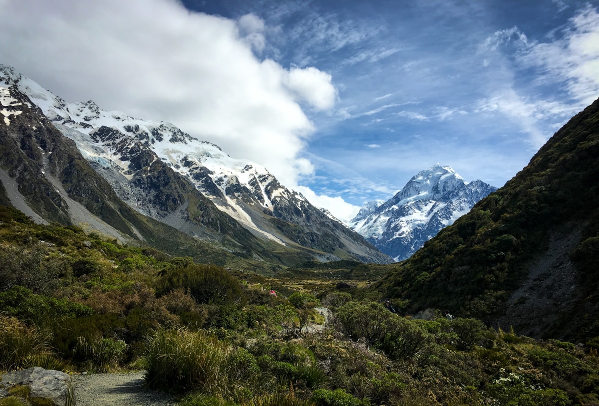
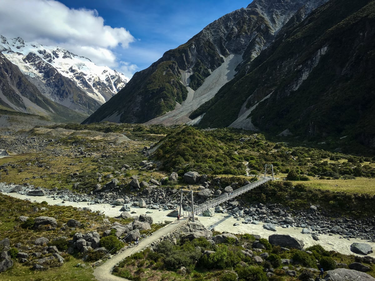
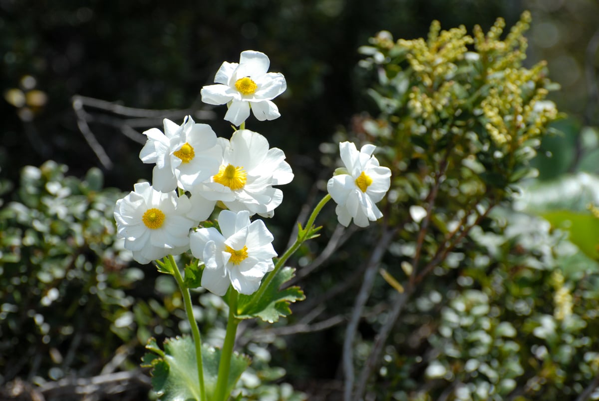
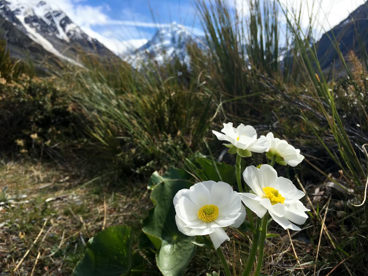
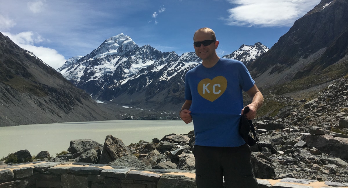
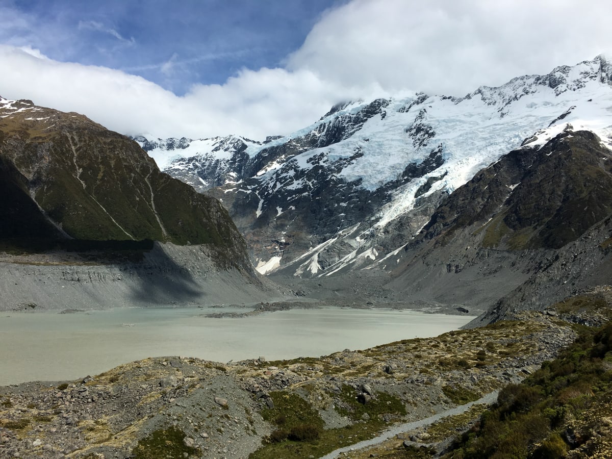
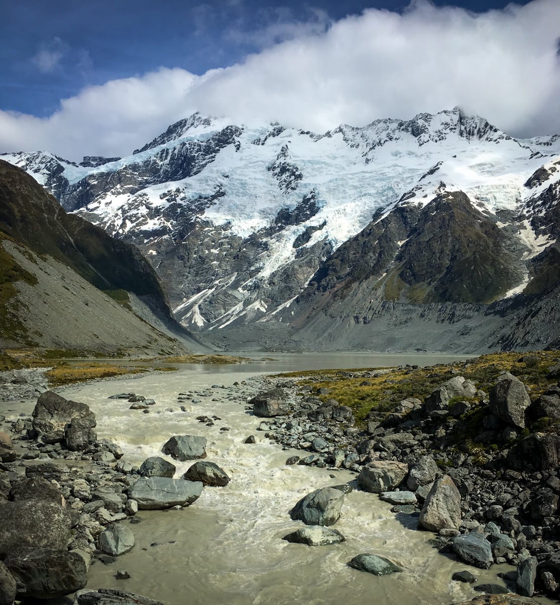
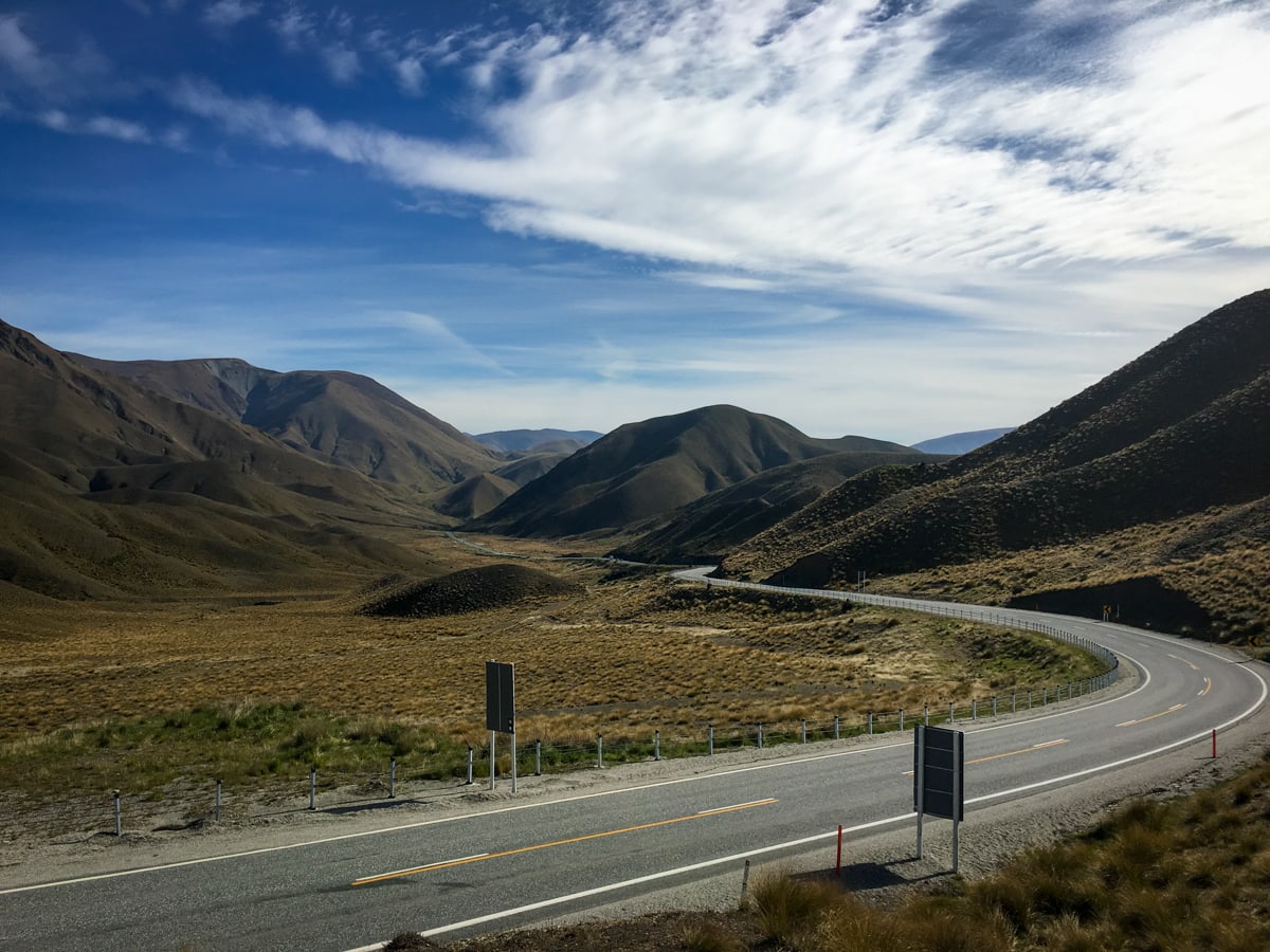
The day after the heli hike, we went hiking again in the Hooker Valley to the west of Mt. Cook (as opposed to Tasman Valley on the east, where we were the day before). Even though we drove instead of flew to the trailhead, it was still pretty awesome. The track goes up over a small moraine hill, along to the Hooker River, across it on three very long swing bridges, across a couple boardwalks, past a number of Mt. Cook Lilies (very pretty, though not technically a lily), and eventually up to a view point where you see across a lake to the Hooker Glacier (which feeds the lake). This is the most popular half day hike in the region – we passed a number of tour groups and smaller pairs or groups of travelers, each with widely different levels of ‘hiking preparedness’. We’ve seen a number of folks hiking in jeans with a jacket and a bottled water that they’re carrying in a plastic grocery store bag. Interesting tactic.
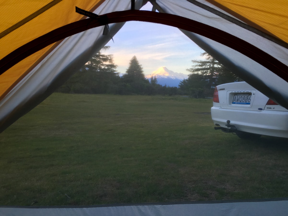
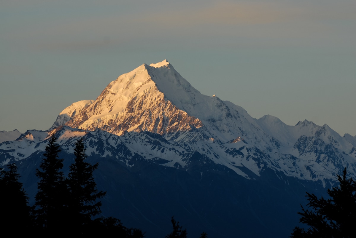
Most of the pictures below are from the hike (see captions for more context), but we also threw in a few from the weekend in general. I’m particularly happy about our campsite after the heli hike – a relatively secluded tent site in a field of grass and pines with a direct view of Mt. Cook. Very cool.
This Post Has 0 Comments