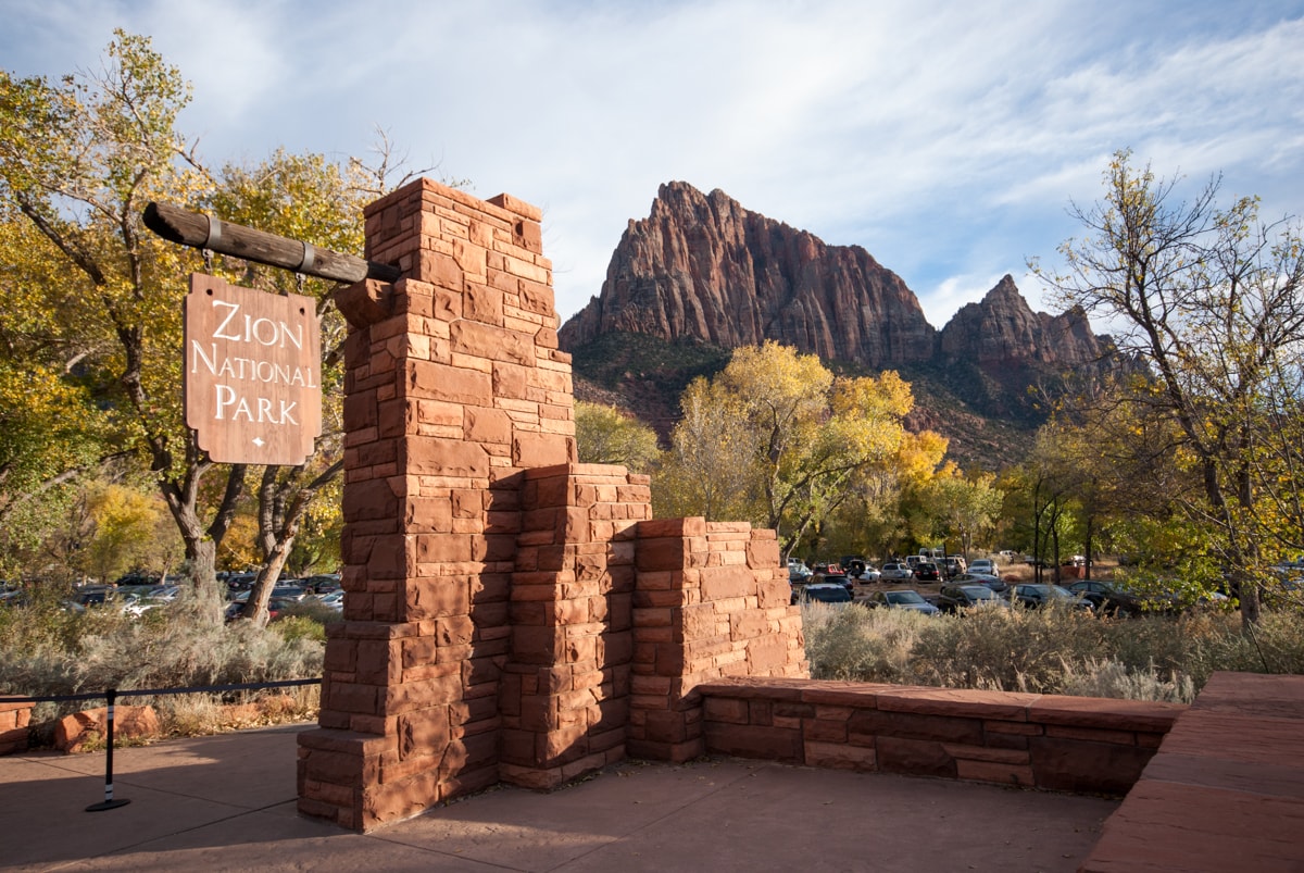
Checking Out the Canyon at Zion
It really started when Dad sent us a link to “20 hikes not for the faint of heart.” I’d been looking for cheap flights to fun places for a few weeks leading up to November (didn’t amount to anything), so had a bit of wanderlust built up already. Then while looking through that list of hikes, I saw this photo (pretty awesome), and figured maybe I’d check out Zion as a destination. Somehow the weather, flight, and the timing all looked reasonable, even given the short timeframe. And since Elisse had mentioned earlier that “we should go hiking this weekend,” it all seemed to fit. So on Wednesday, we decided to head out on an early flight to Las Vegas on Saturday morning.
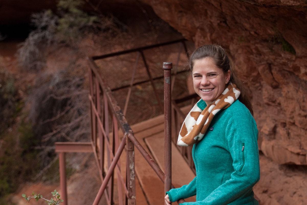
After a disappointing ride from the airport to Hertz (the rental car shuttle was playing “Santa Claus is coming tonight” on November 19th, in 65 degree weather in the middle of the desert – Christmas had not started yet people), we were quickly on our way! We showed up a few hours later, and found Parker had already arrived from Salt Lake – he was up for a bit of last minute adventure as well.
– – – – – – – – – – – – – –
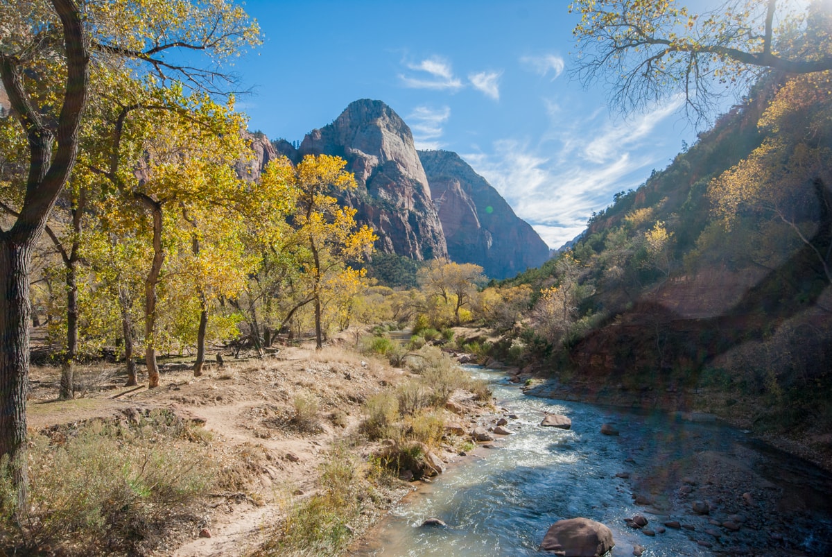
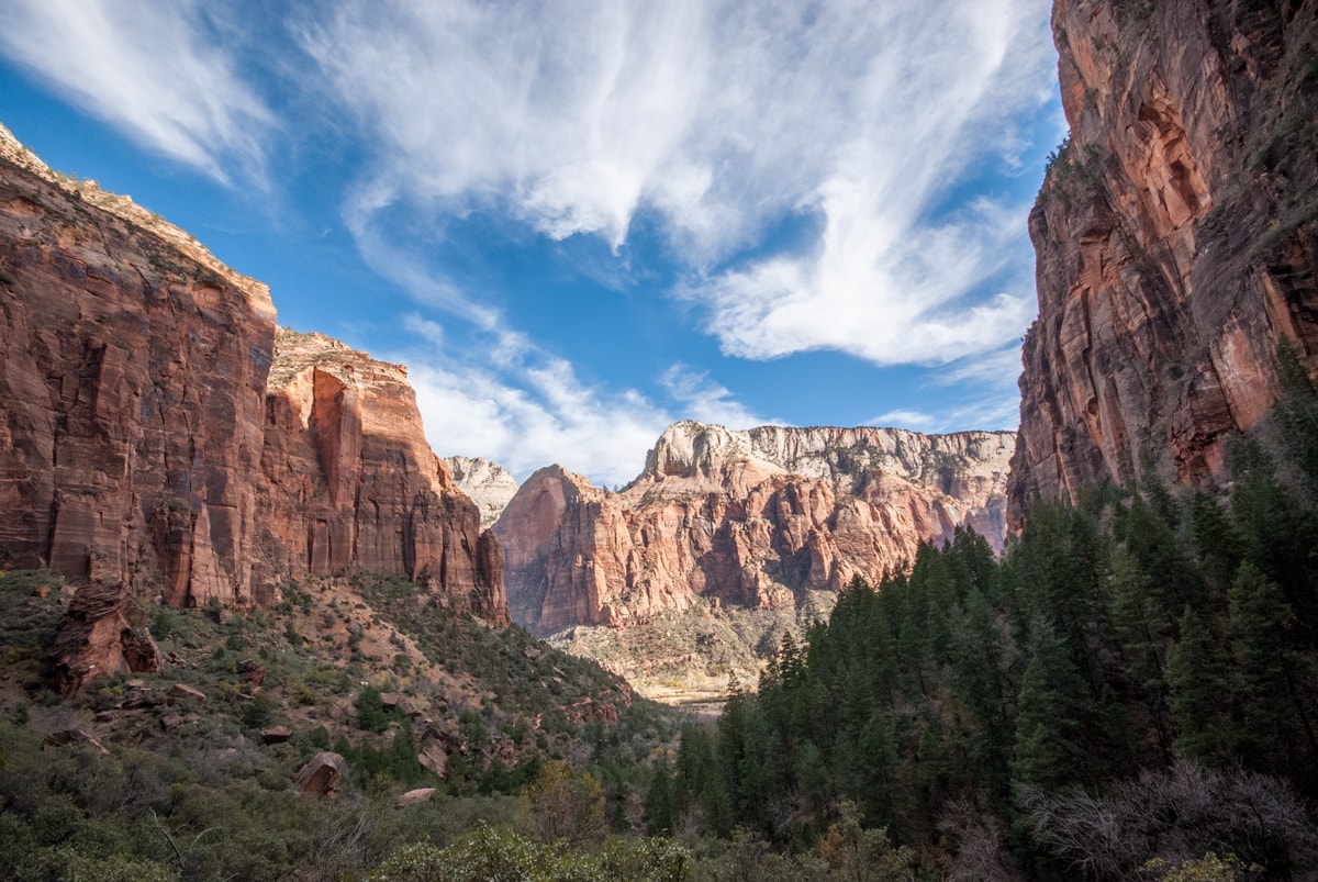
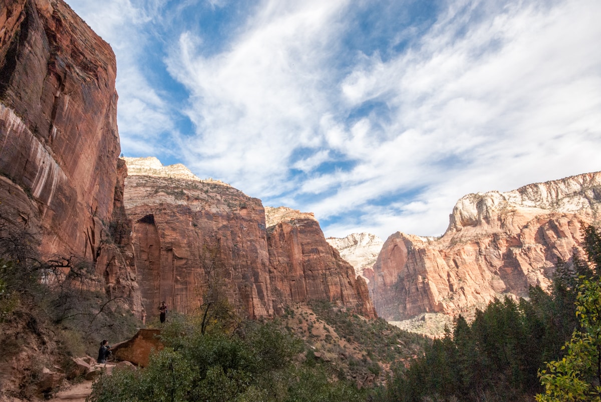
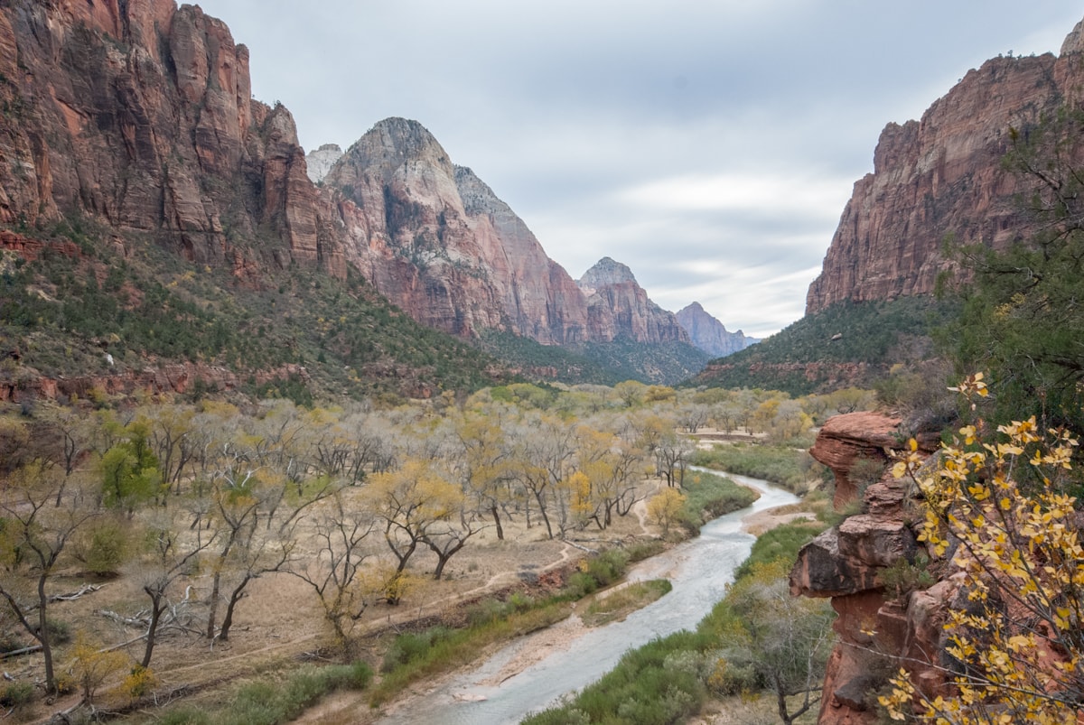
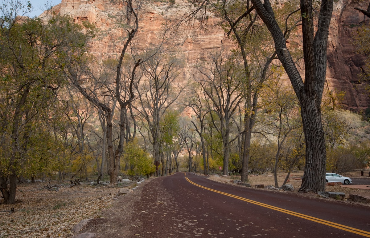
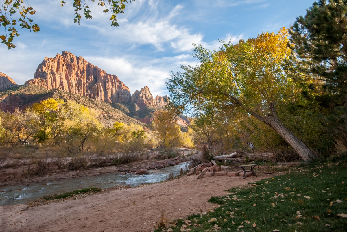
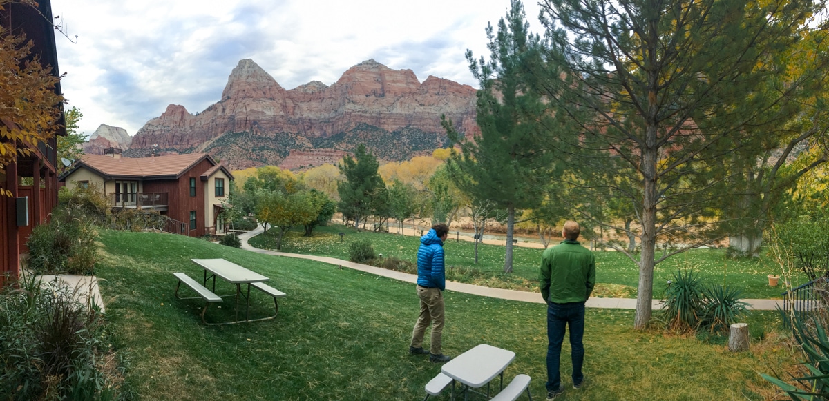
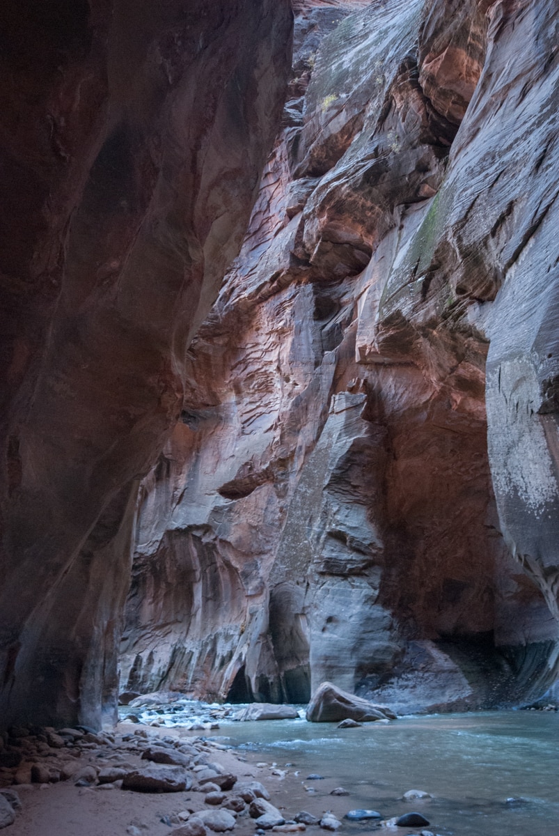
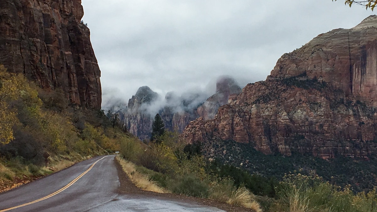
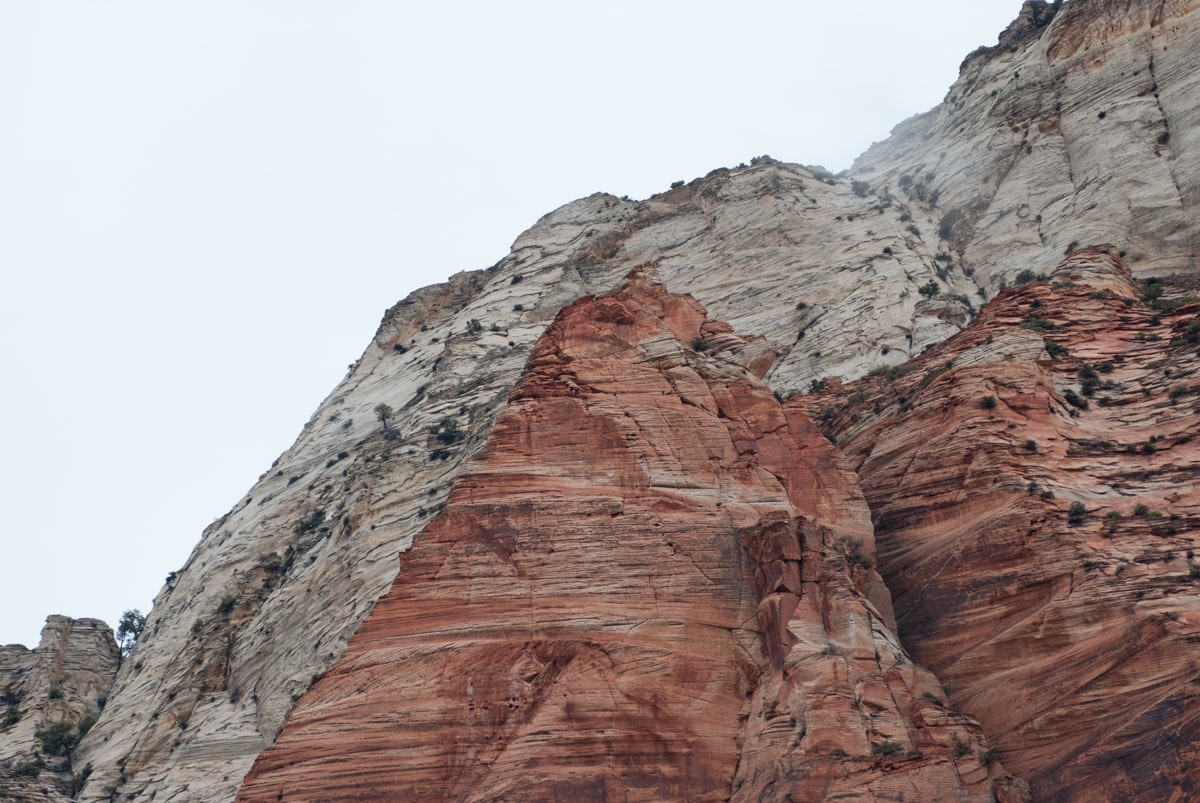
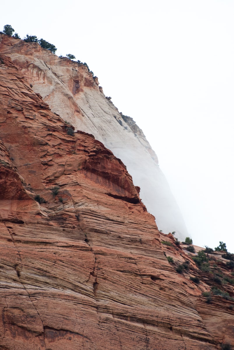
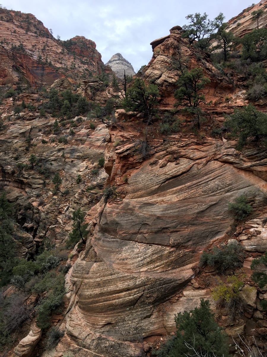
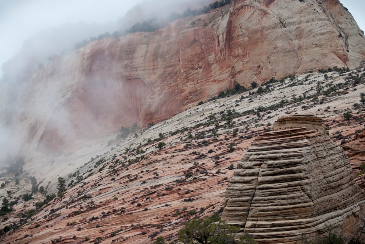
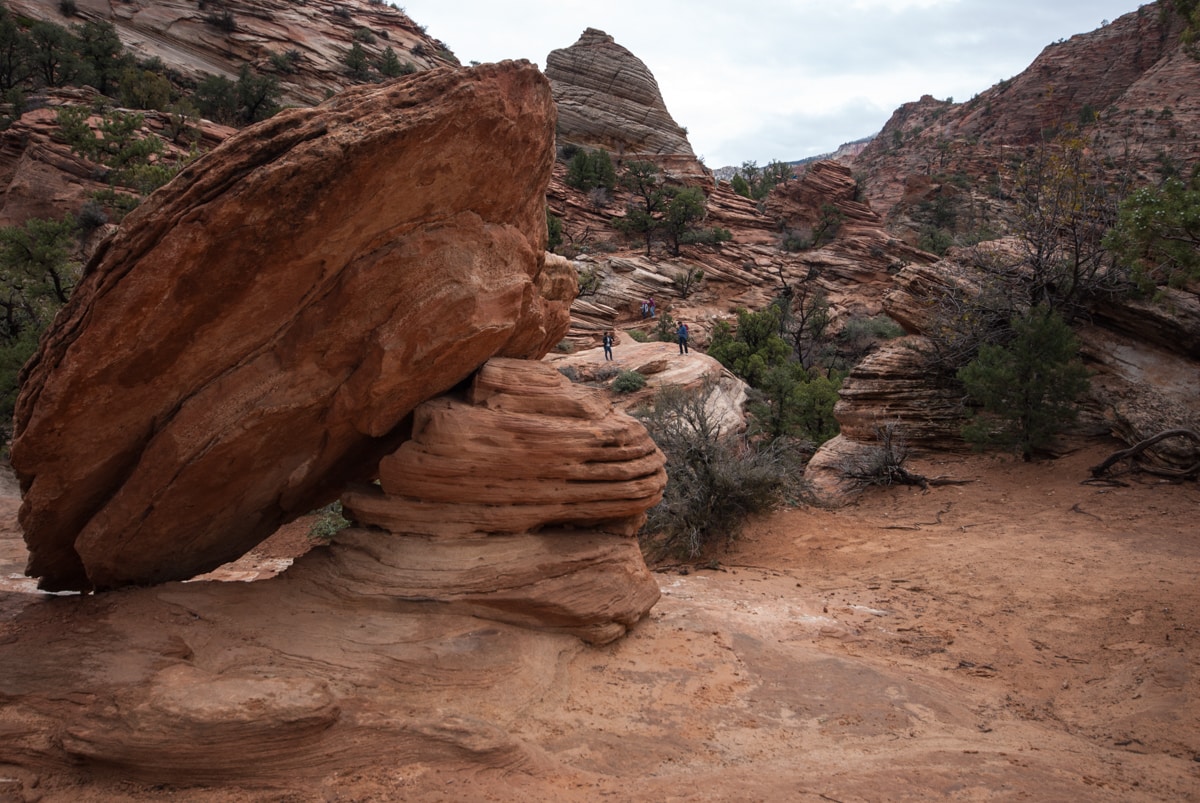
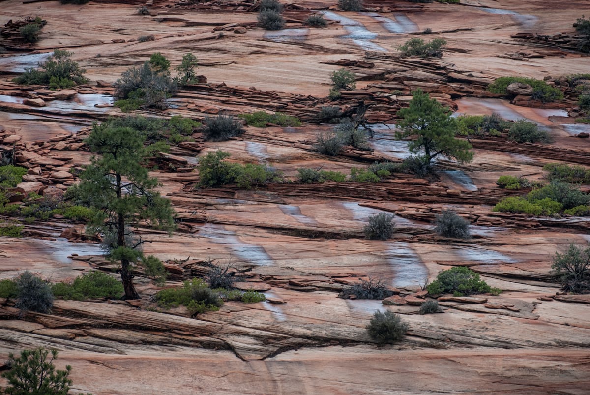
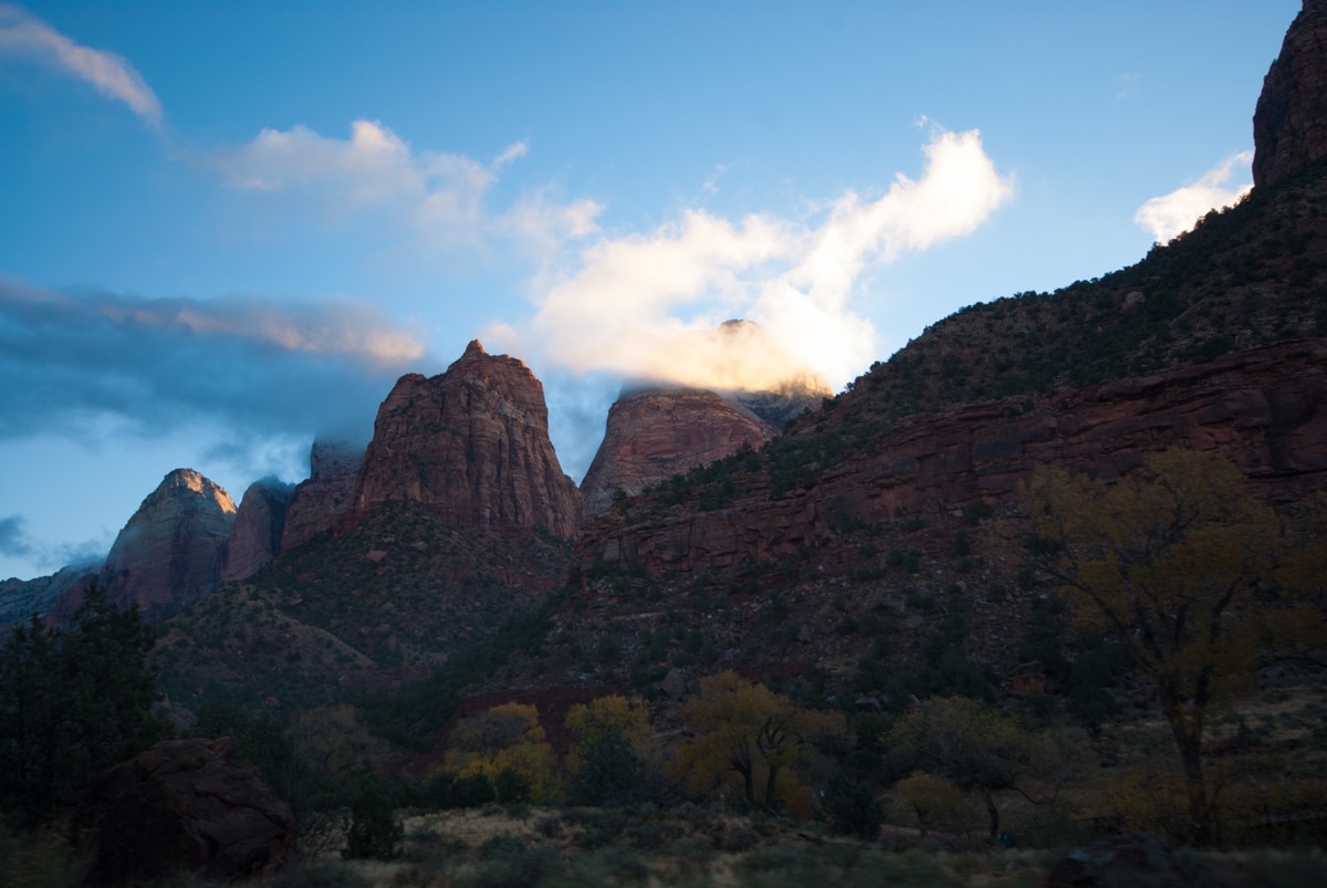
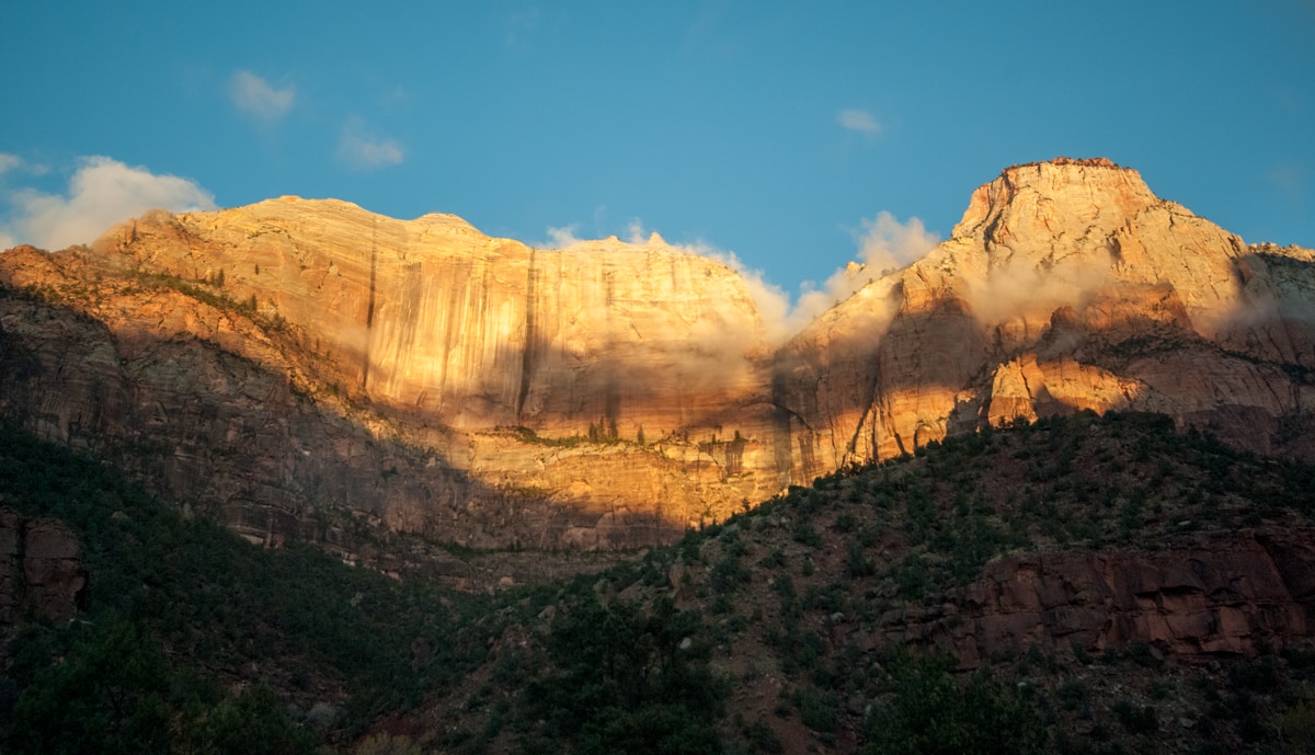
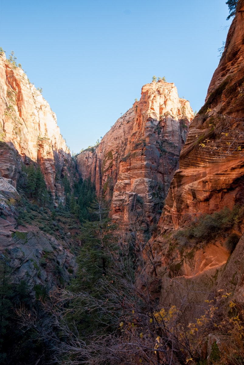
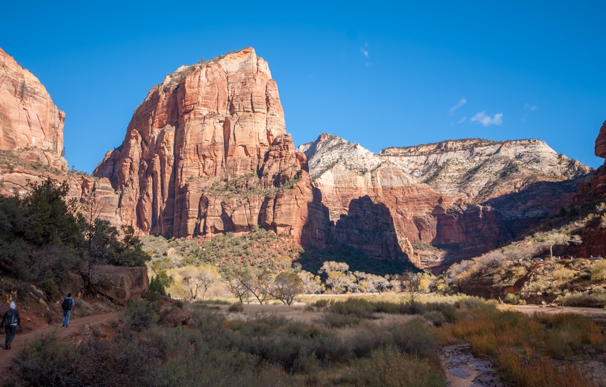
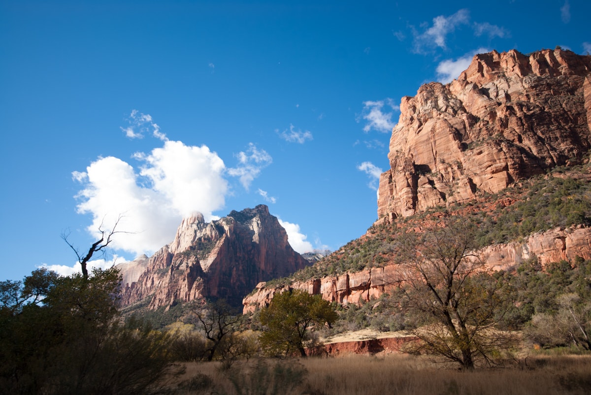
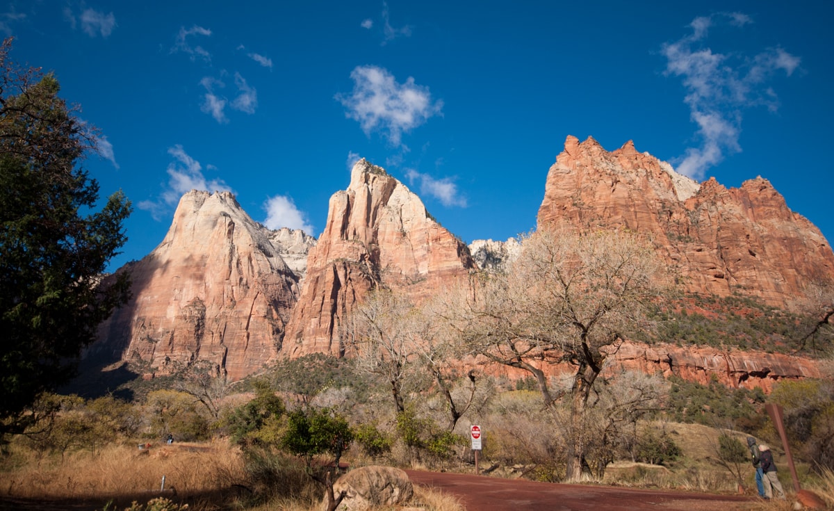
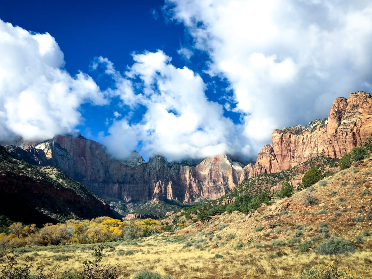
Among National Parks, Zion is medium sized both horizontally and vertically. The Virgin River has carved a many thousand foot deep canyon out of the Colorado Plateau (i.e., the area drained by the Colorado River – the park is in Utah) for us to explore. The effect is particularly striking in Zion, not just because of the tall, almost vertical canyon walls, but because of the variety of colors (reds, greys, whites, browns) throughout the canyon. The park has one road that goes up and back down the canyon, and one spur road leaving the east side of the park that goes through a mile long tunnel built right into the sandstone canyon wall in the 1930s.
So, to translate geography into activity – Zion actually isn’t too hard to get a feel for in a few days. And it’s not a driving park, it’s a hiking park! In fact, the whole time we were there, we only got in the car twice. (It also helps that they have a handy shuttle system that takes you up the one road on weekends in the shoulder season.)
– – – – – – – – – – – – – –
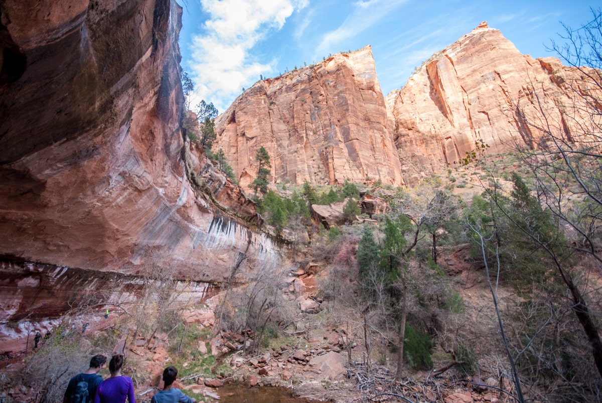
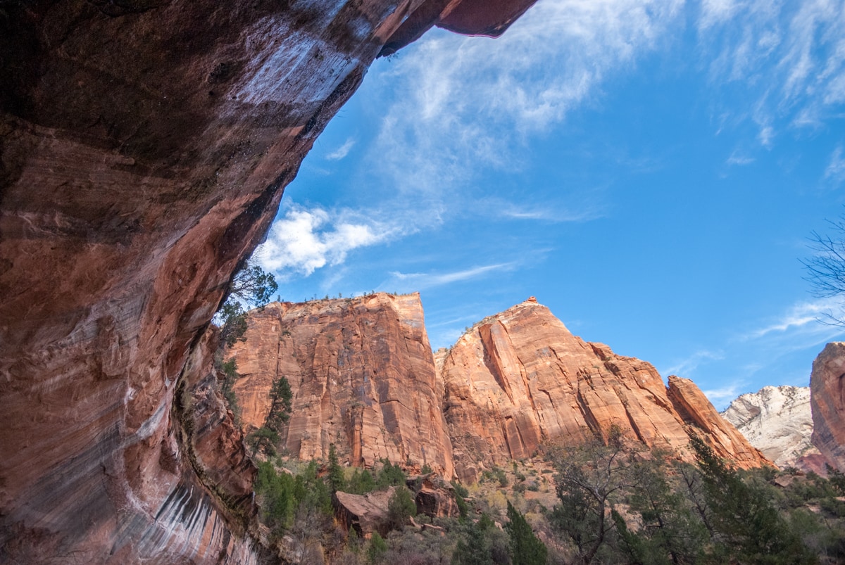
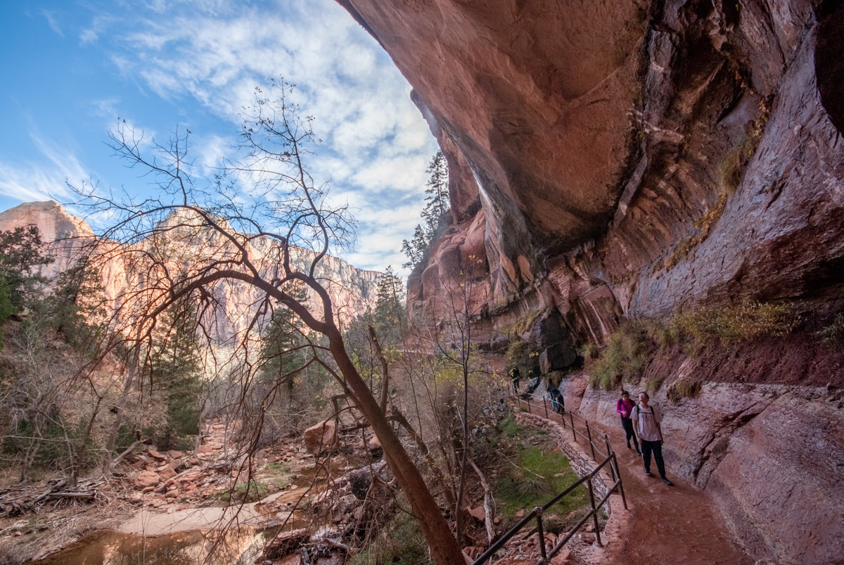
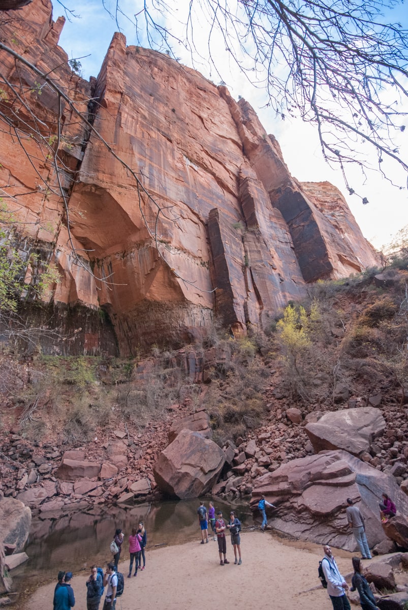
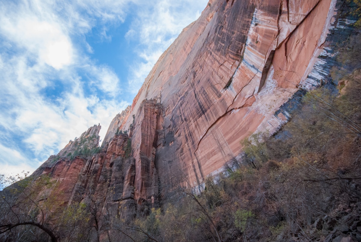
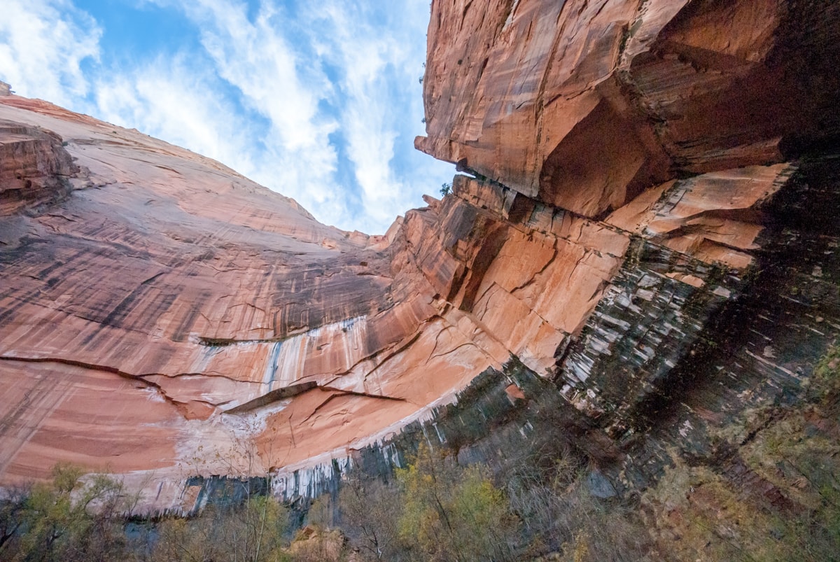
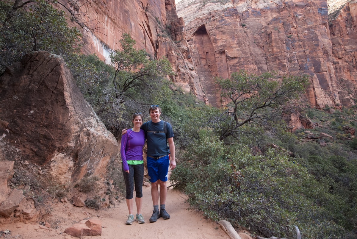
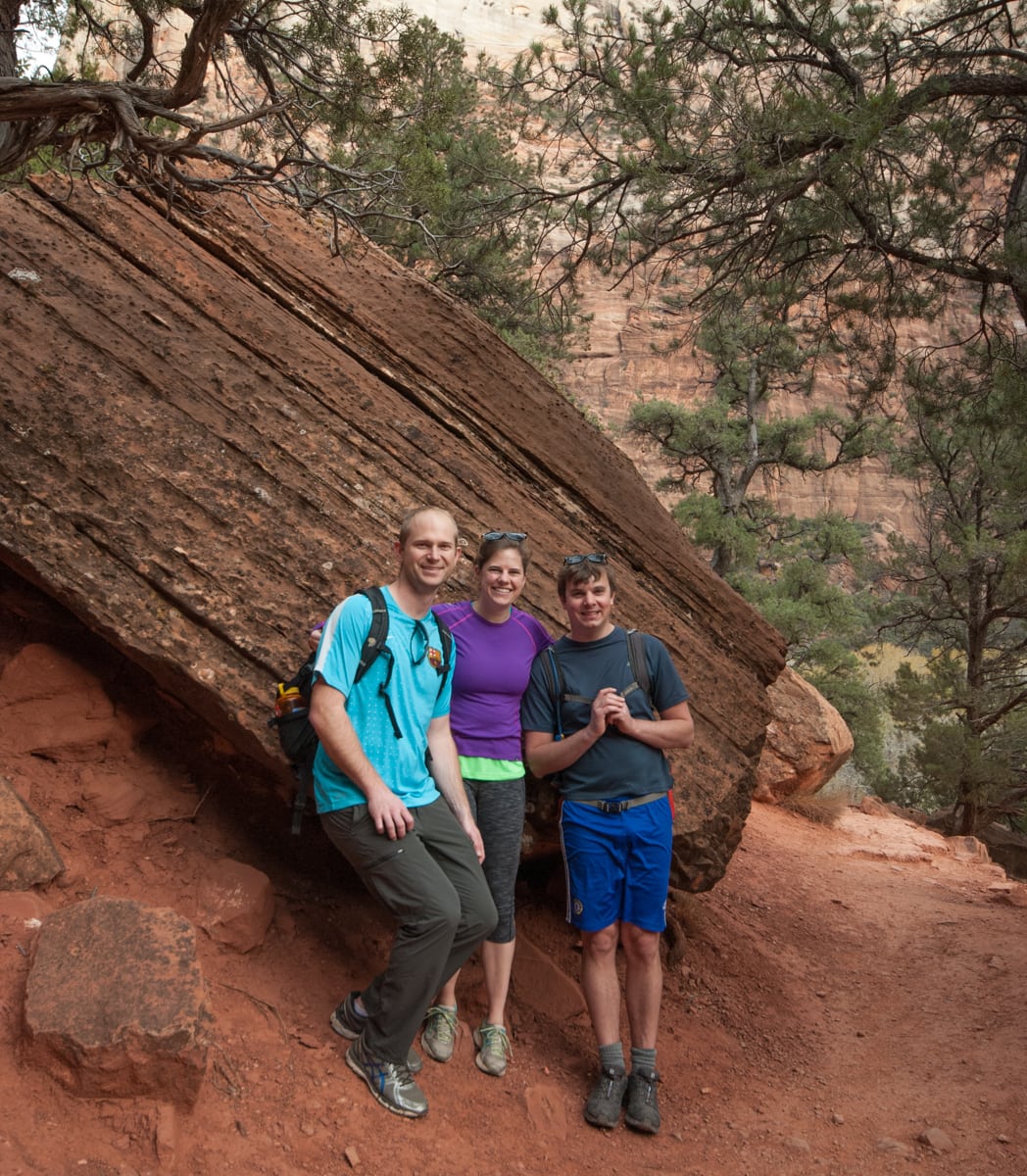
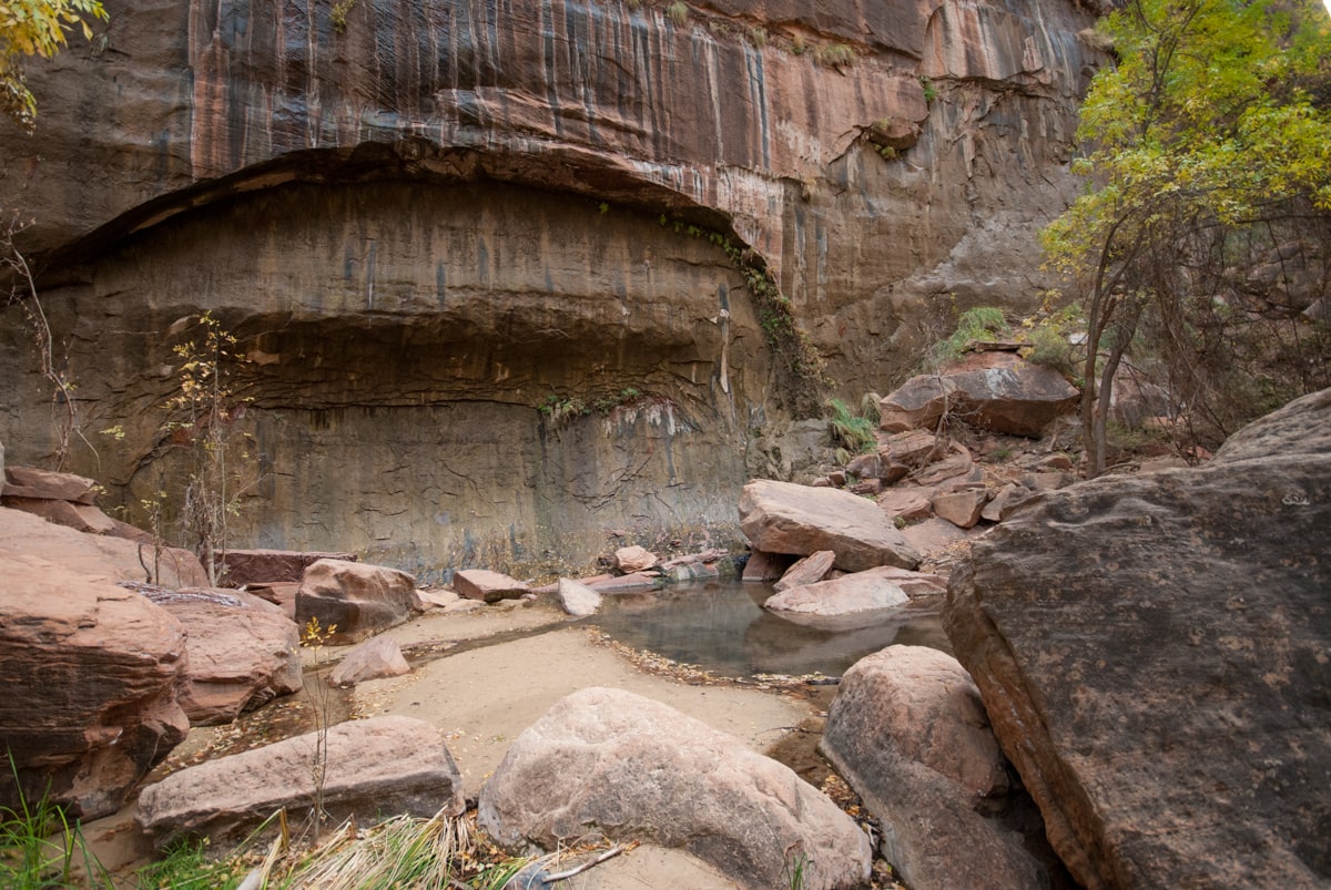
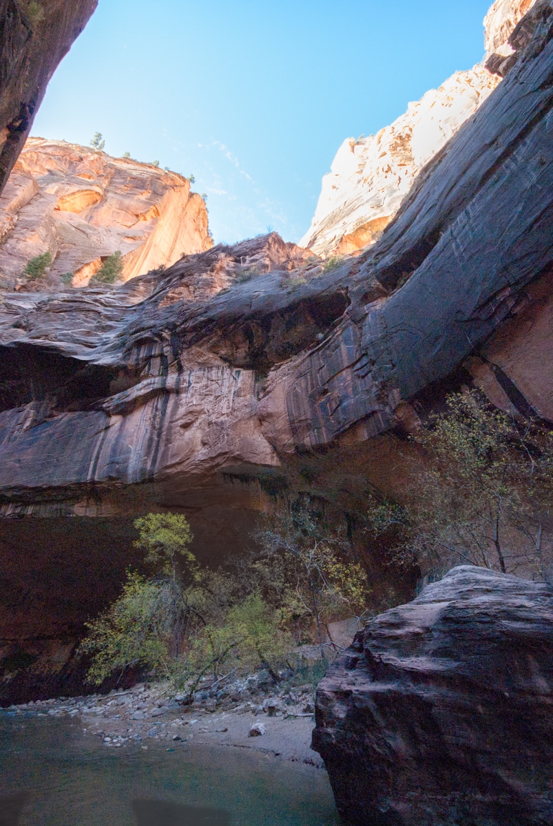
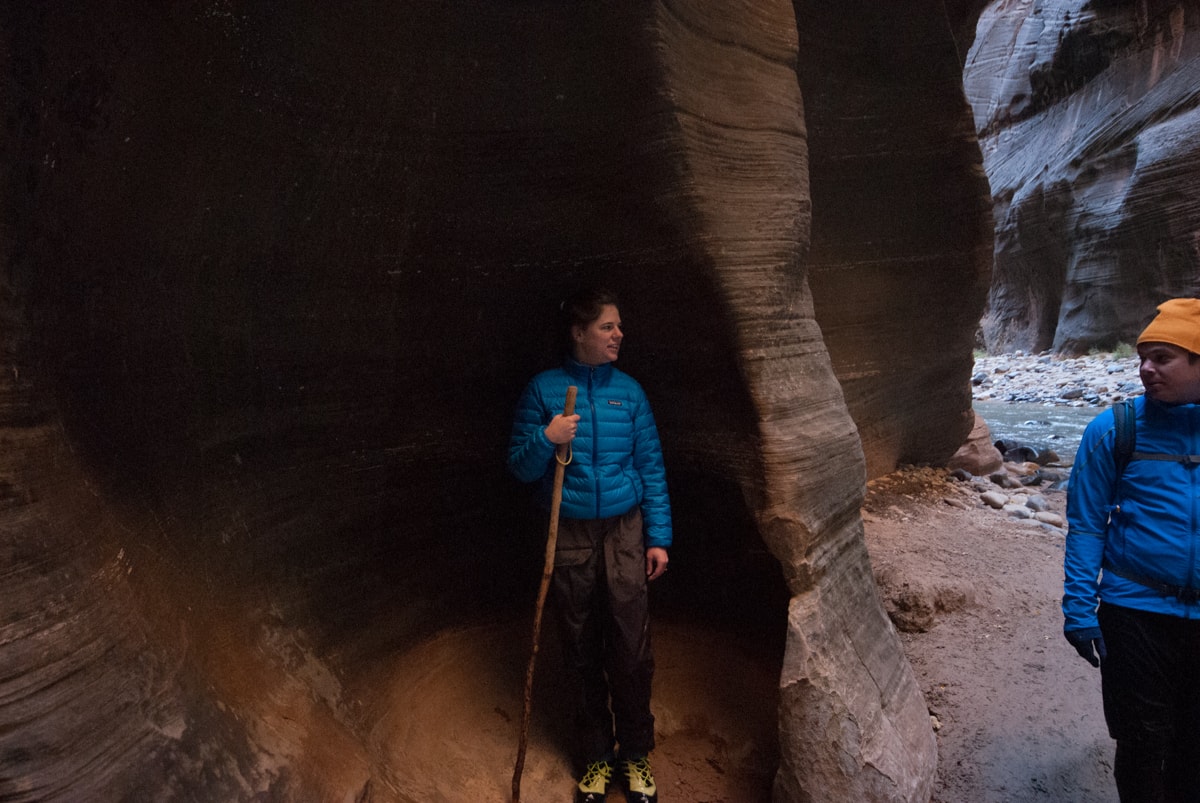
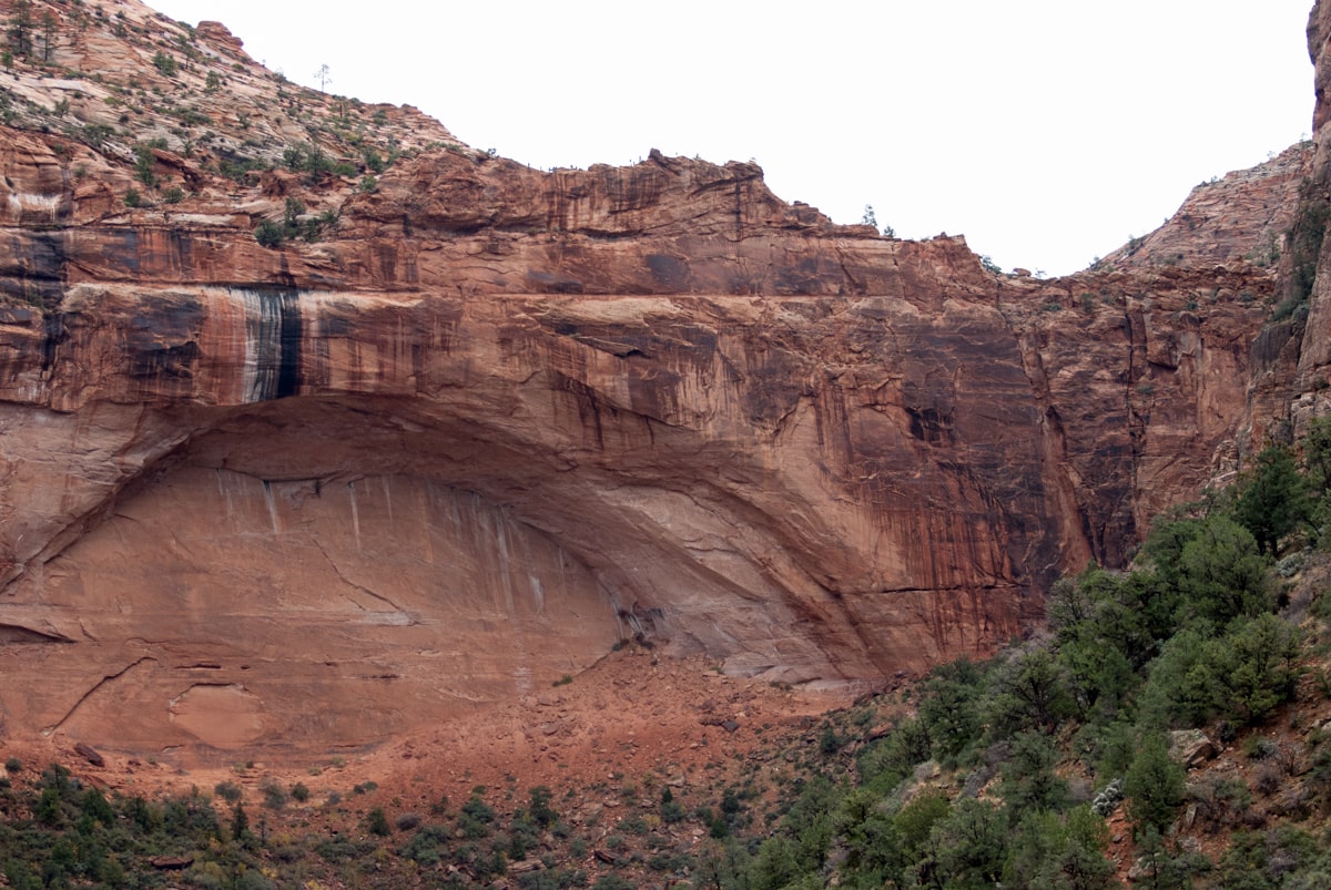
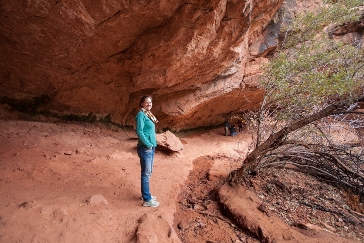
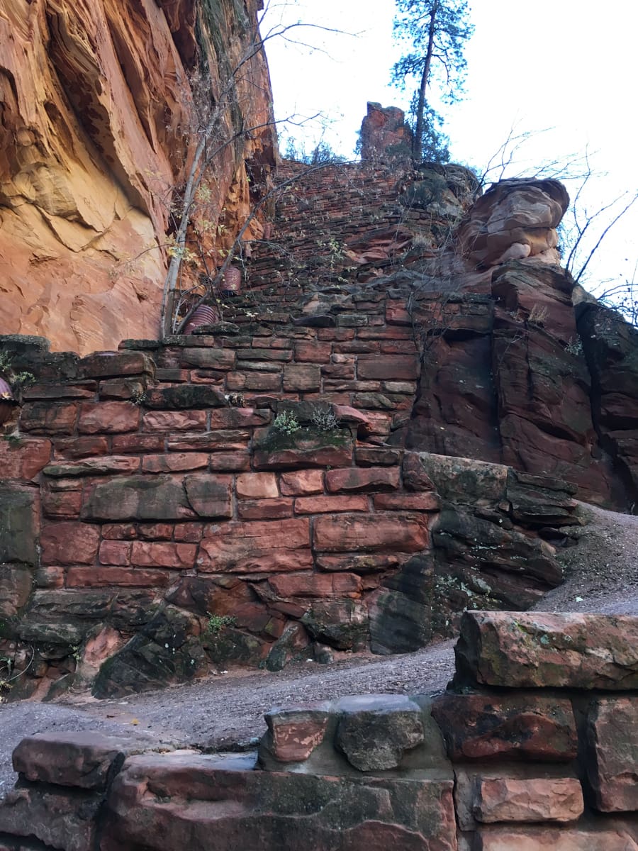
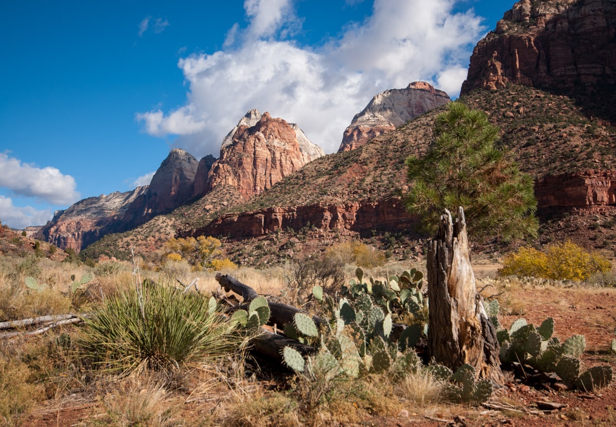
Ok, so we’ve arrived. That afternoon we went hiking to the Emerald Pools (lower, mid, upper). Can’t say they were very emerald (lack of water, wrong time of day), but the hike was really pretty, and went through this super interesting half circle hanging cavern feature where we walked behind a (small) waterfall / water drizzle.

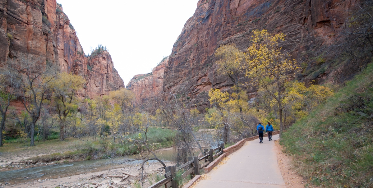
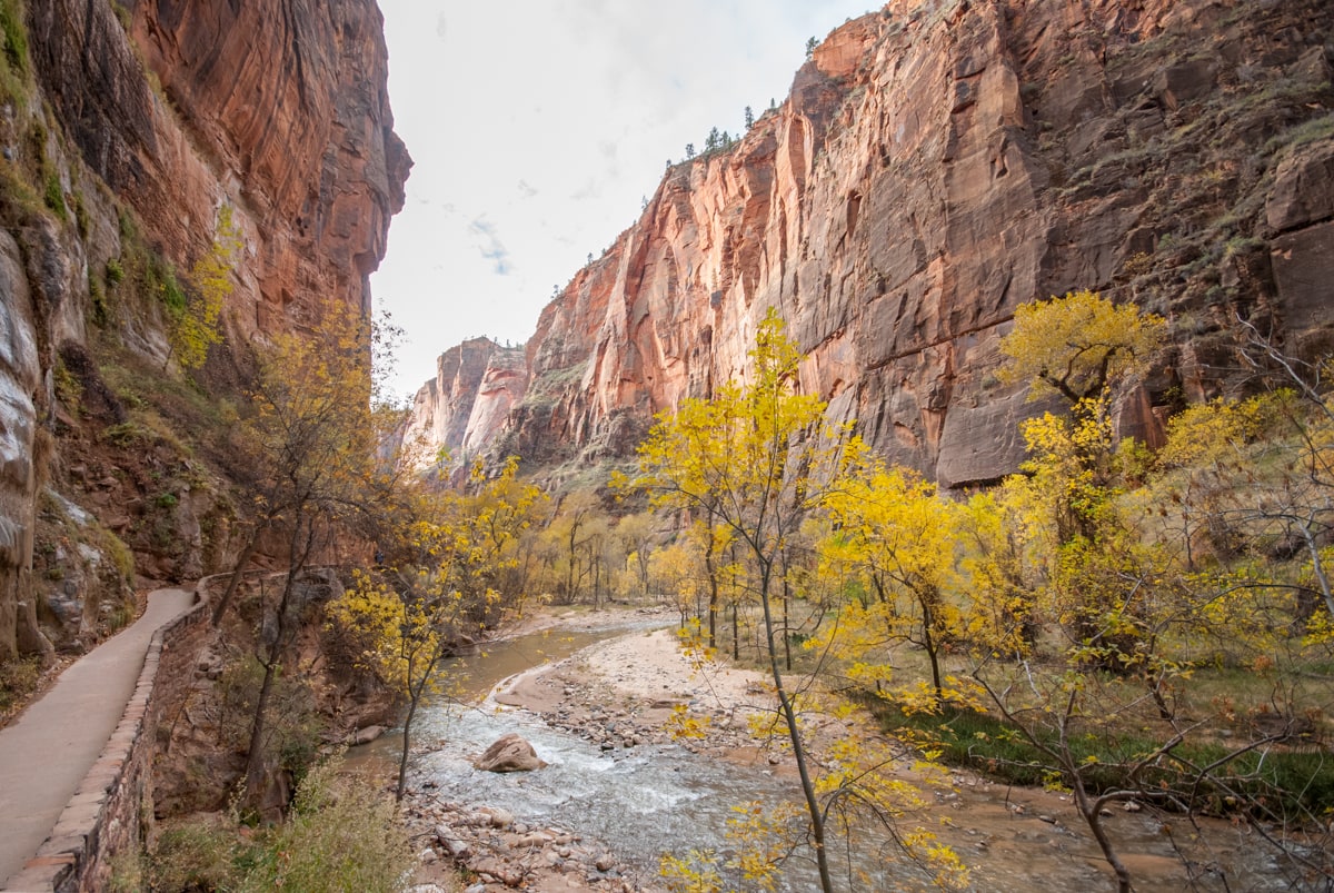
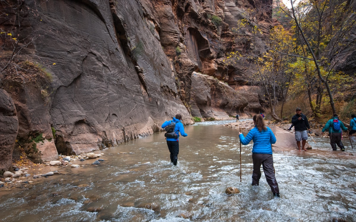
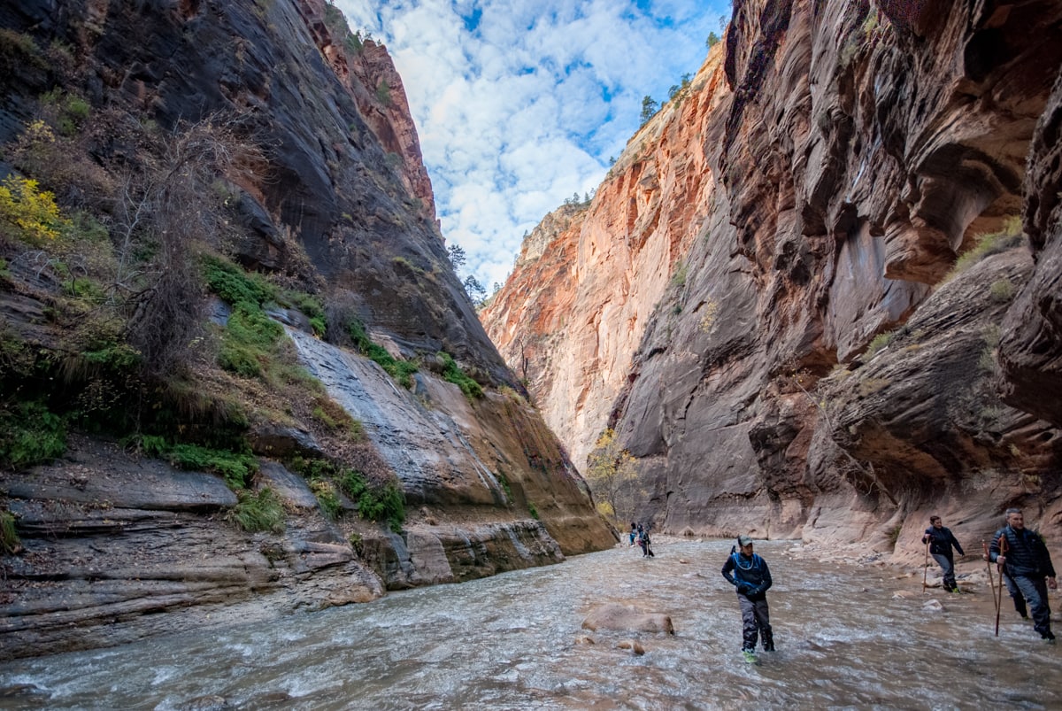
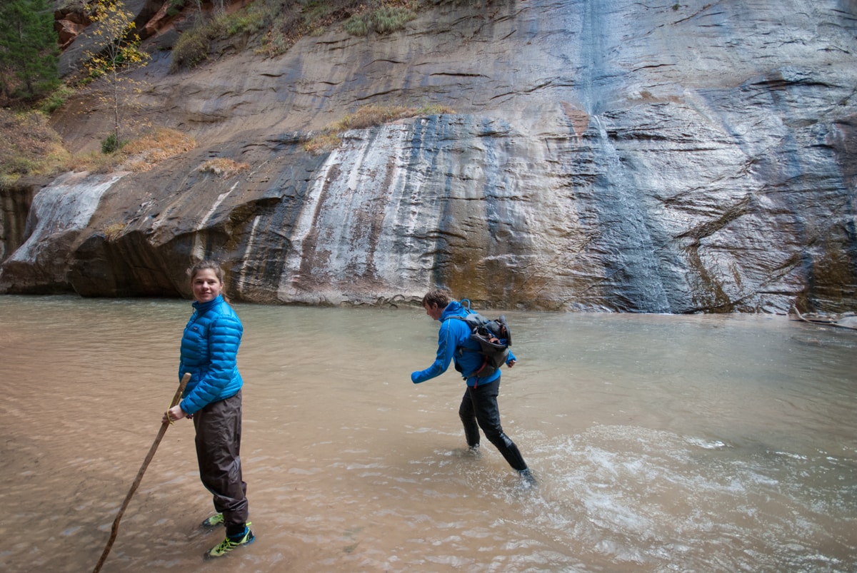
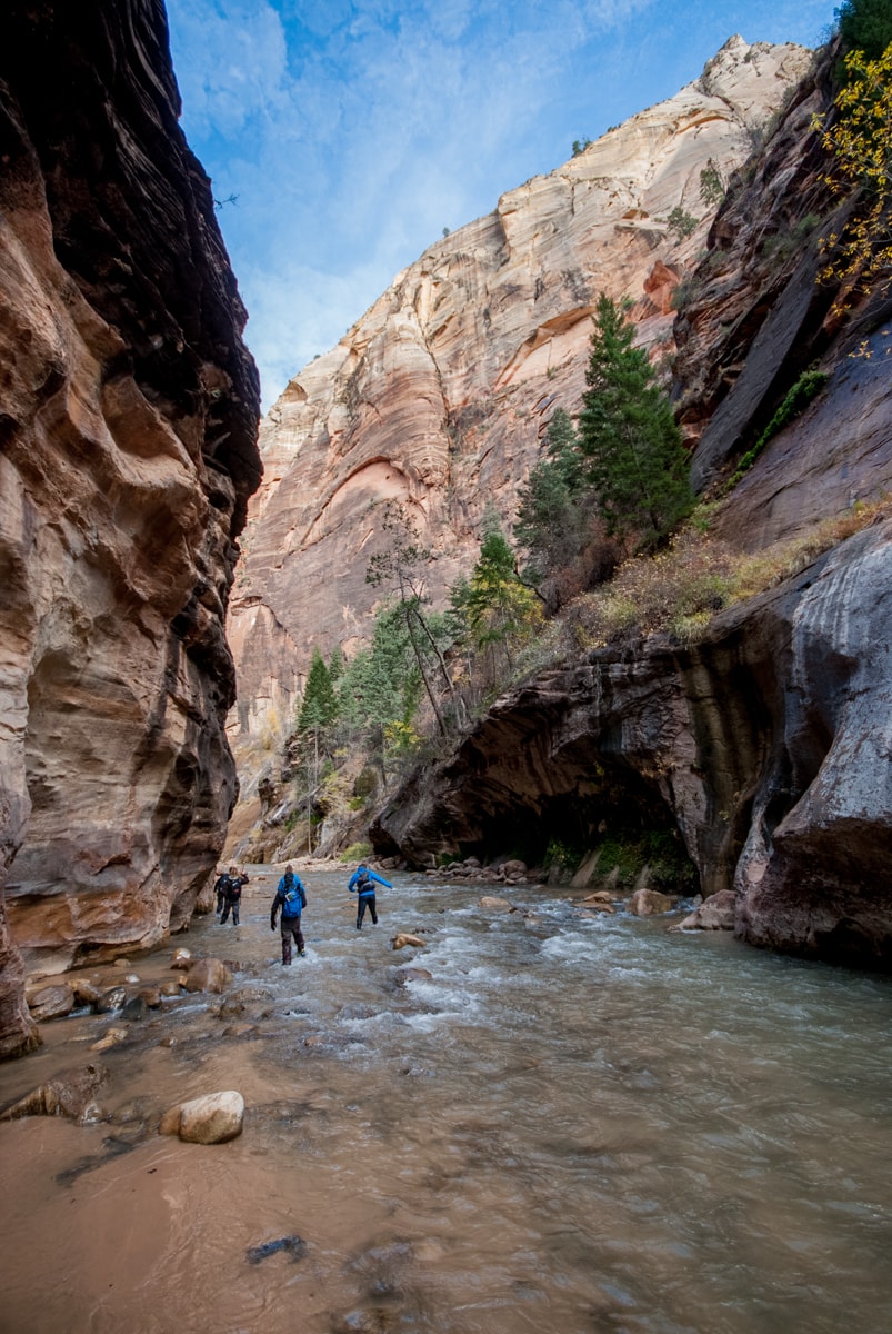
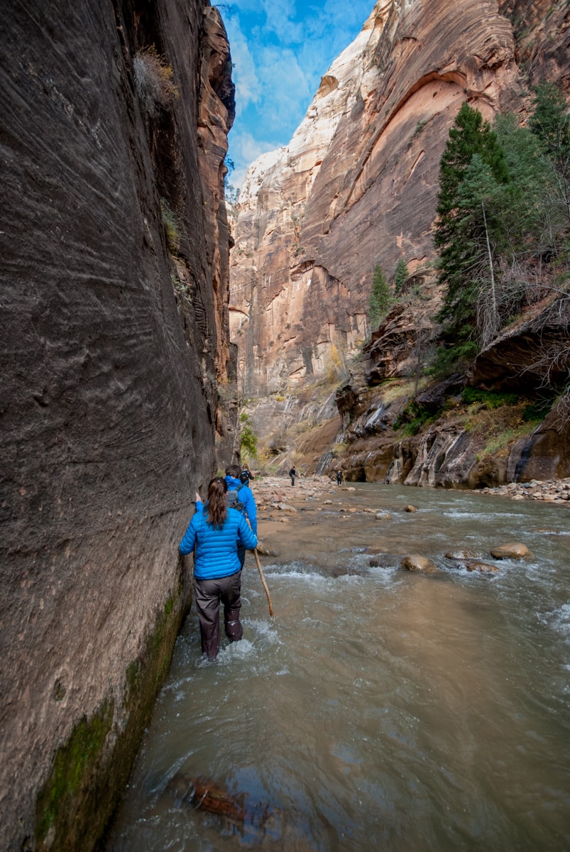
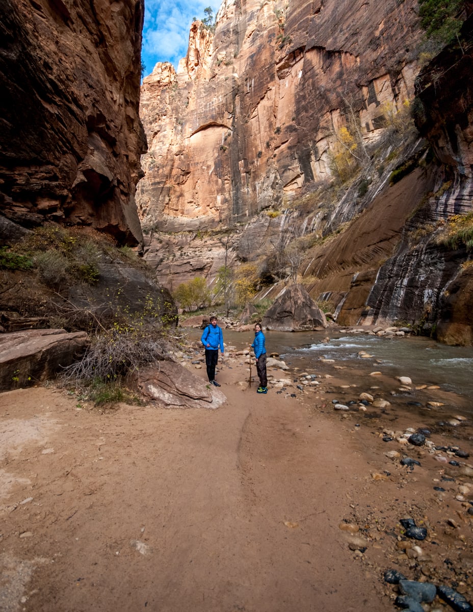
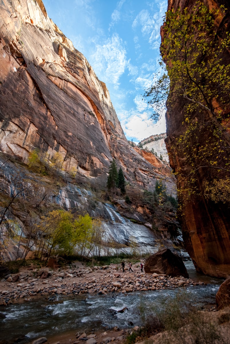
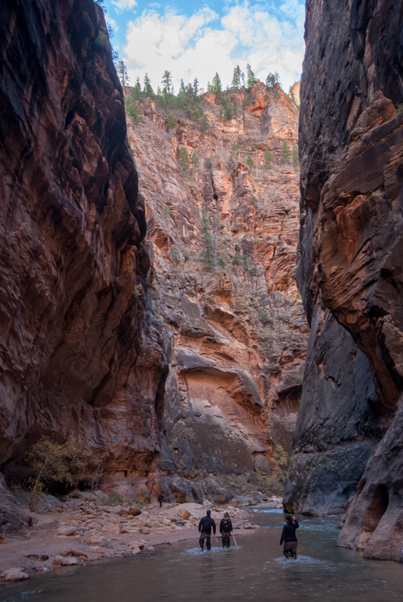
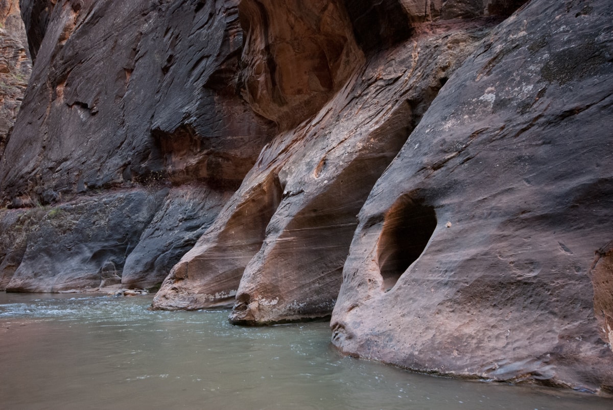
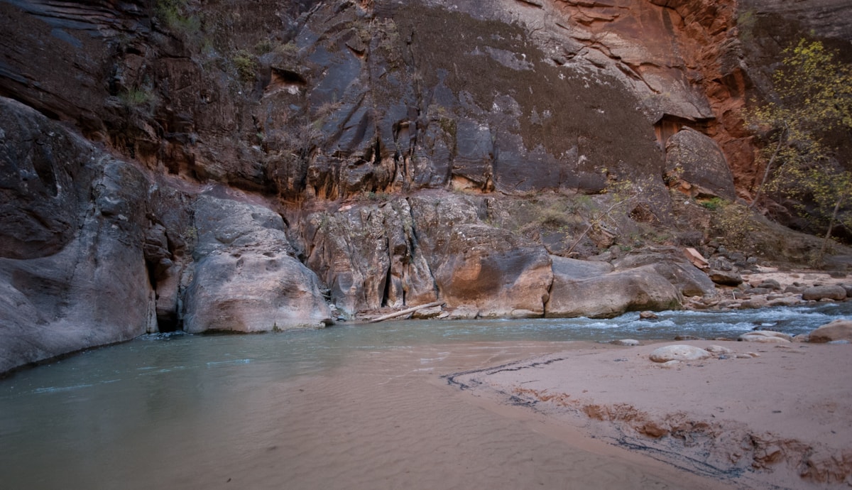
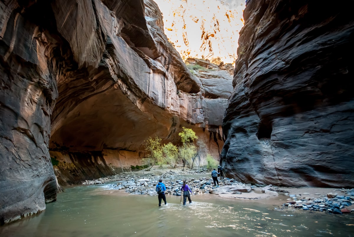
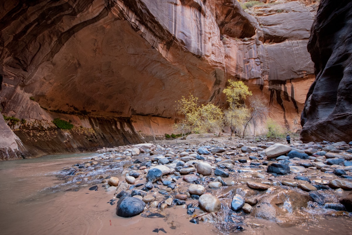
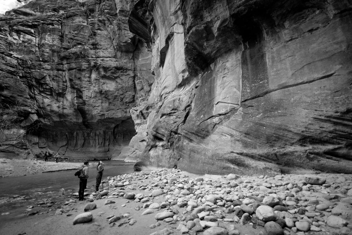
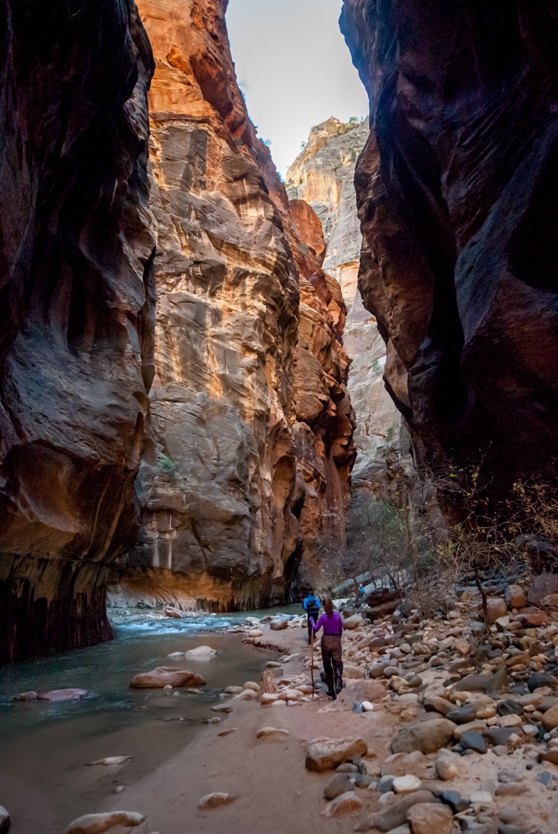
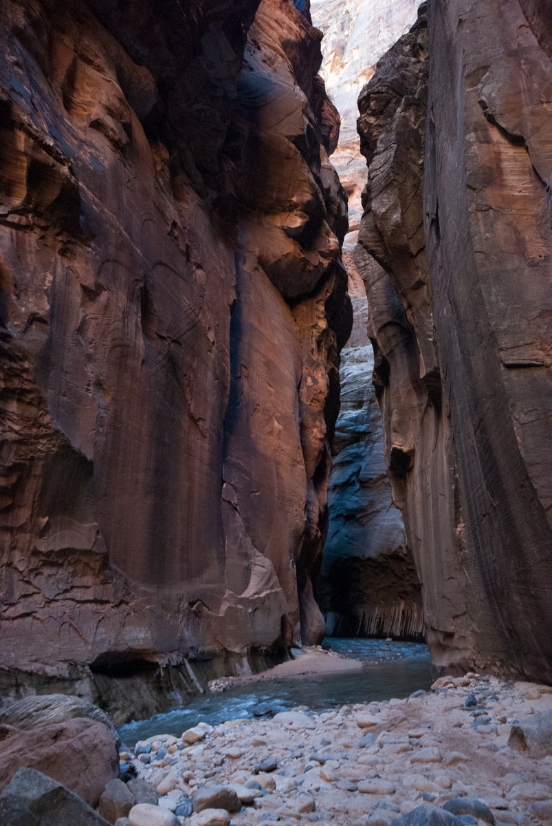
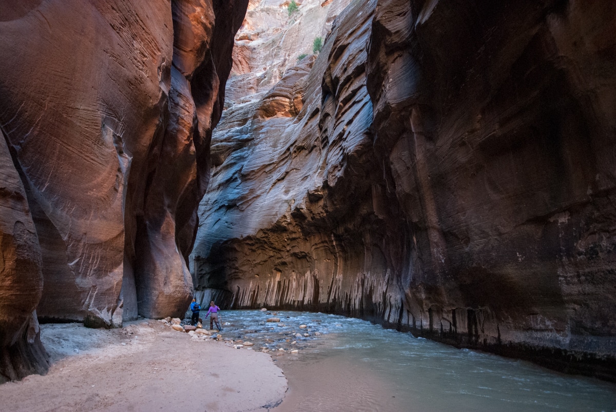
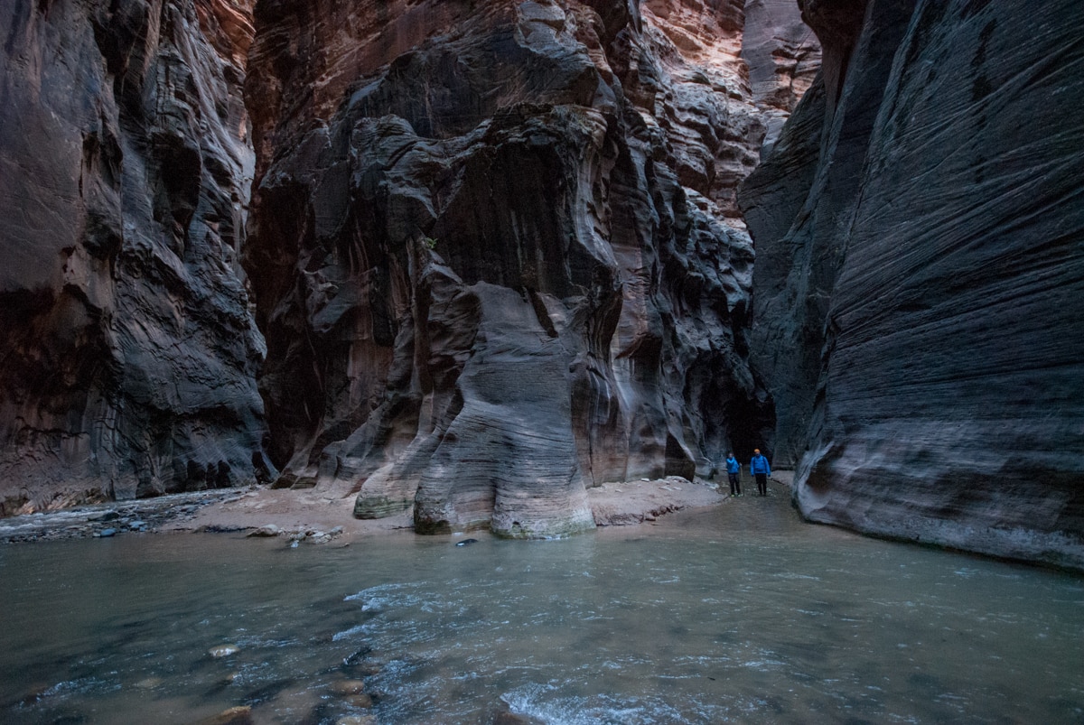
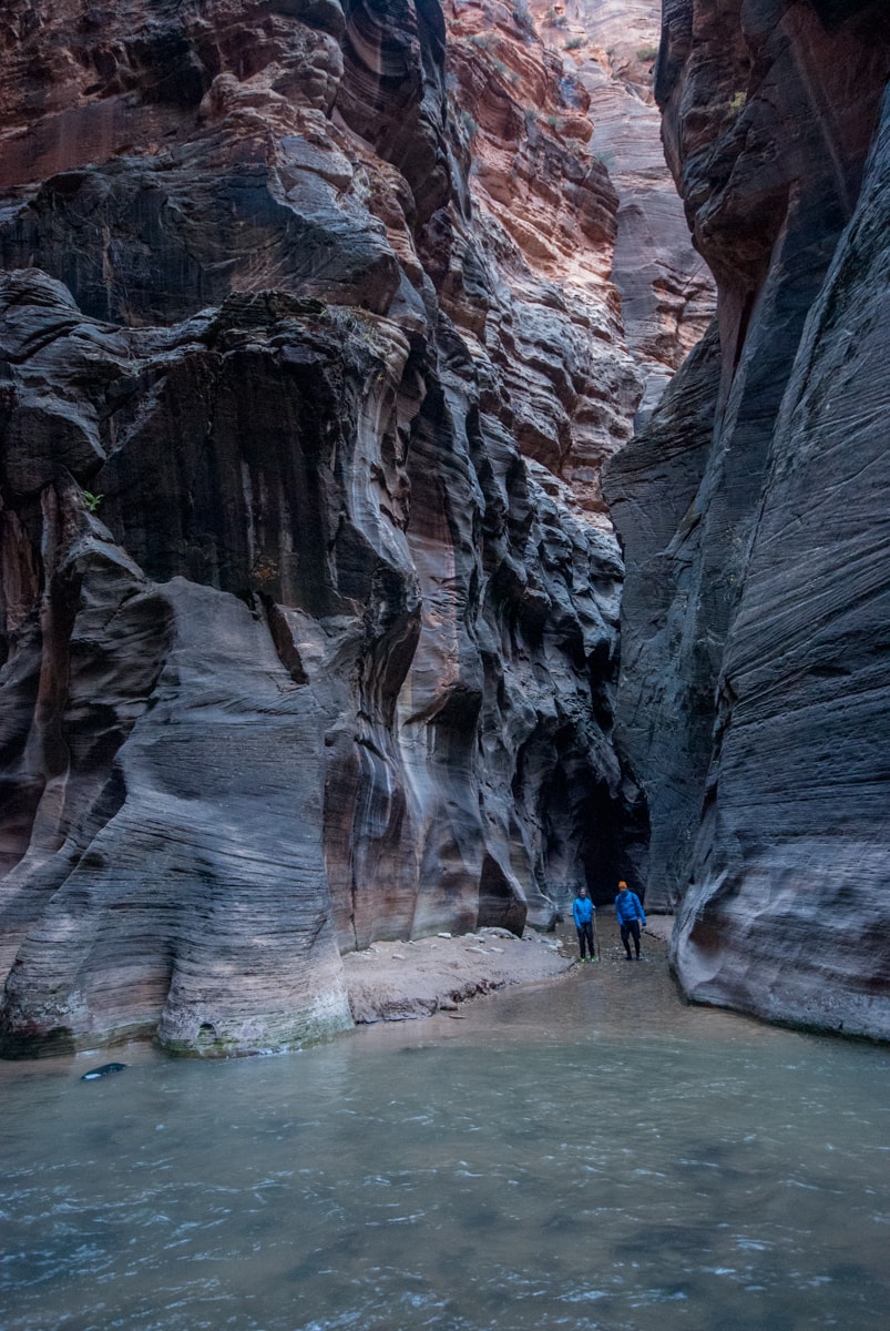
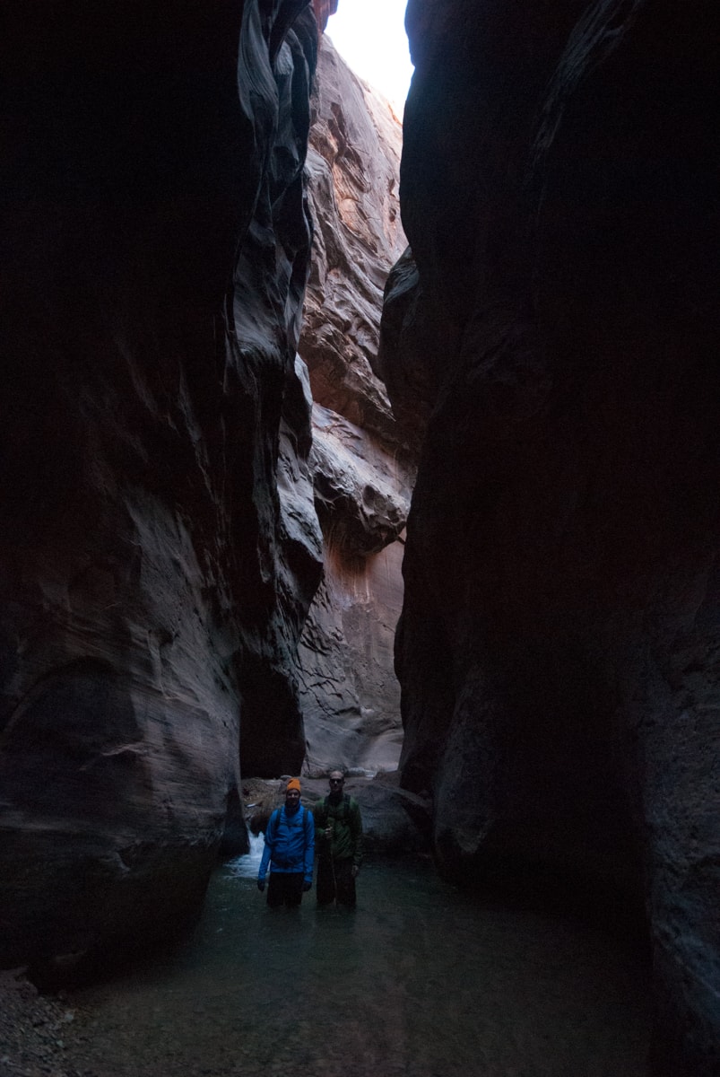
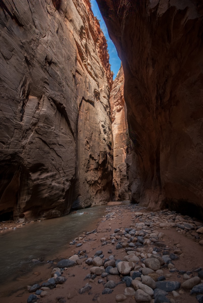
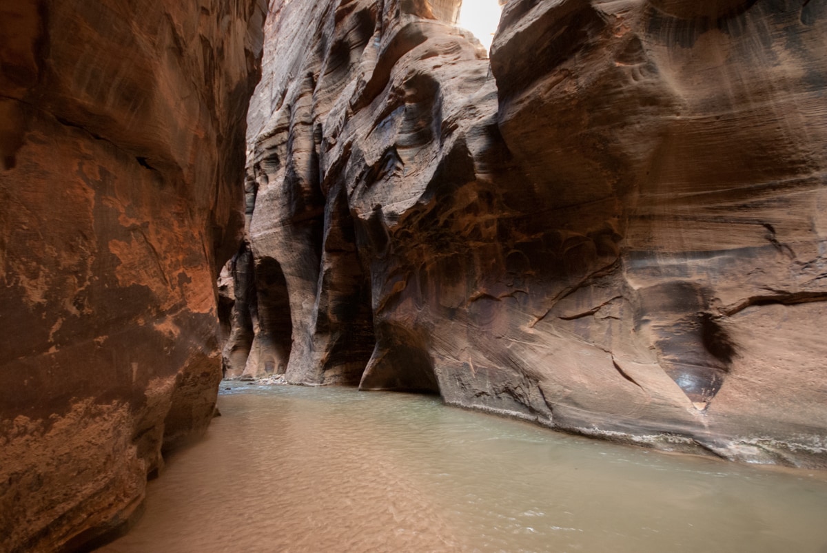
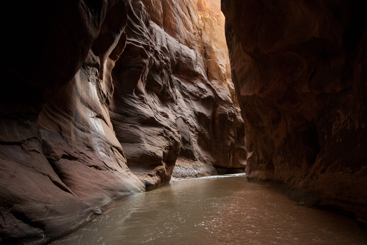
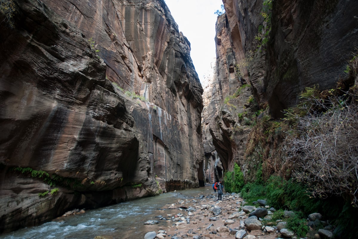
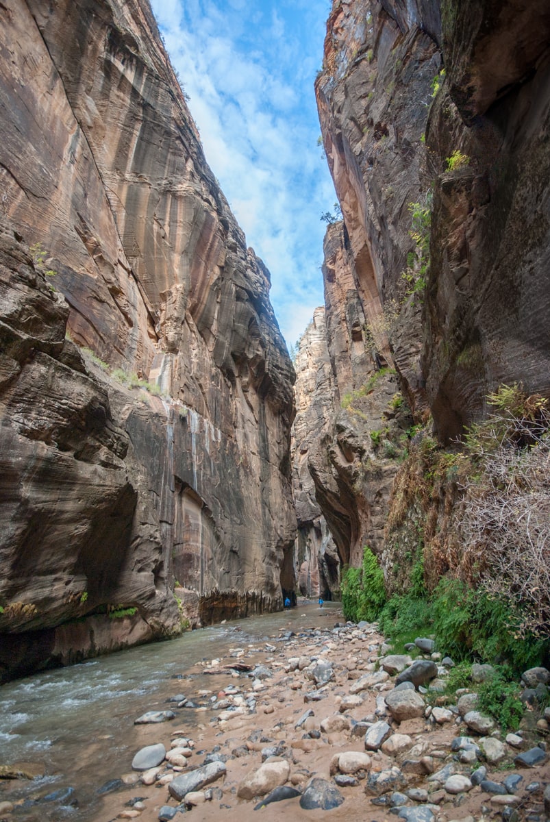
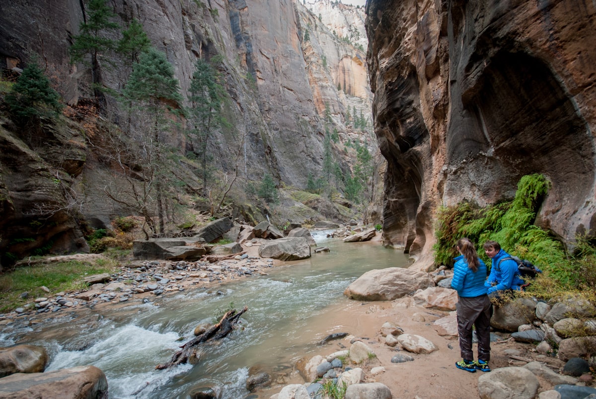
Because the weather forecast was good the next day, we decided to hike The Narrows, which essentially continues following the Virgin River up the canyon, beyond the point when the canyon becomes too narrow for the road to continue. We rented dry pants and water shoes and packed some warm gear and snacks for a river day. We ended up hiking about four miles upriver, with a half mile diversion down a side canyon (kinda route – canyons and gps aren’t friends). With the water level that day, we ended up hiking about half on sand / river rocks and half in the river, at its deepest around thigh level. The scenery was pretty remarkable. Even at noon, parts of the canyon floor were relatively dark – just too little opportunity for sunlight to make it down to the water level given the tall canyon walls.
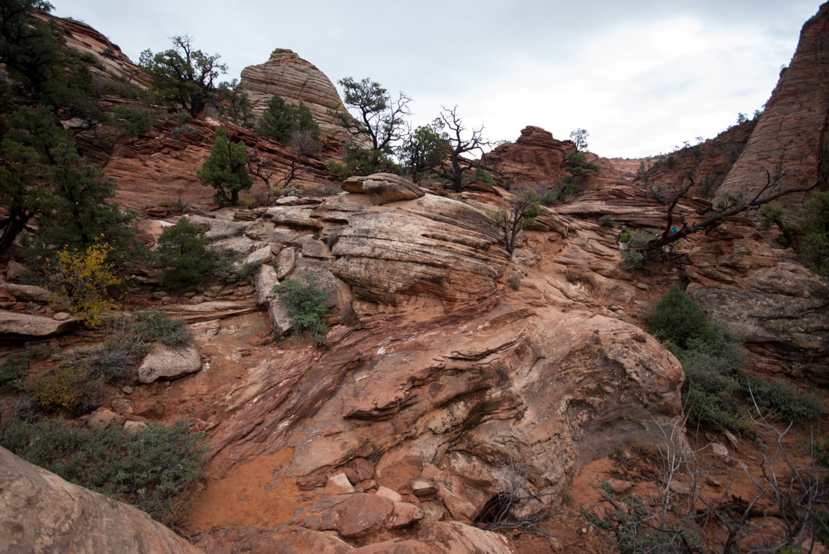
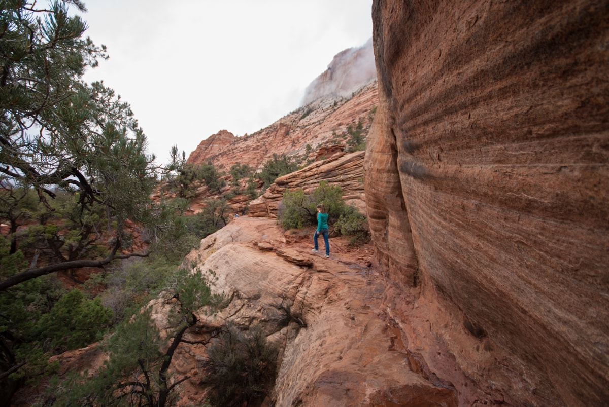
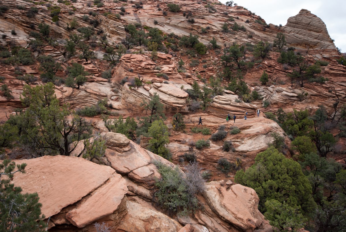
The next day it rained. The river flooded. (Good thing we’d already done the Narrows hike. The NPS closed it because of the spike in river levels. Not a good place to be in a flash flood.) Since the weather had predicted 100% sunshine, and we were in the middle of a desert, we’d actually not brought rain gear. So we used the opportunity to catch up on some reading and work email, and to do a small 1.5hr hike up on the rim of the canyon when the clouds cleared for a while.
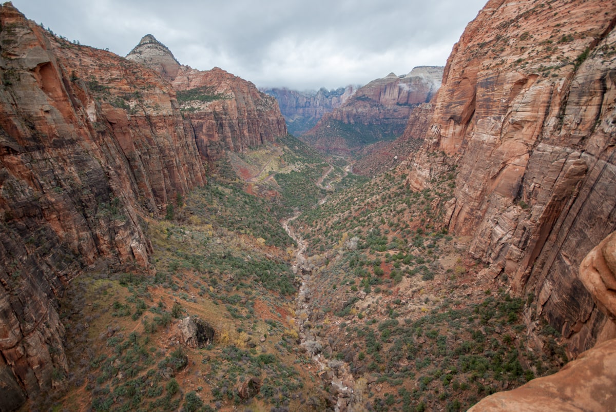
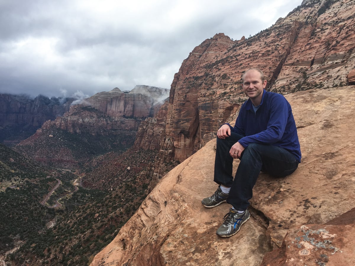
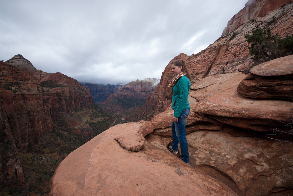
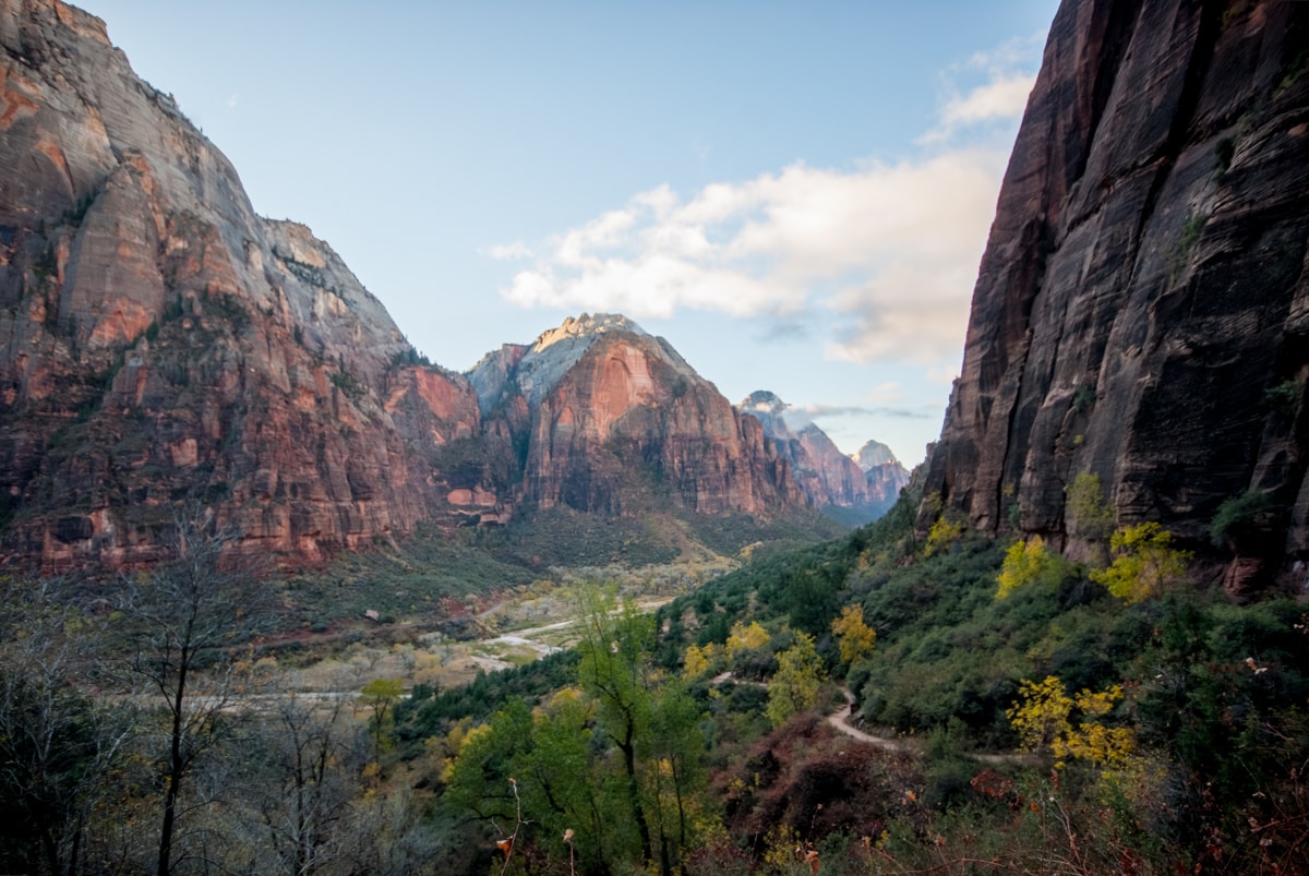
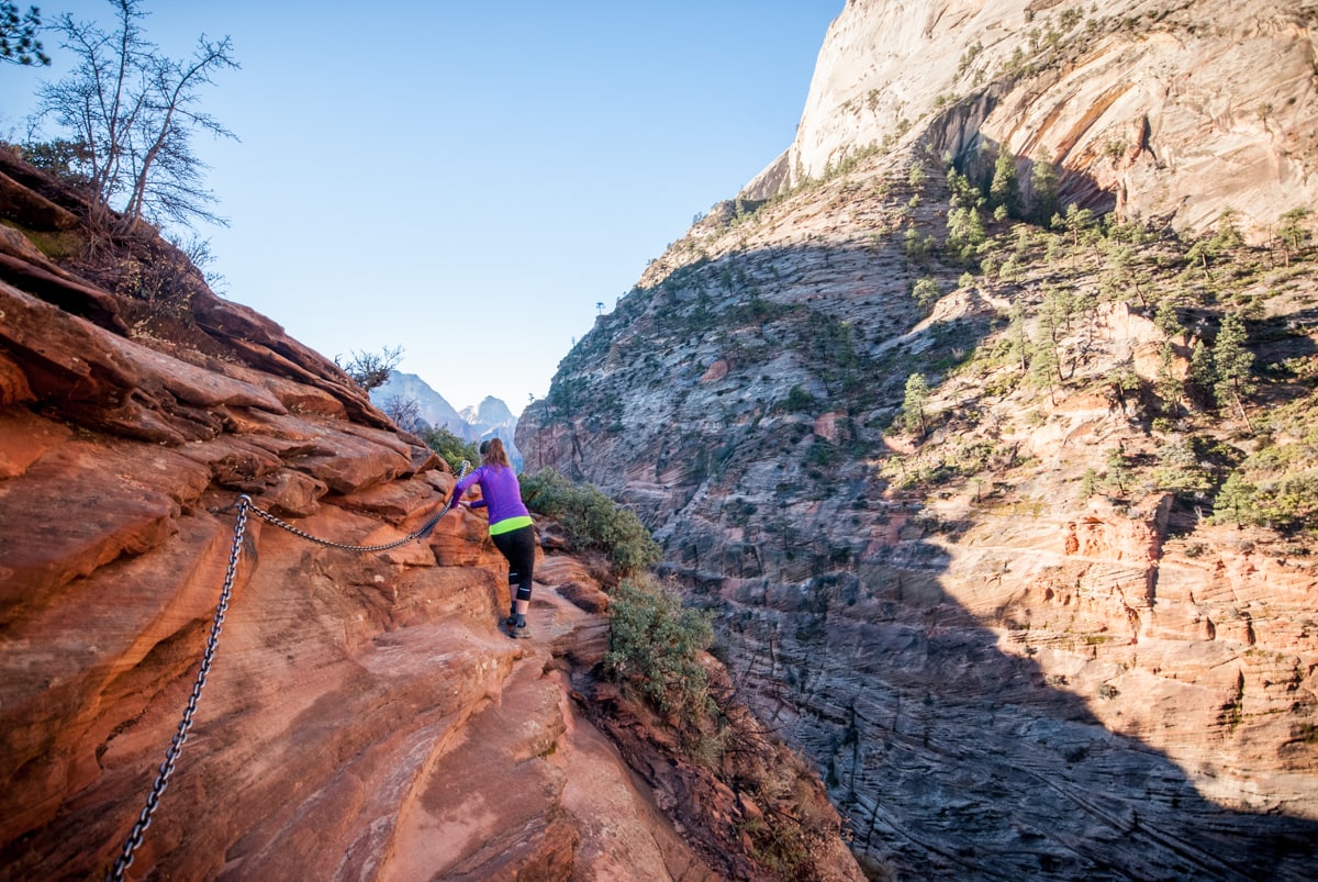
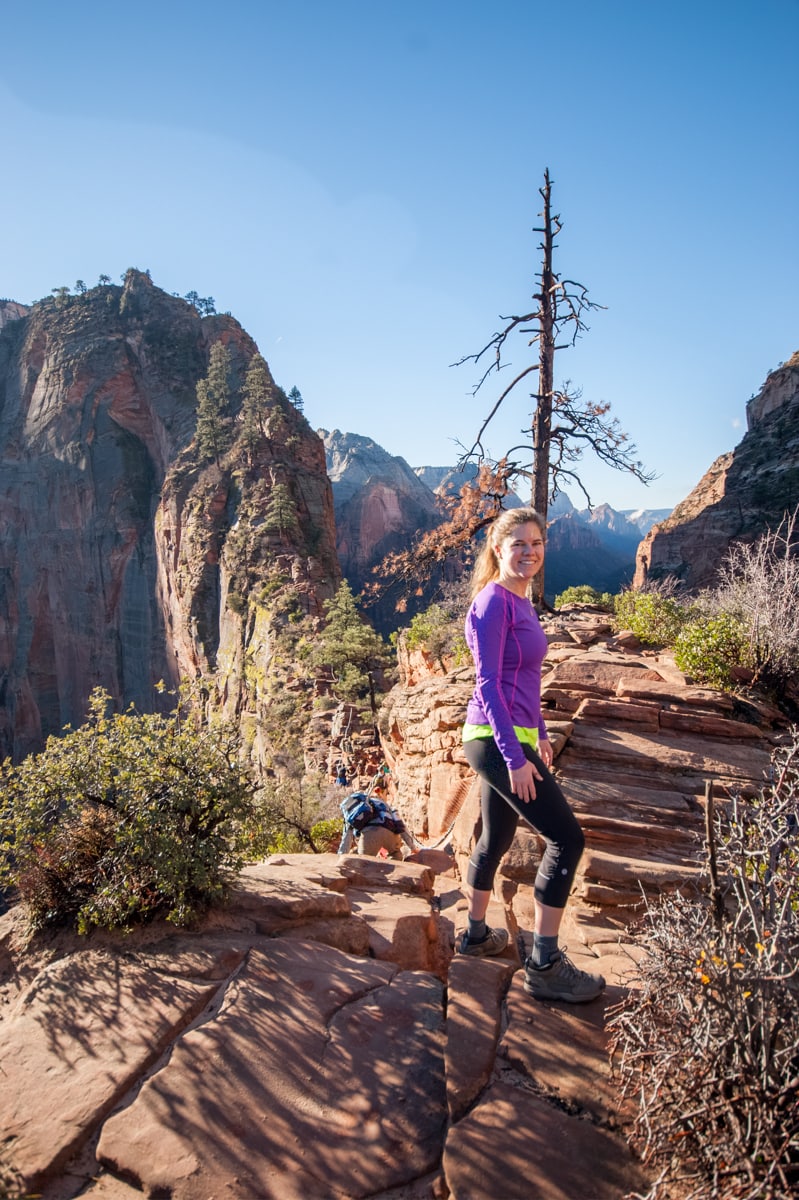
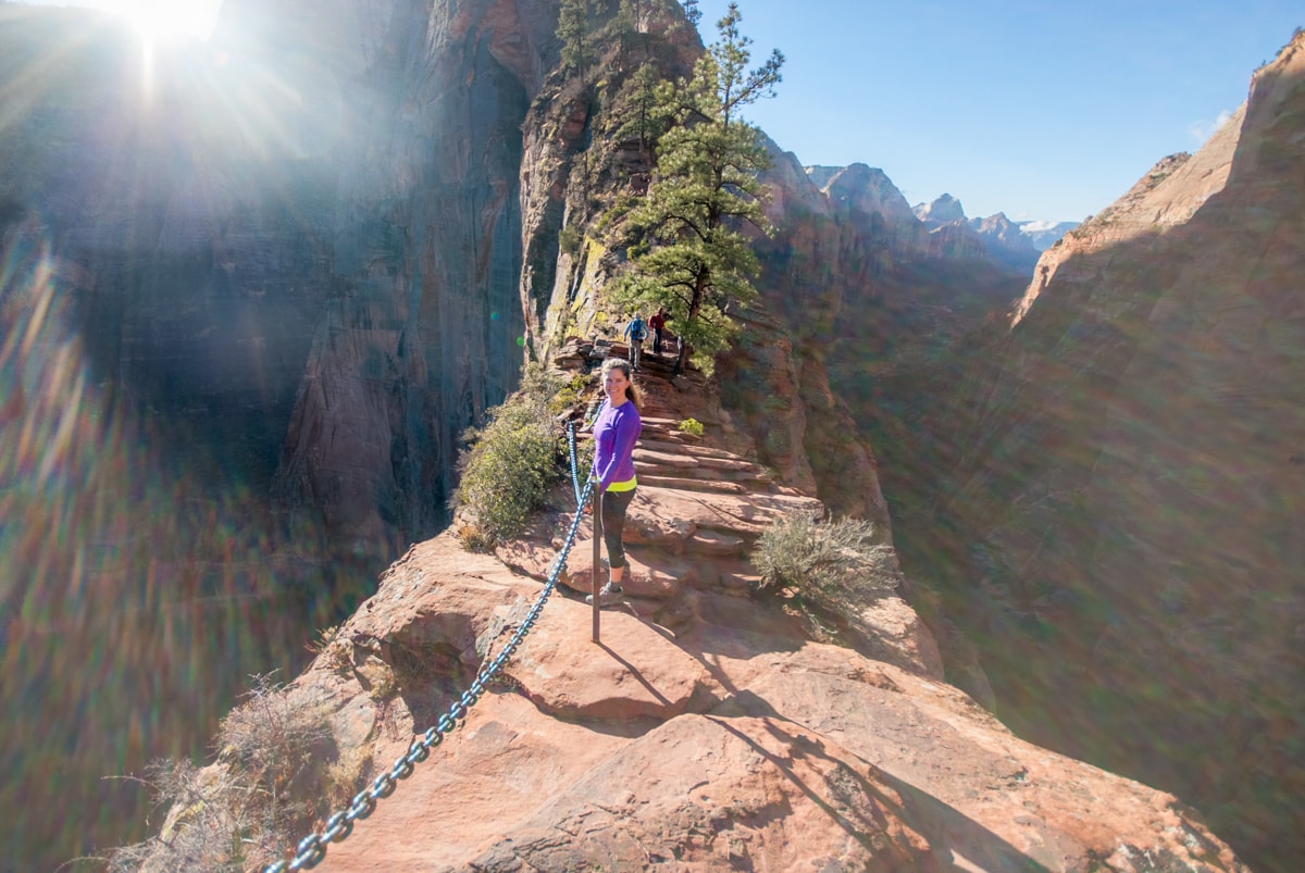
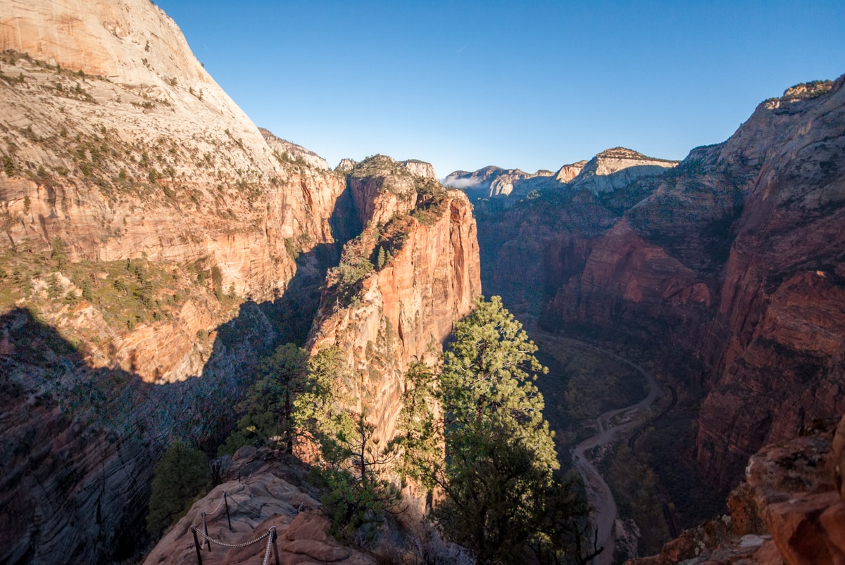
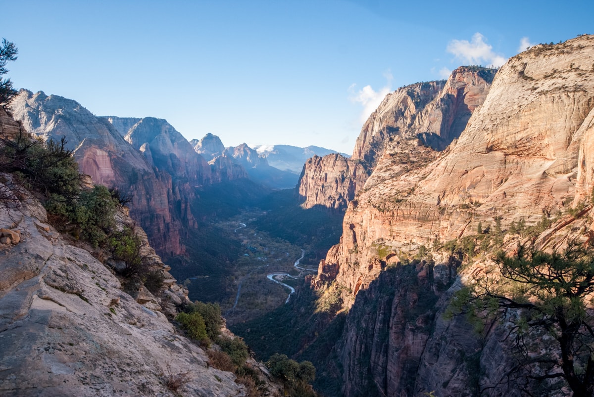
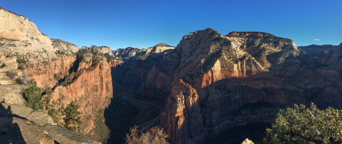
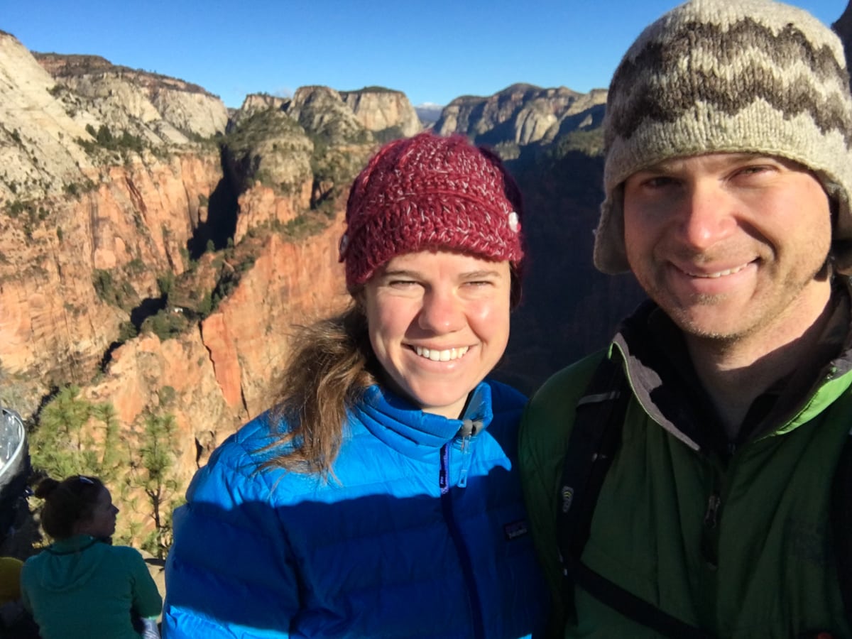
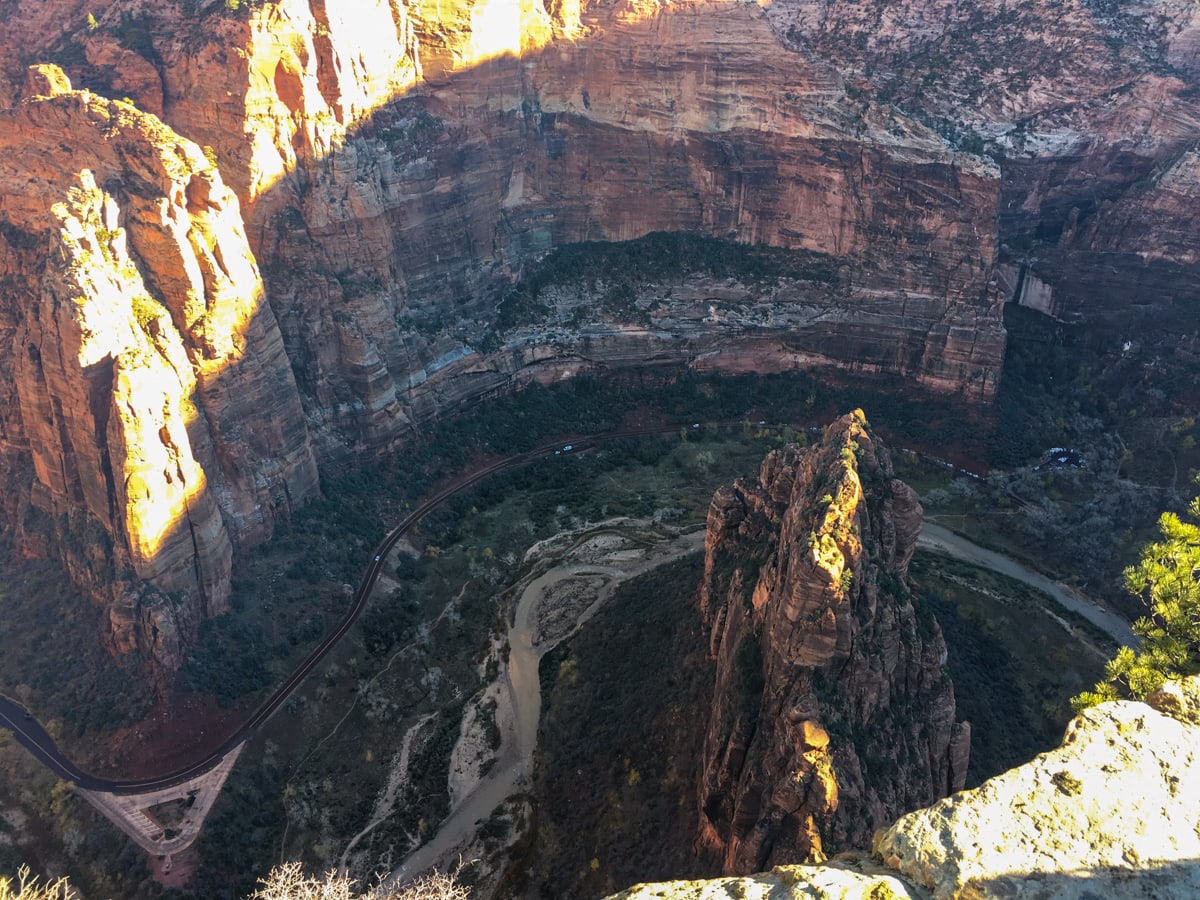
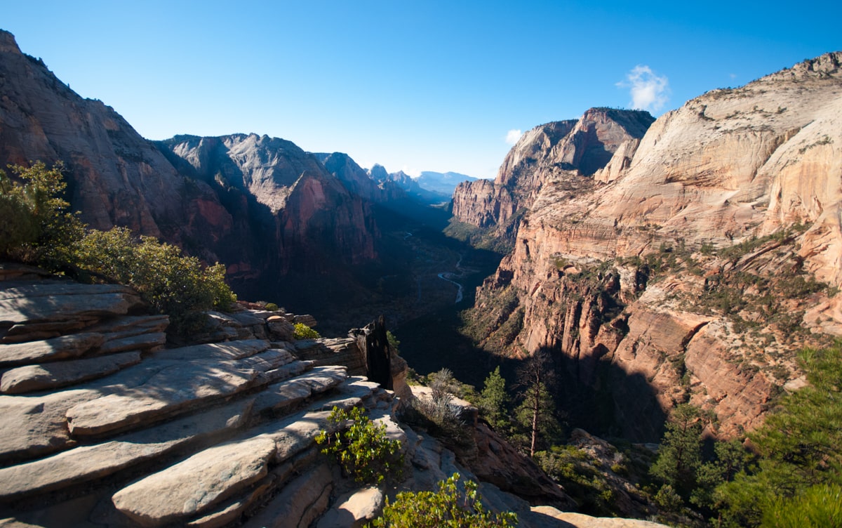
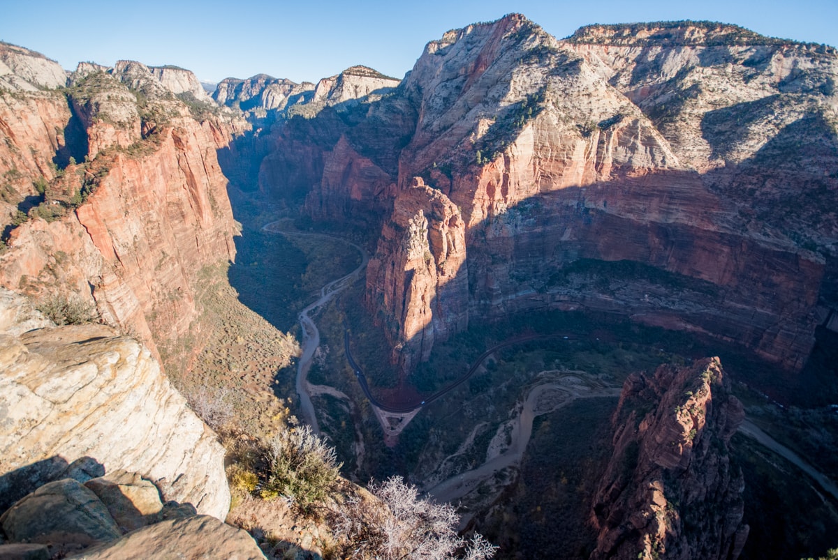
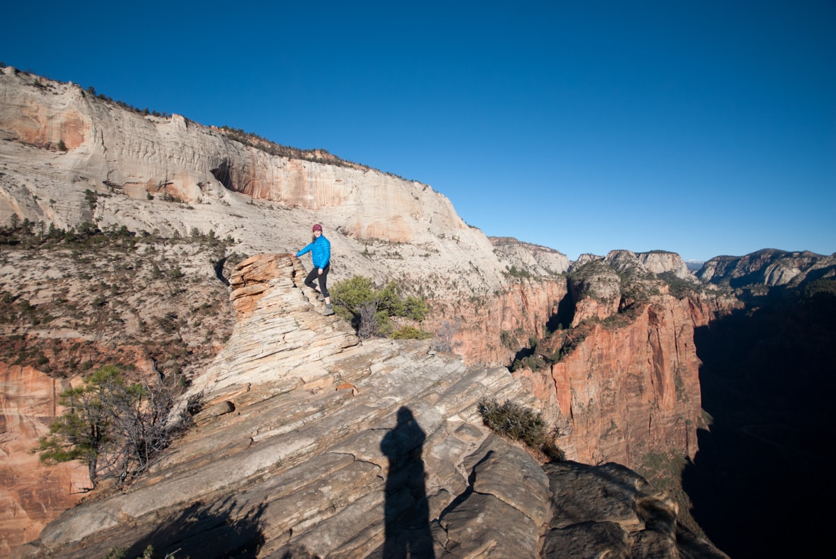
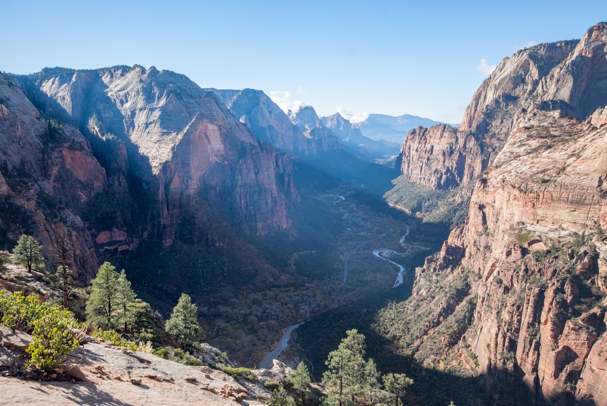
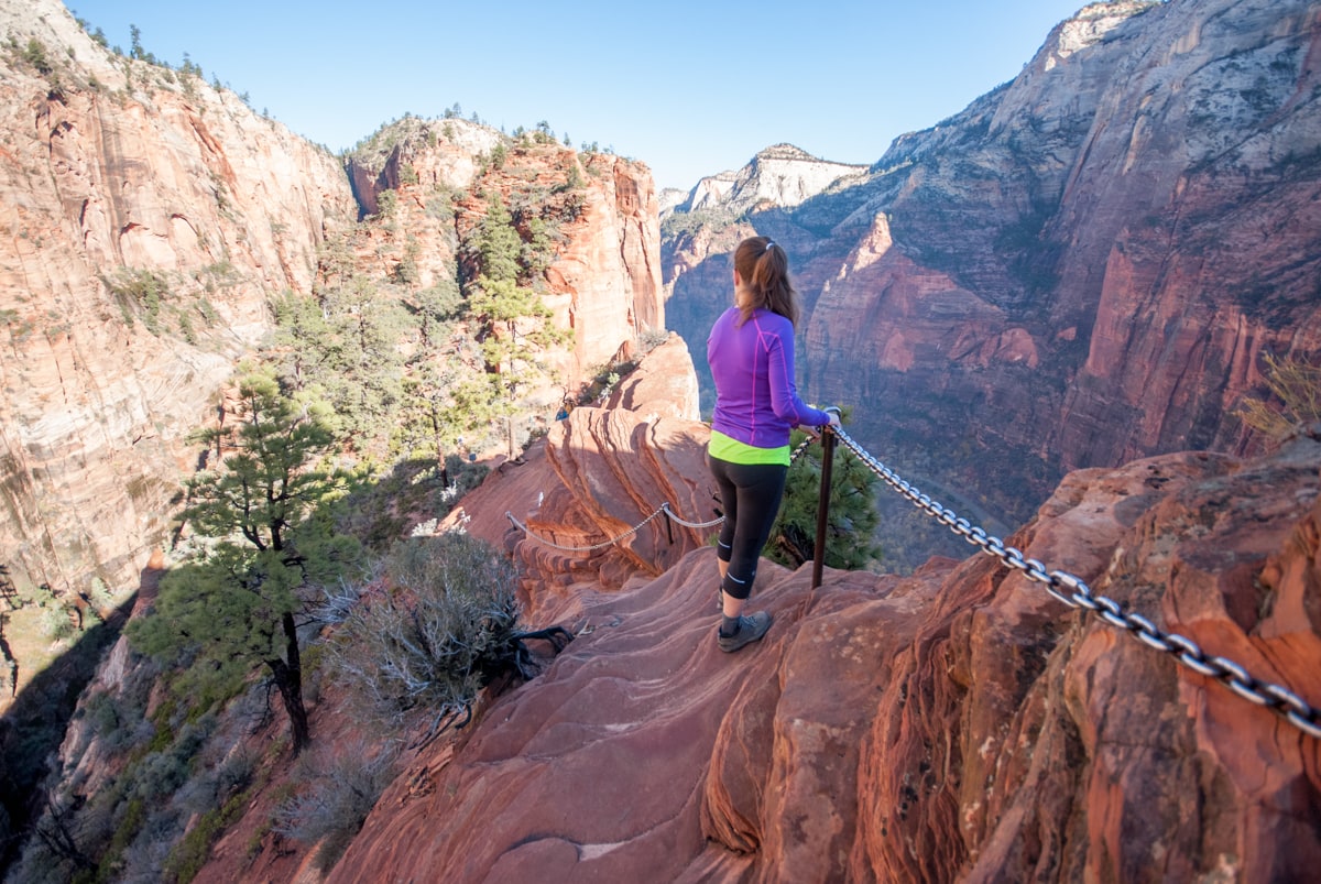
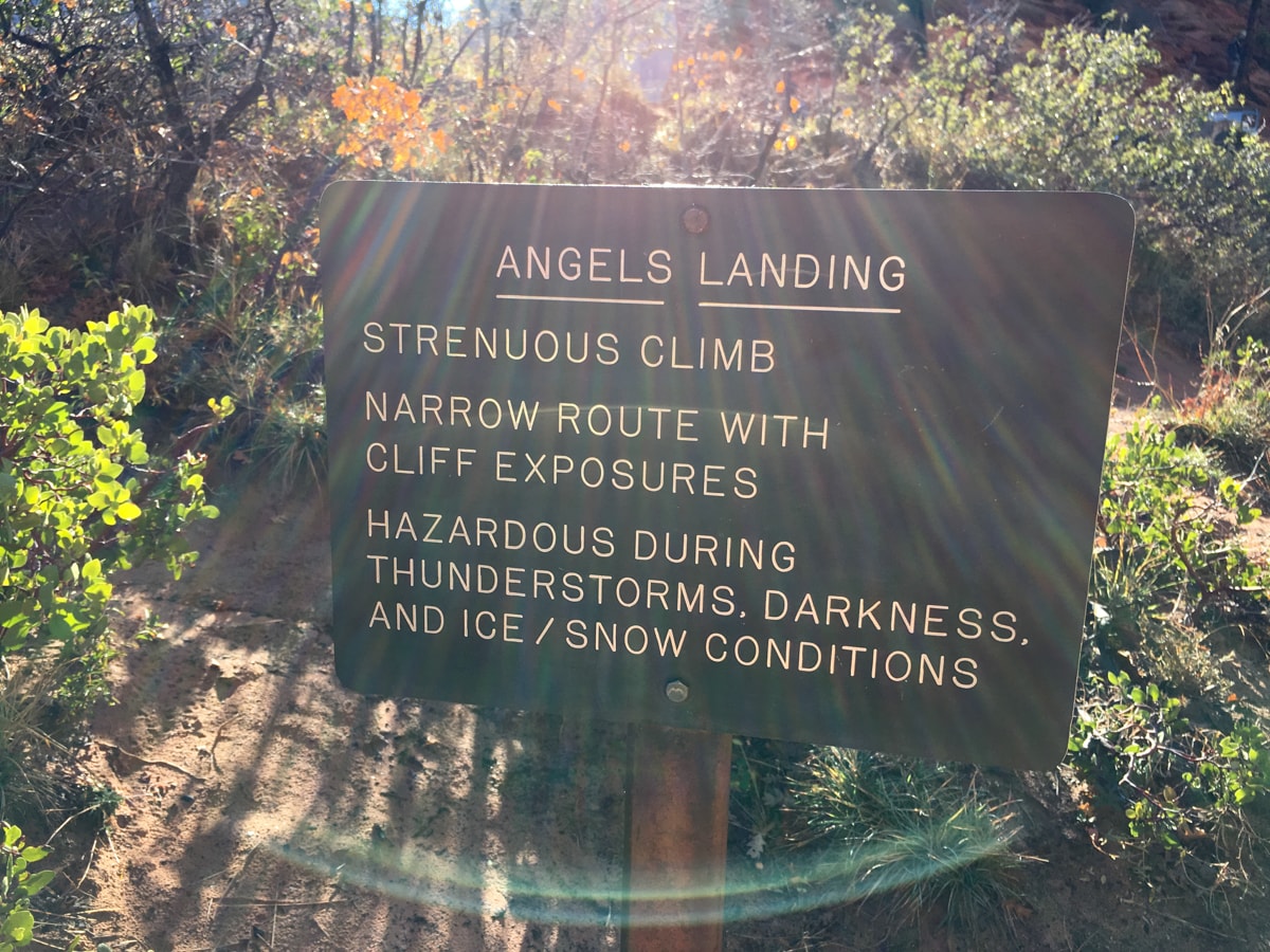
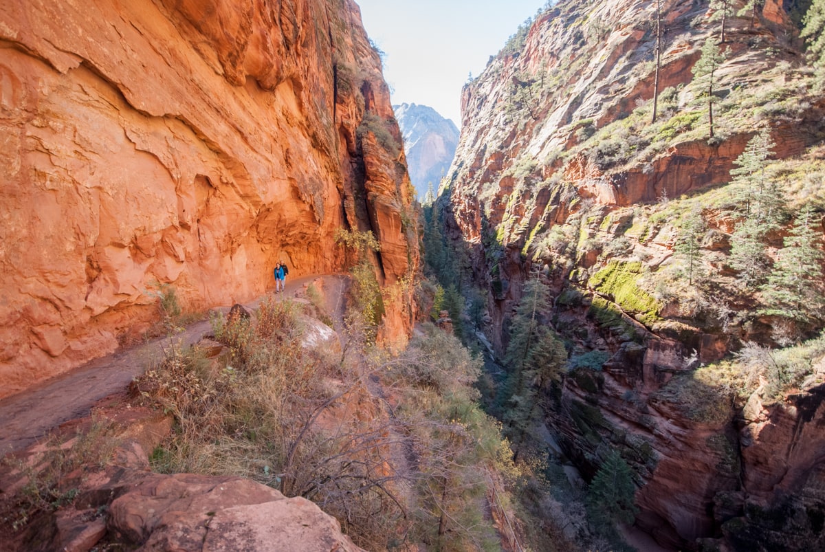
Then, day 4, was the Angels Landing (sic) hike. The river makes a big 180 degree turn around this jutting of canyon wall, which has over time formed a shark fin of sandstone that happens to be hikeable (max class 3, exposure) all the way to the top. And given the popularity of the hike, NPS has installed chains on all the iffy parts, so it’s really closer to class 2. But regardless – it’s something. 2.5 miles from bottom to top, and about 1600 ft up (route).
The first 1.5 miles are on a nice trail (some paved) ascending from the floor of the canyon. Then once you top out onto the low point of the shark fin, the fun begins. Basically you head up the ‘ridgeline’ to the top of the feature. It’s actually sandy up there, oftentimes slope-y footing (partially due to erosion from so many hikers), and the rock is crumbly in places, so we paid attention. At one point, you walk on a 3ft wide stretch of rock with thousands of feet of exposure off both sides – very fun. At the top, you have great views down canyon as it widens and the ‘mountains’ (i.e. rim of the plateau) are all visible, and up canyon towards the Narrows as it gets continually narrower and narrower. We made friends with a couple of chipmunks, and eventually headed down.
– – – – – – – – – – – – – –
Zion is beautiful. Go during the shoulder season! It apparently gets up to 105 in the summer with horrible crowds. We had 55-65 degree days with medium amounts of people. We loved it.
– – – – – – – – – – – – – –
Overheard:
“I’m gonna punch that monkey in the face.”
“You scared the deer because you talked too loud.” “It couldn’t hear me in the bus!” “Deer can hear everything in the world.”
“Oh Christmas nuts!”
This Post Has 0 Comments