Staying Dry on the Routeburn Track
We begin with a lesson in ‘real’ English: a burn is a ‘watercourse that varies in size ranging from a large stream to a small river.’ One such example, the Route Burn, which we walked along for more than a day as it wound through beech forest and alpine landscapes, is the namesake of the Routeburn Track.
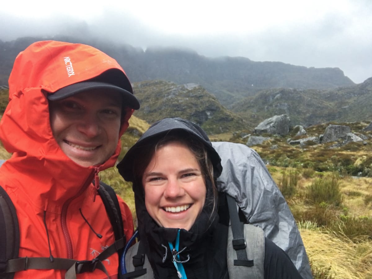
Like other Great Walks in NZ, Routeburn has a system of beautifully located huts spaced nicely along the track. For some reason now not totally clear to us, we opted seven months ago to reserve tent sites instead of hut spaces. Word to the wise – the huts are much drier. That said, if you have a rain fly for your pack and are relatively well prepared, a little rain won’t hurt much. So while we had a bit of a wet trip, both Elisse and I came away from it thinking that the Routeburn is our favorite Great Walk yet. Elisse: Because the Routeburn Track is awesome!!!!
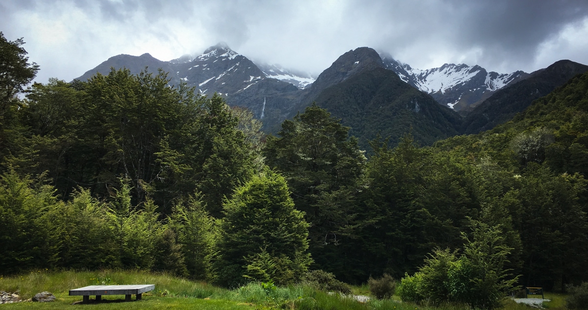
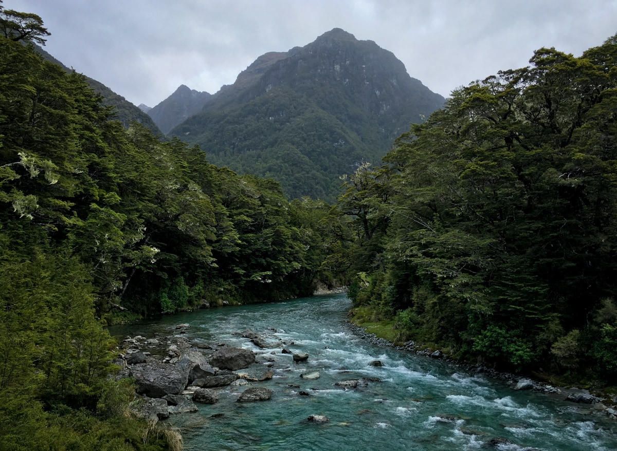
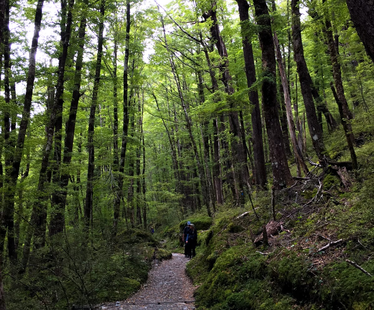
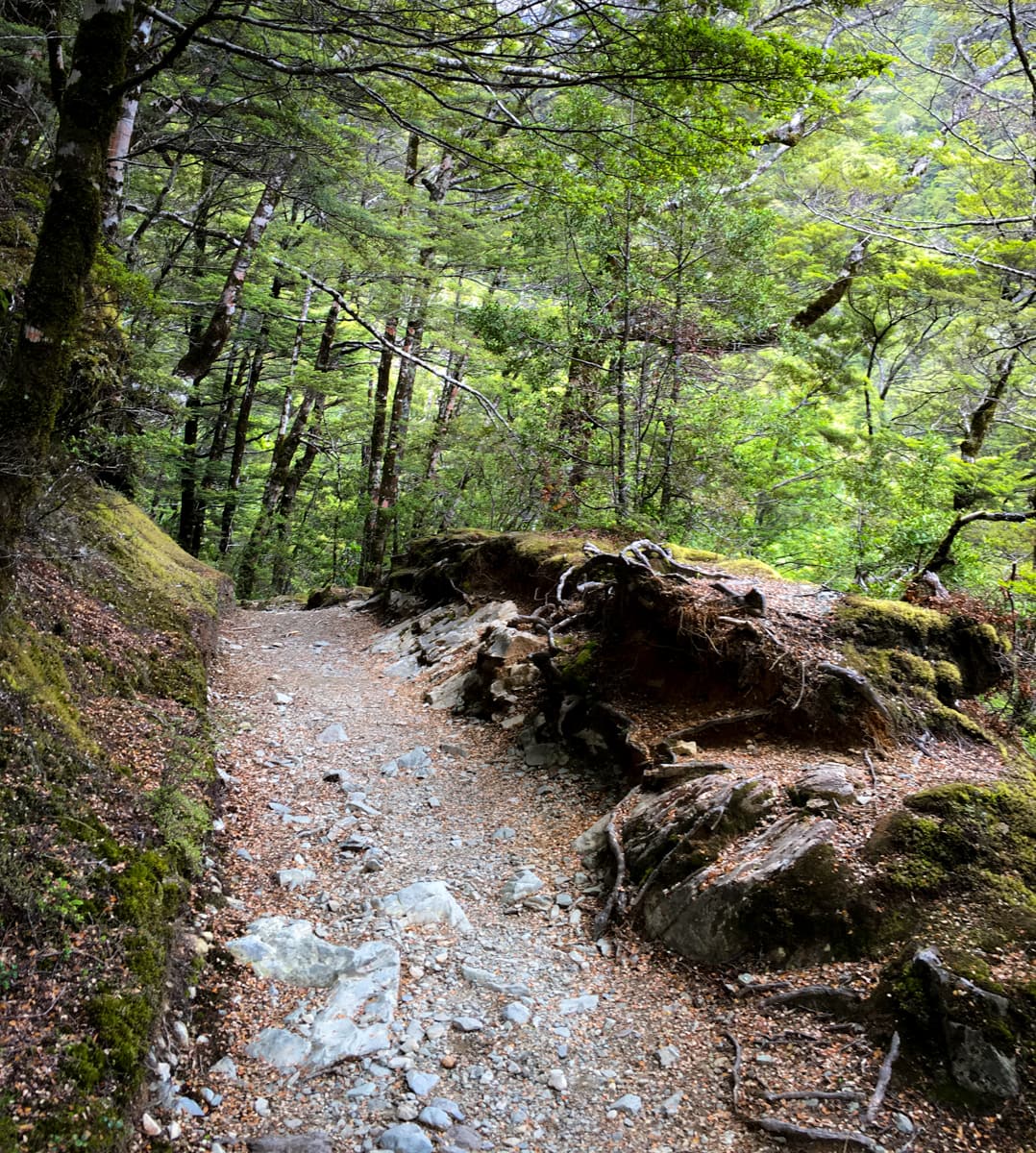
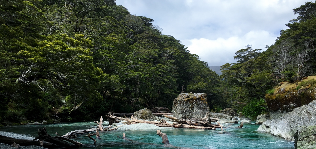
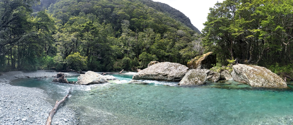
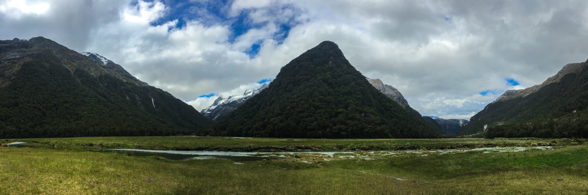
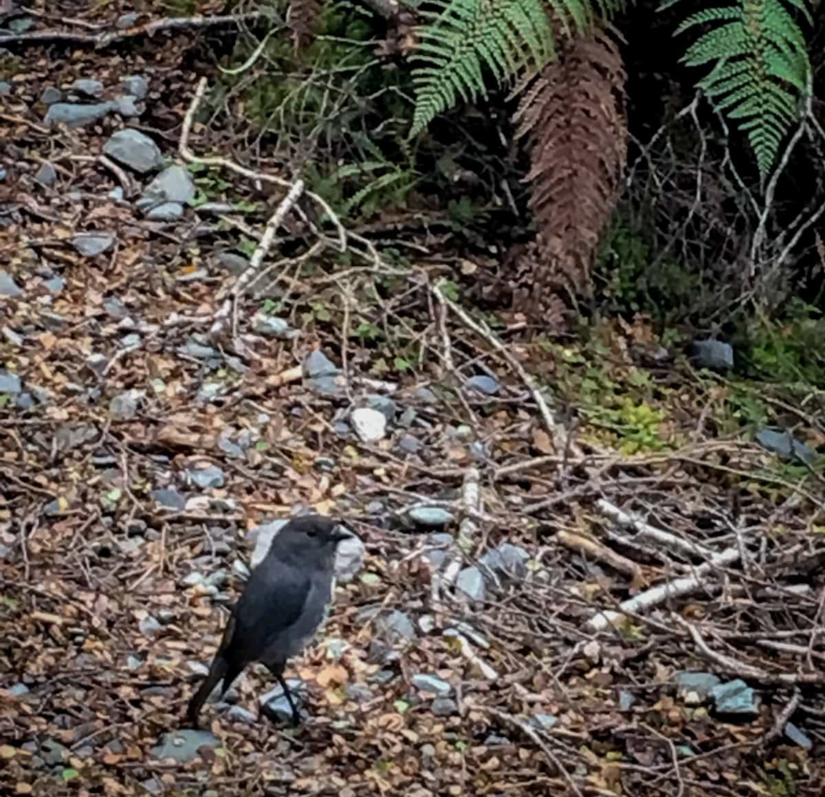
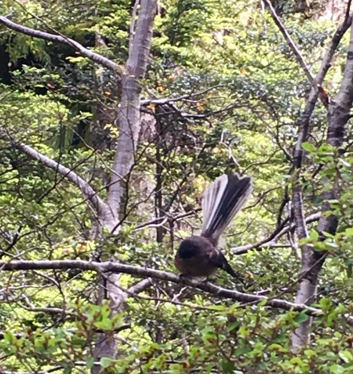
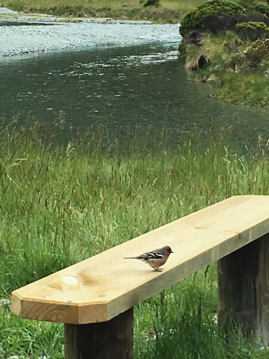
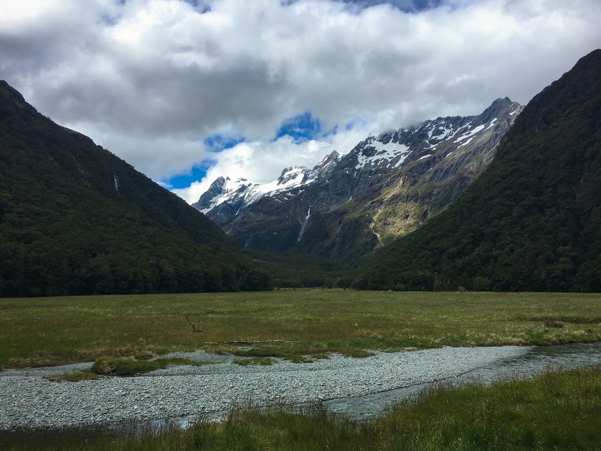
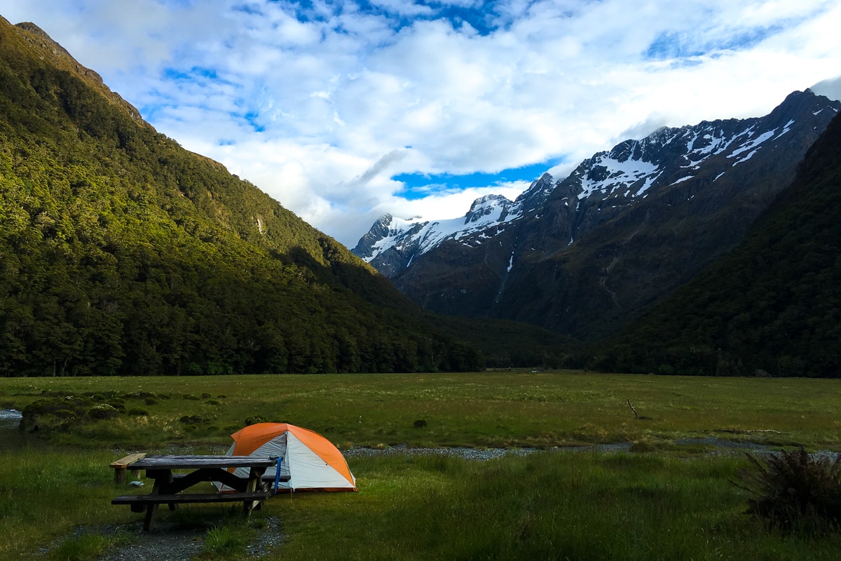
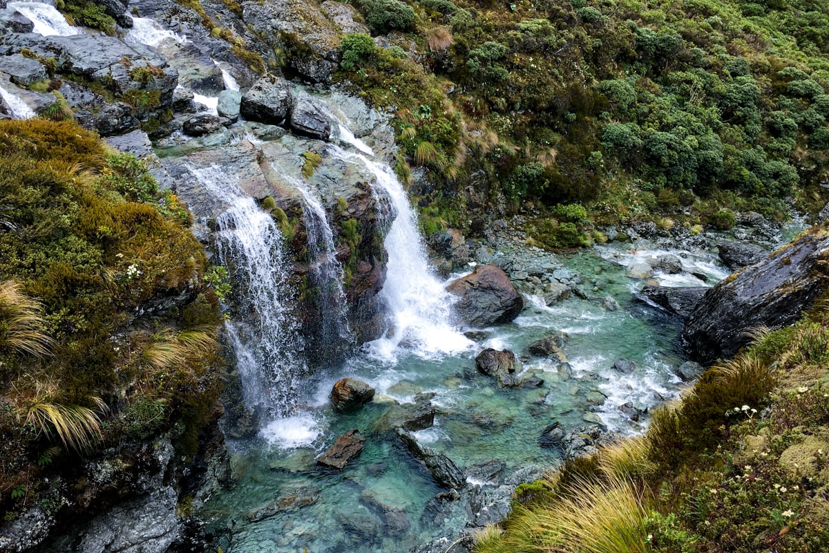
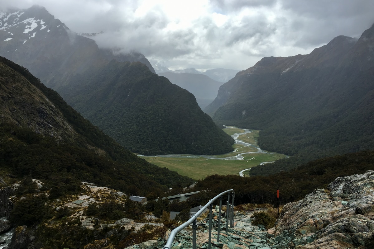
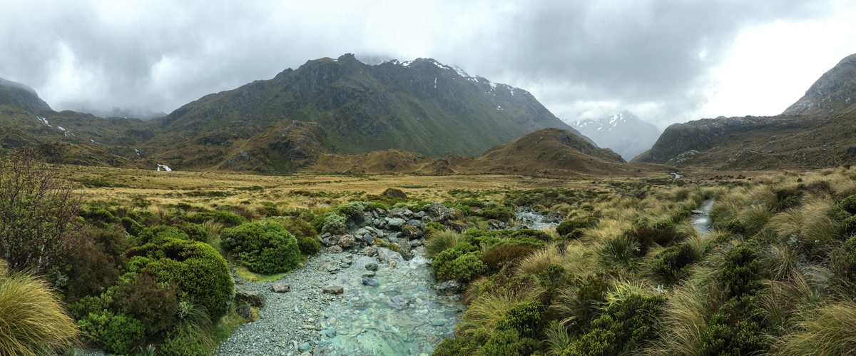
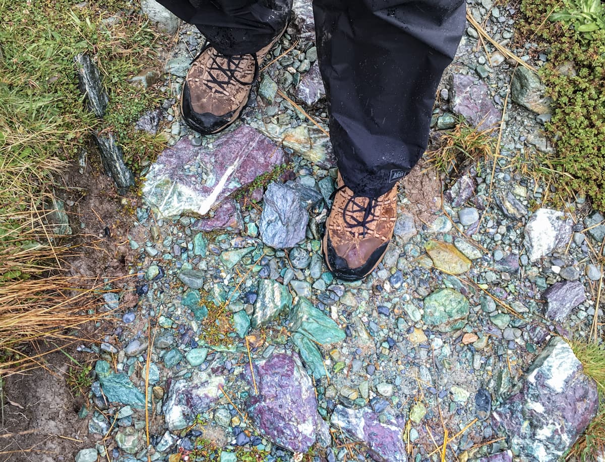
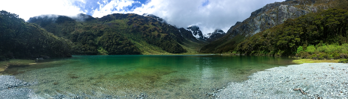
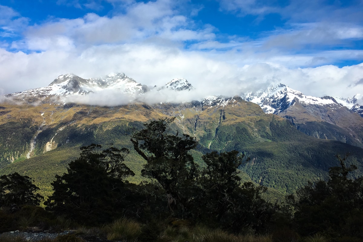
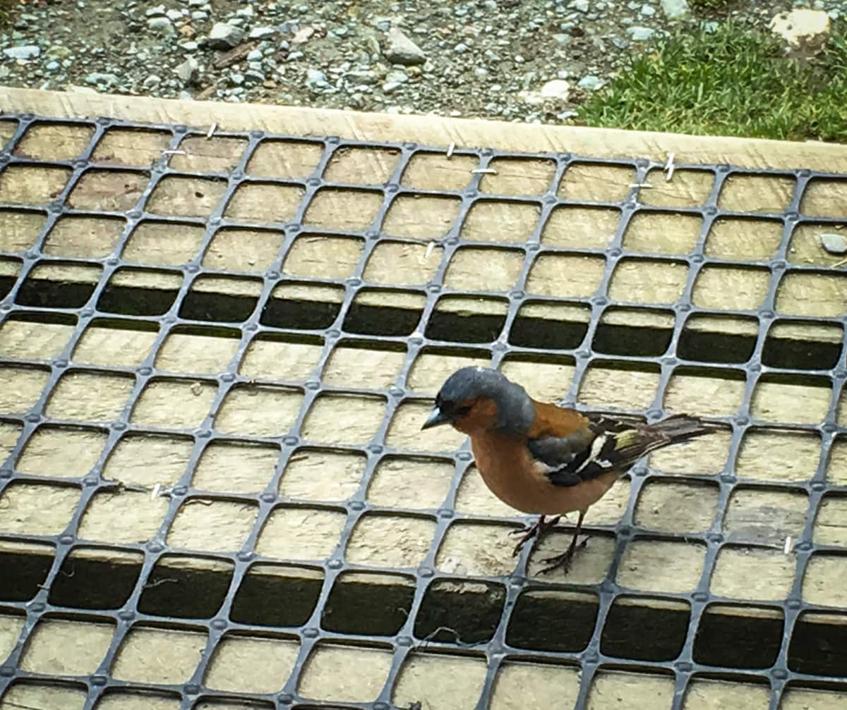
The first few miles took us on a well maintained trail up through more beech forest. The canopy was high above our heads, making the whole area feel airy and light – an interesting contrast to most of the Milford Track landscape which felt packed with plant life of various forms. The trail followed along the river for most of day 1, giving us beautiful views of a turquoise river carved through bright white-gray rock, and then spat us out in a large, grassy valley surrounded by rocky cliffs and snow-capped mountains. We camped in the Routeburn Flats, a wider part of the river valley where the DOC has installed toilets, water pumps, and a sink to rinse your dishes in. All in all, it was super scenic, plus we spotted a black robin, a couple of fantails, some chaffinch and tomtits!
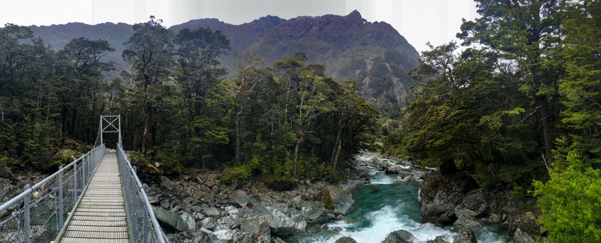
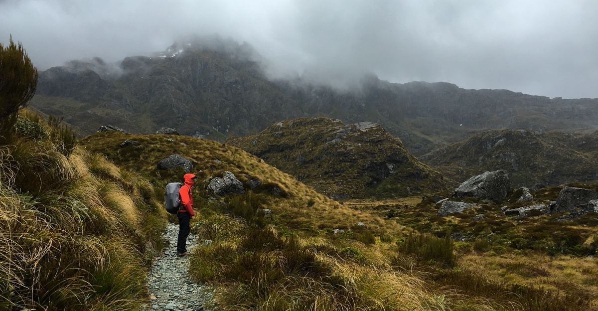
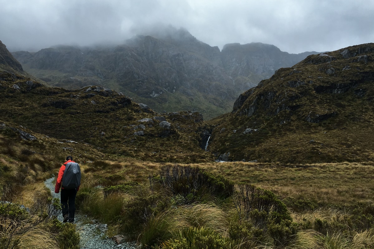
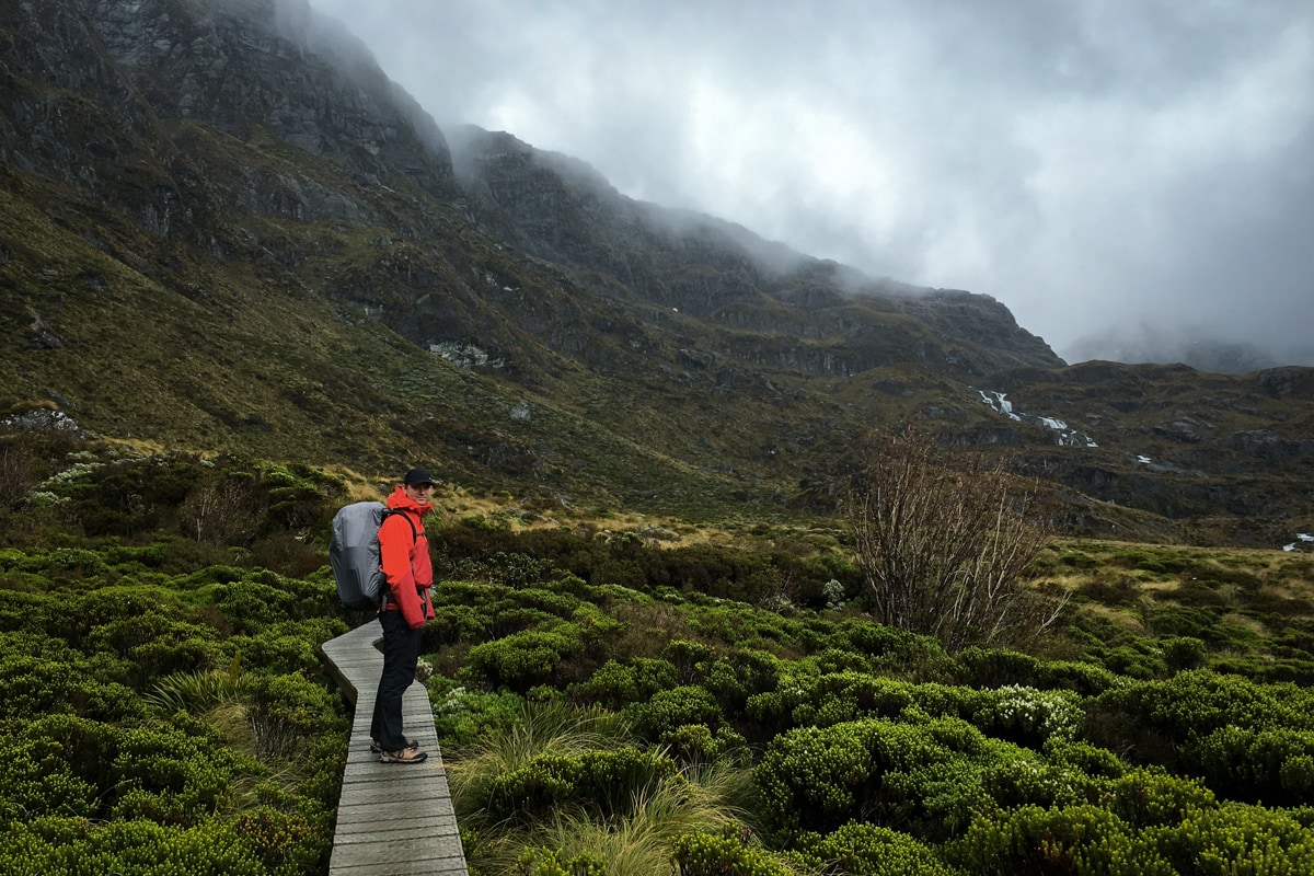
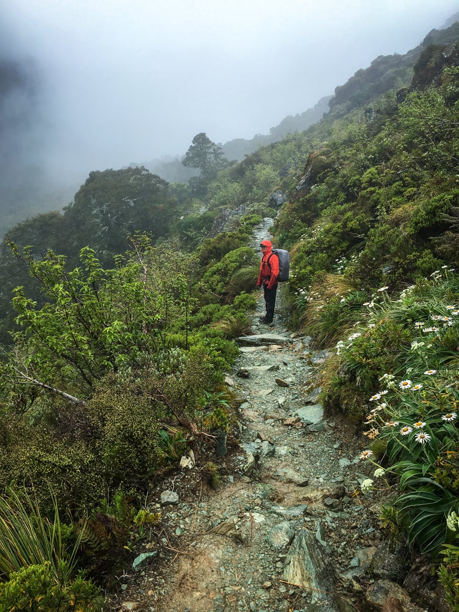
We got started in early-mid morning on day 2, well before the clouds had rolled in. The most recent forecast called for morning rain and afternoon showers, so we figured we should take advantage of our weather luck as much as we could. Right after we arrived at the Routeburn Falls Hut, 300m vertically above our campsite, the rain started. The volume of rain wasn’t tremendous, but it turned out to be consistently drizzling for most of the day, which made us a bit wet and fully saturated the forest.
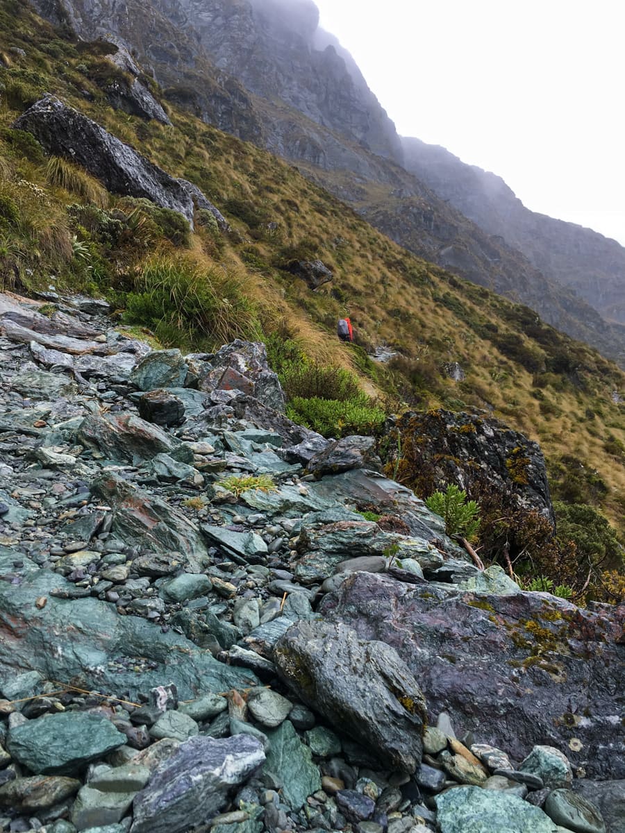
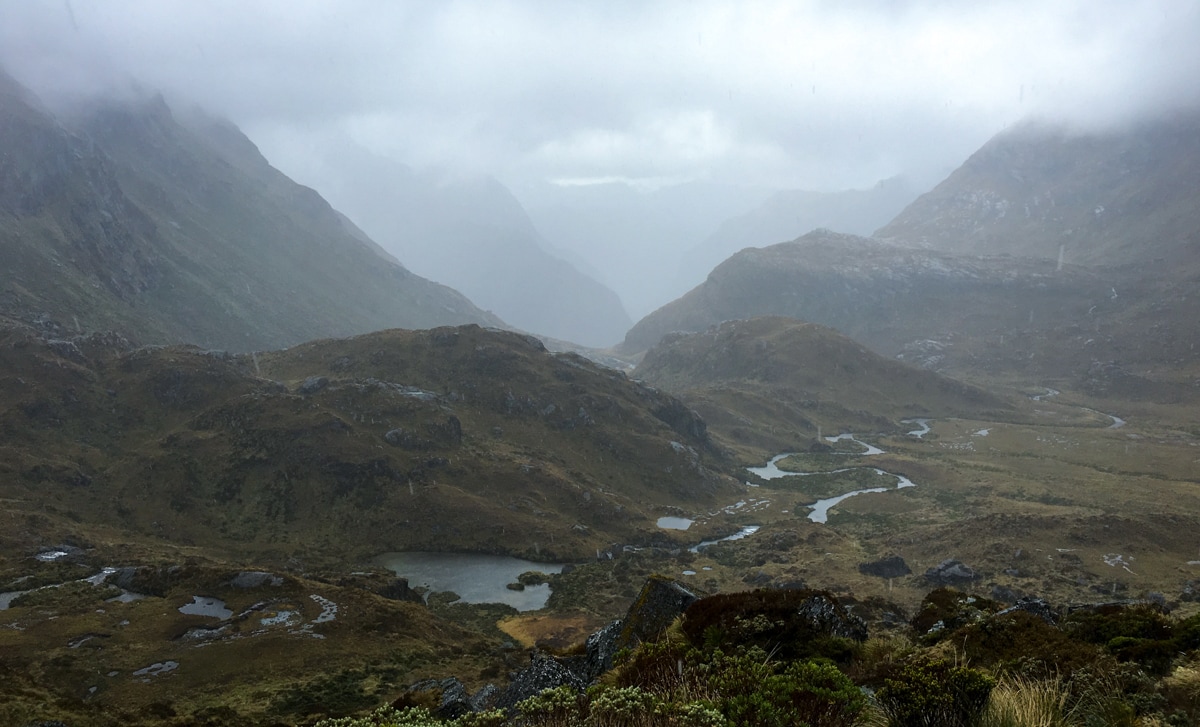
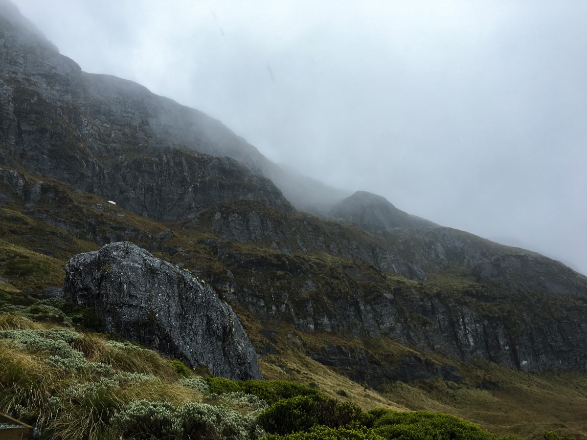
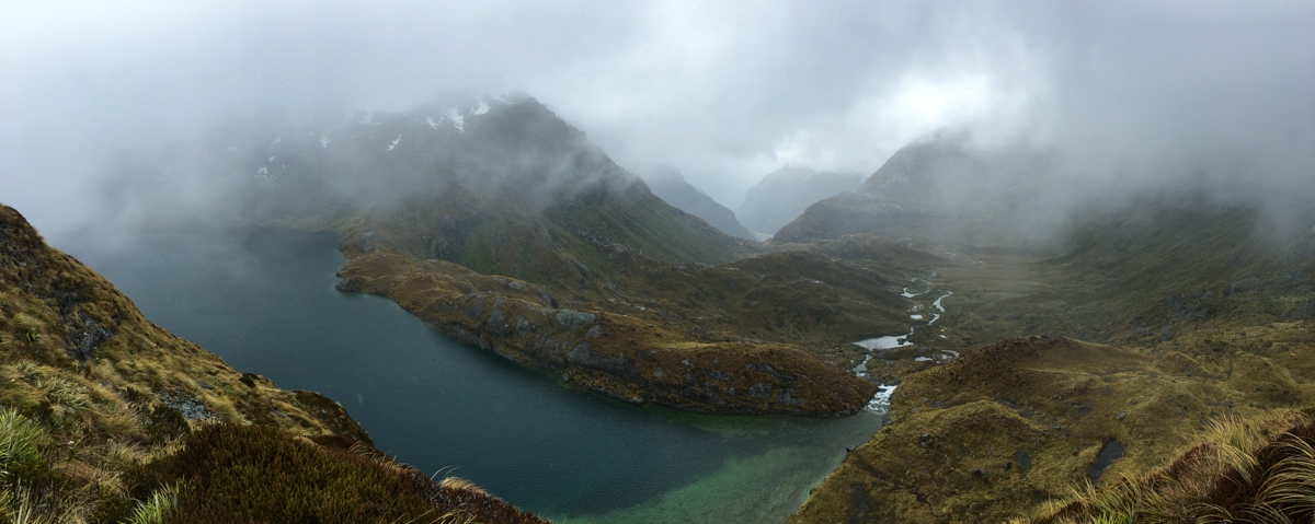
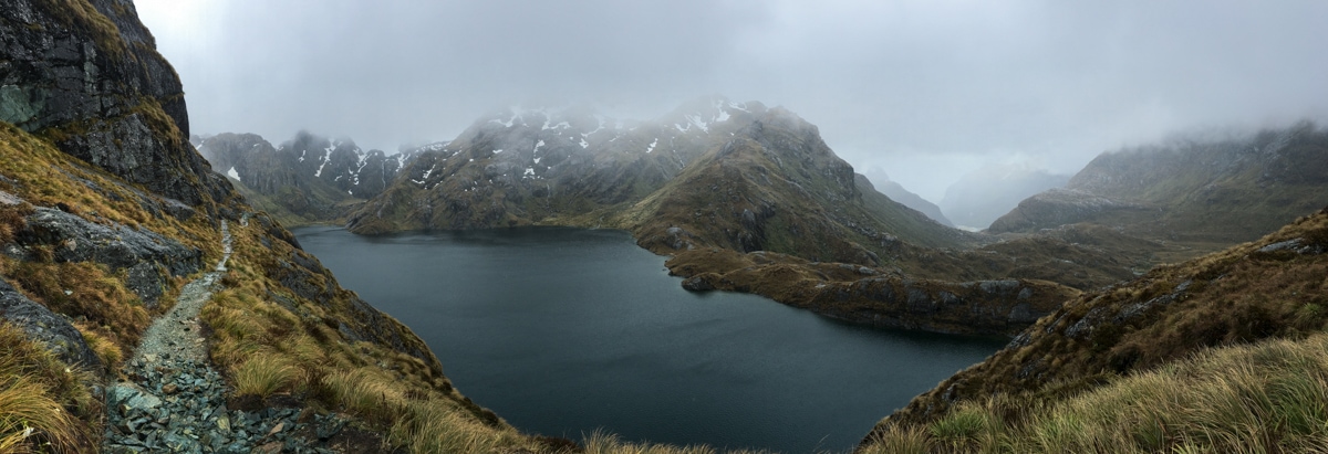
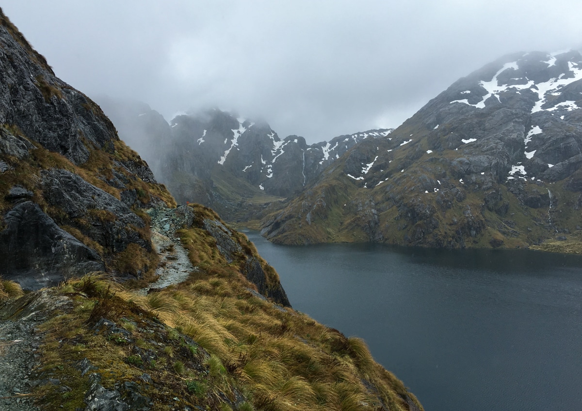
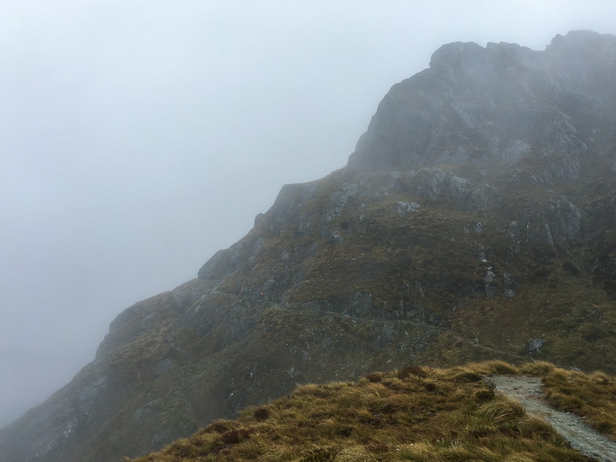
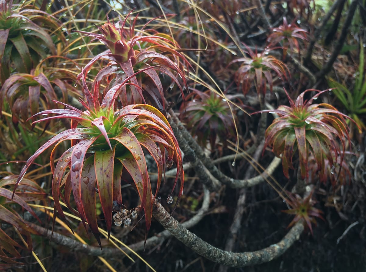
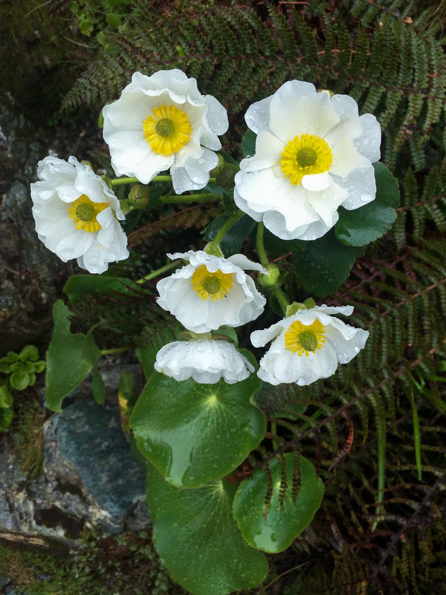
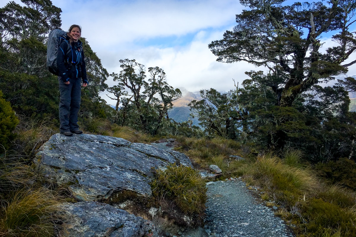
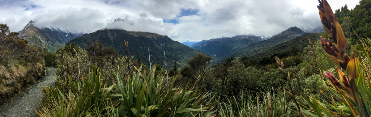
The rain also prompted us to plan for a stop at the Harris Saddle Shelter, another 300m above the Falls Hut, in order to wait for the supposed afternoon sun that we’d been hearing about. The climb up from the Falls to the Saddle was spectacular, and probably the main reason we like this track so much. Great rock formations, beautiful alpine plant life, a large lake near the saddle and really nice walking trails, occasionally cut into very steep mountainside.
Turns out the Saddle Shelter wasn’t as large as we expected, and it quickly filled up with many other trampers who all shared our ‘wait out the rain’ plan. Particularly amusing (/annoying? but mostly amusing) was a group of 12 boys and 3 men, all on a backpacking outing for which they were kind of prepared. Our favorite moment was when adult leader #1 started trying to organize lunch. He tried loudly asking all the boys if they had the sausage, which pretty much failed because no one owned up to having the sausage, and no one decided to double check. After trying out that tactic a couple more times, he went around the room one by one to each boy saying “Paul, do you have the sausage?”, “Jimmy, do you have the sausage?”. Turns out none of the boys in the shelter had the sausage. Simon had the sausage, and Simon had fallen behind with another boy and a leader and would arrive in about 30m. Seriously Simon, you’re holdin’ us all back, buddy.
While we were amused by all the lunch shenanigans, we quickly decided to leave after overhearing that the female half of the group should arrive into the already crowded and steaming hut soon. So back into the drizzle we went.
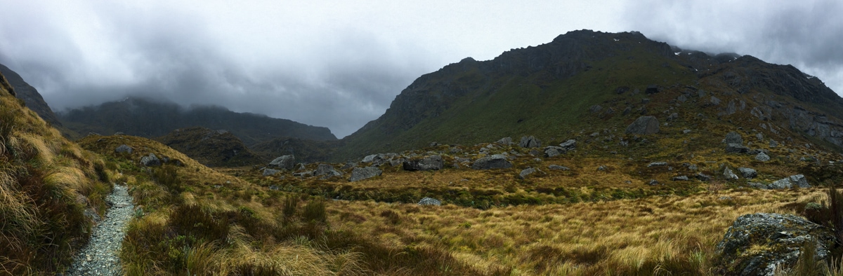
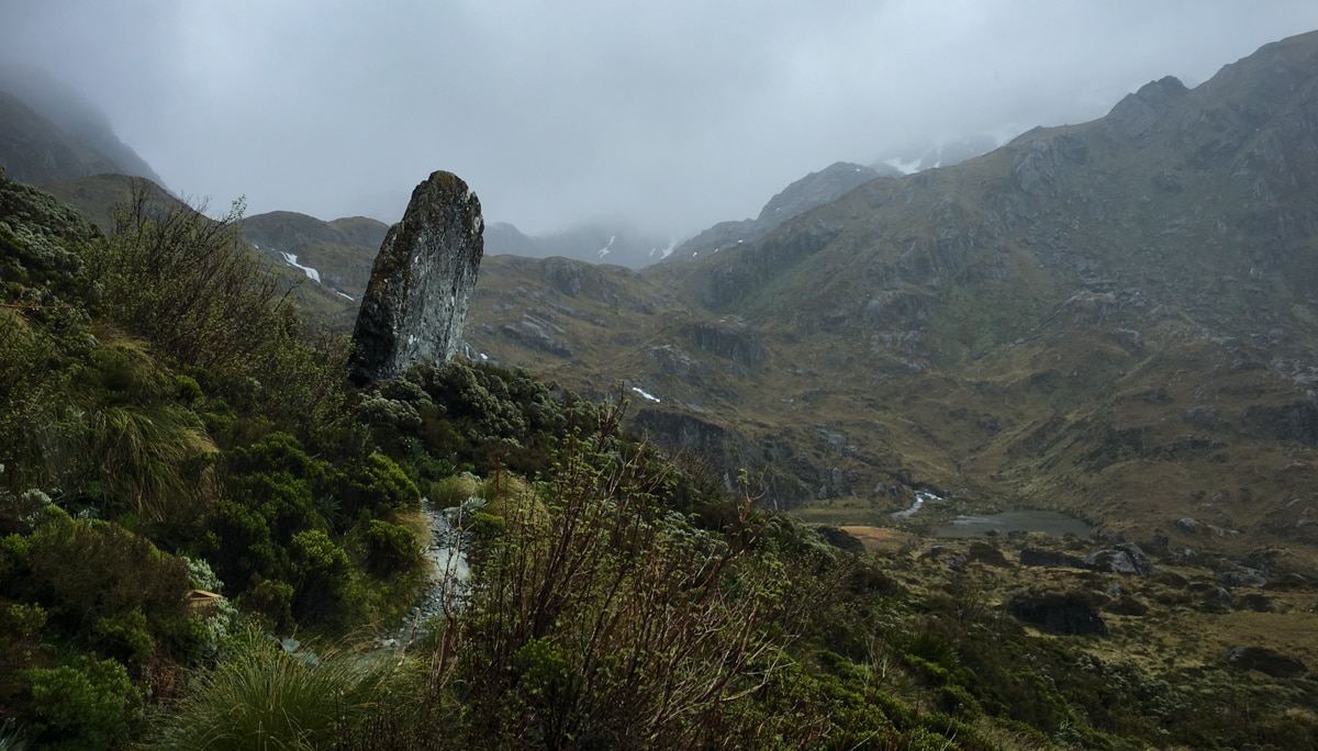
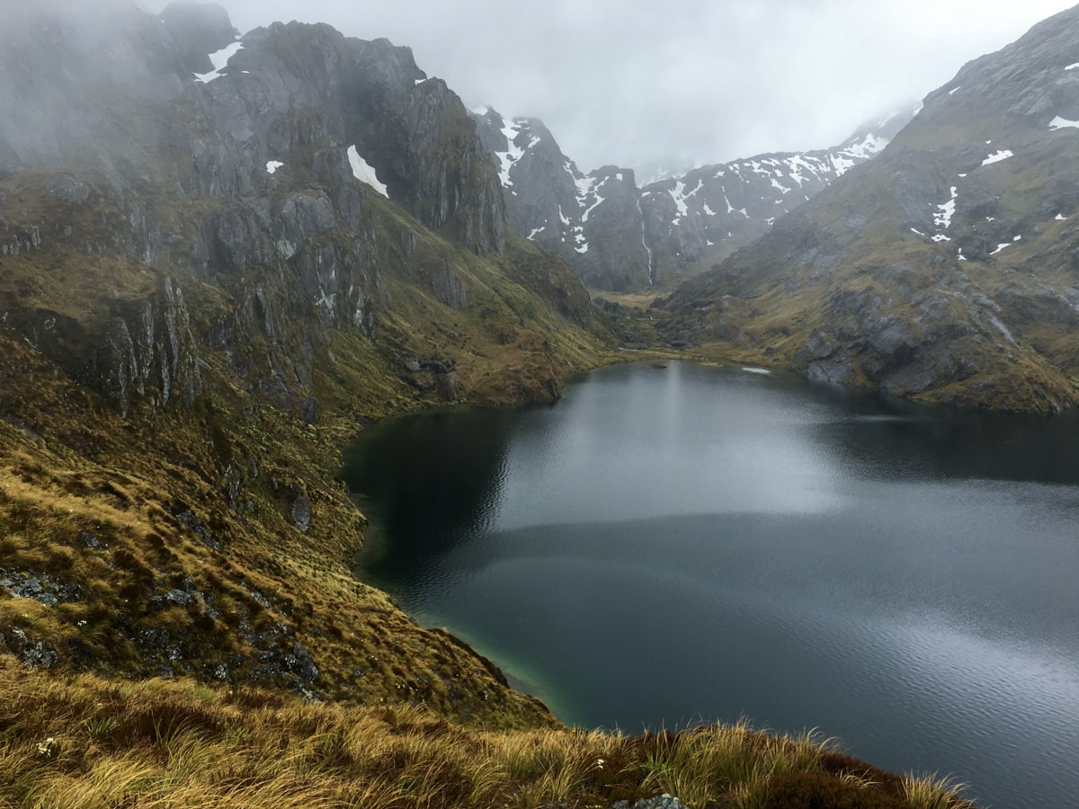
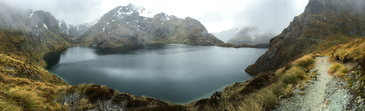
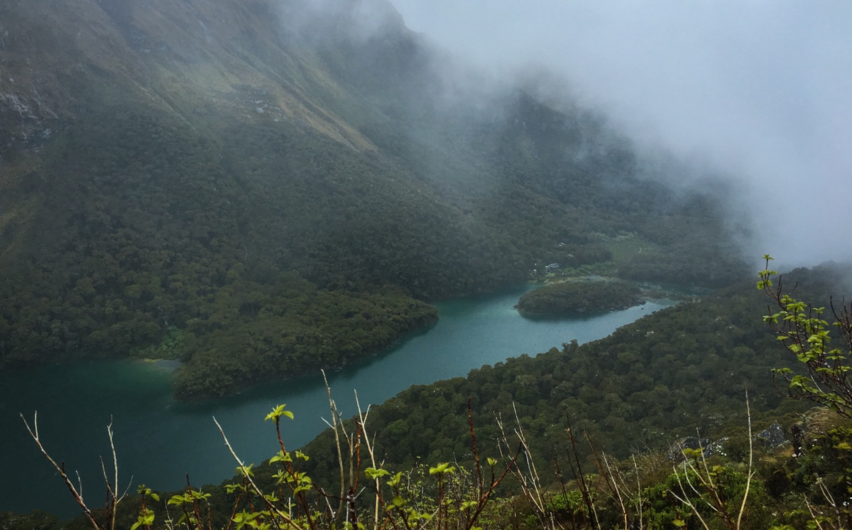
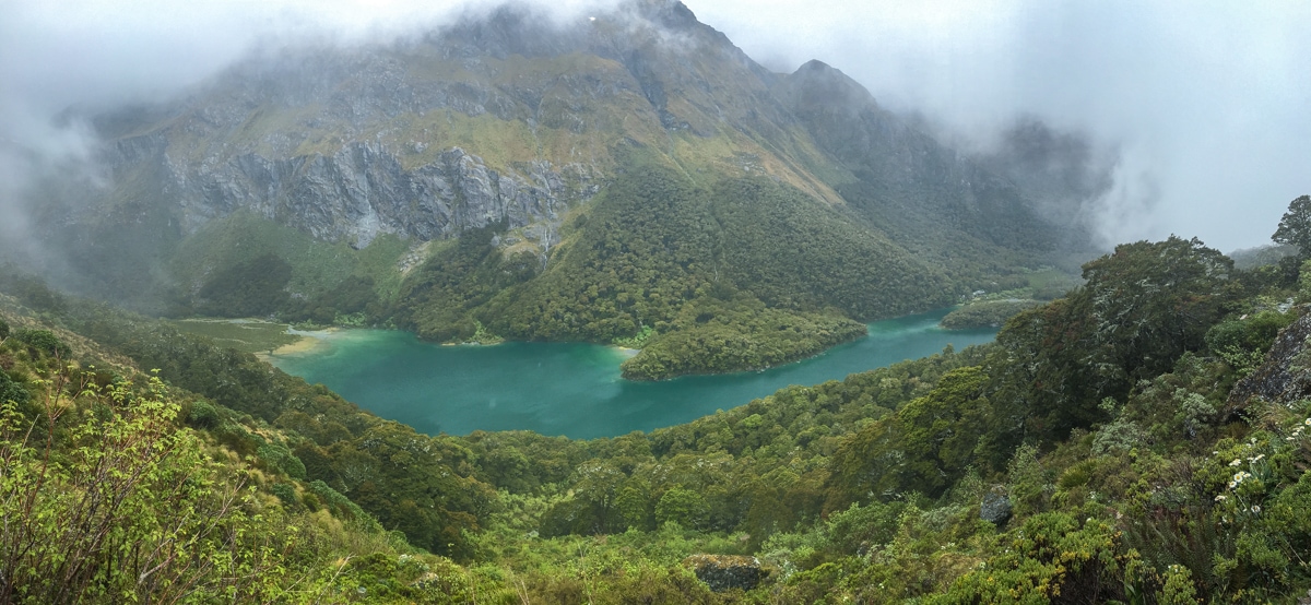
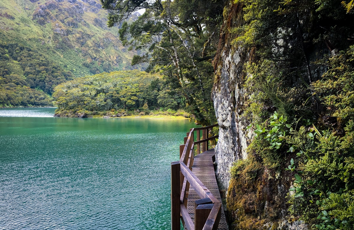
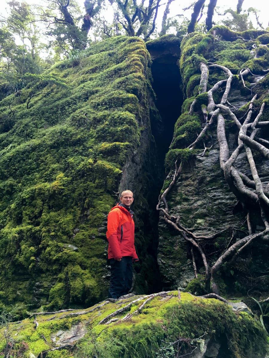
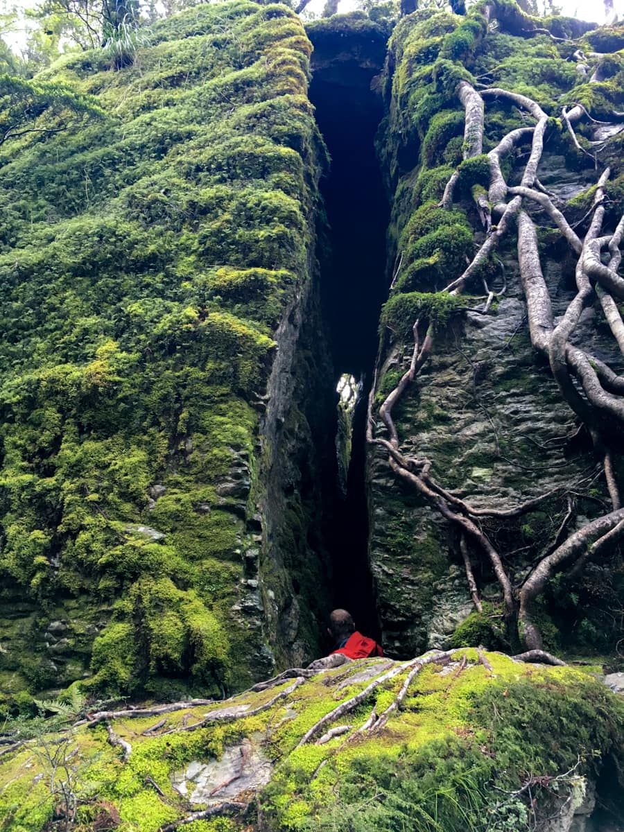
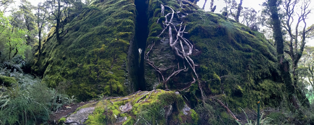
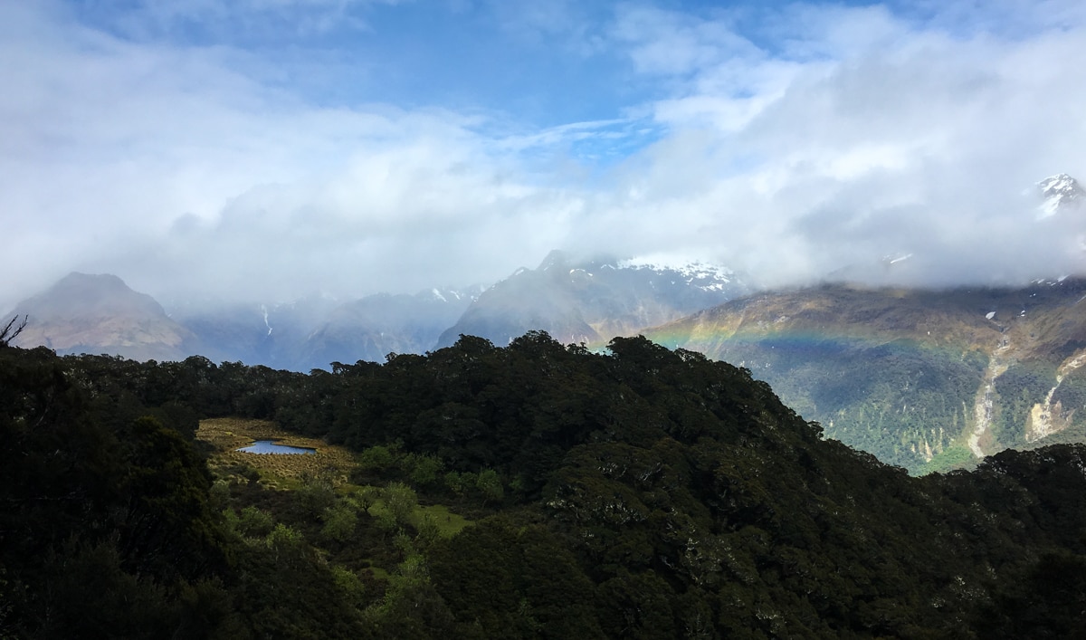
The rest of the day was wet and gray (we’re certain there were beautiful mountain views obscured by complete white-out), and we didn’t take many photos because there wasn’t much to see until we stumbled upon Lake Mackenzie. Set very prettily with mountains all around, we caught puzzle piece glimpses of the whole landscape as holes in the clouds jostled around for the rest of the afternoon and evening. We set up our tent on a slightly elevated (cool!) but hardpacked and astro-turfed (not so cool, for difficulty-of-staking reasons – we ended up using large rocks) site that looked generally down towards the lake. Then we took an evening stroll through the bush to the gigantic Split Rock, (well, if not originally, named), made some food, read for a bit, and fell asleep early.
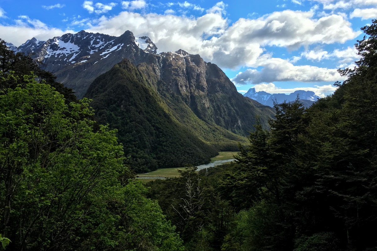
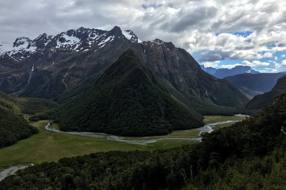
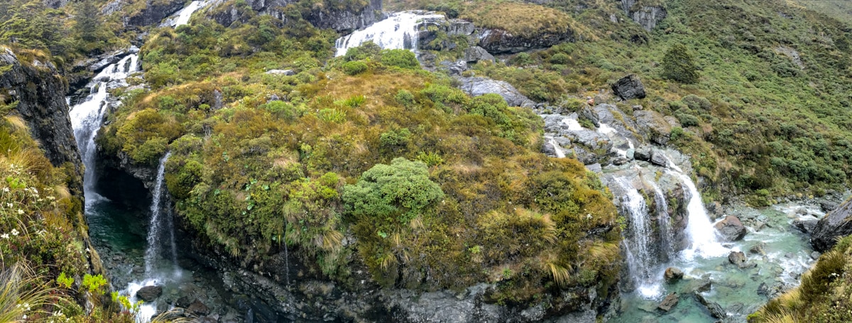
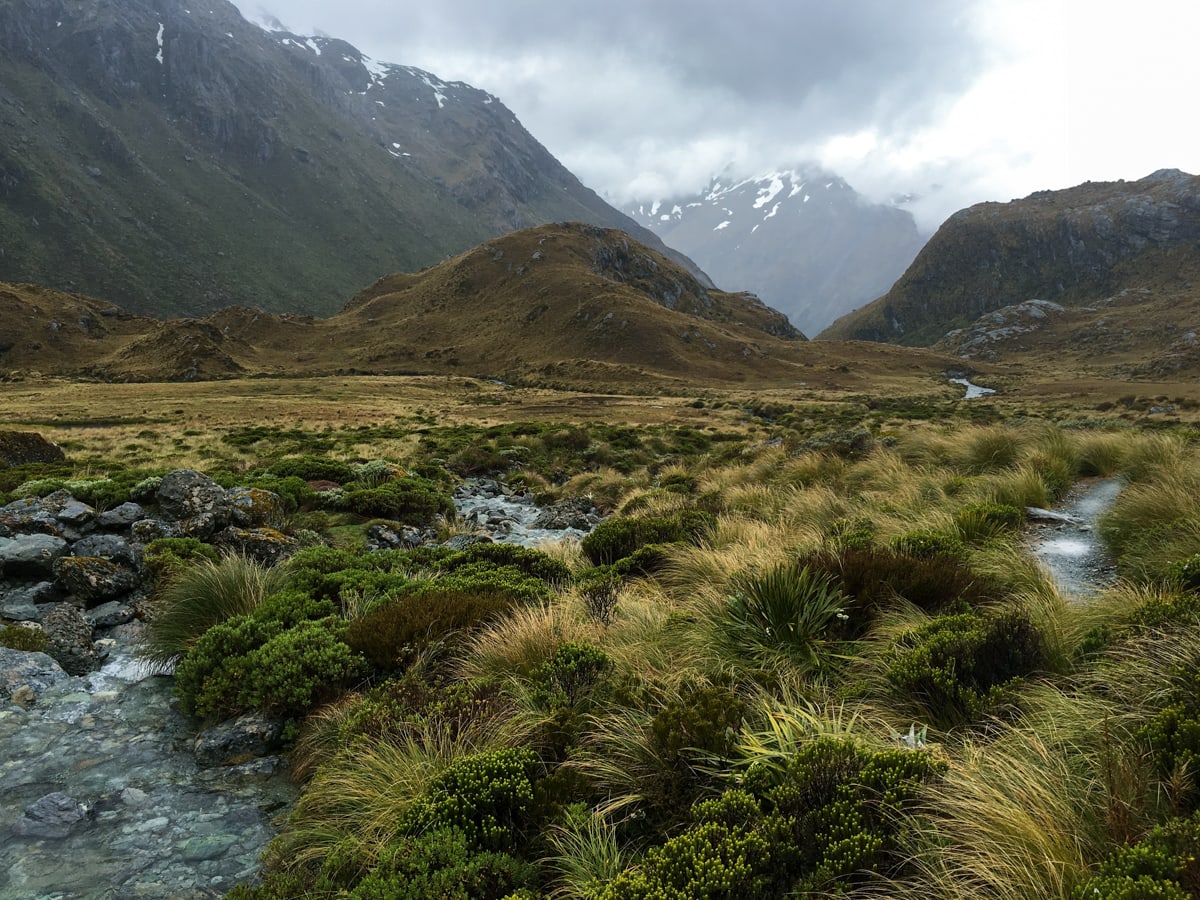
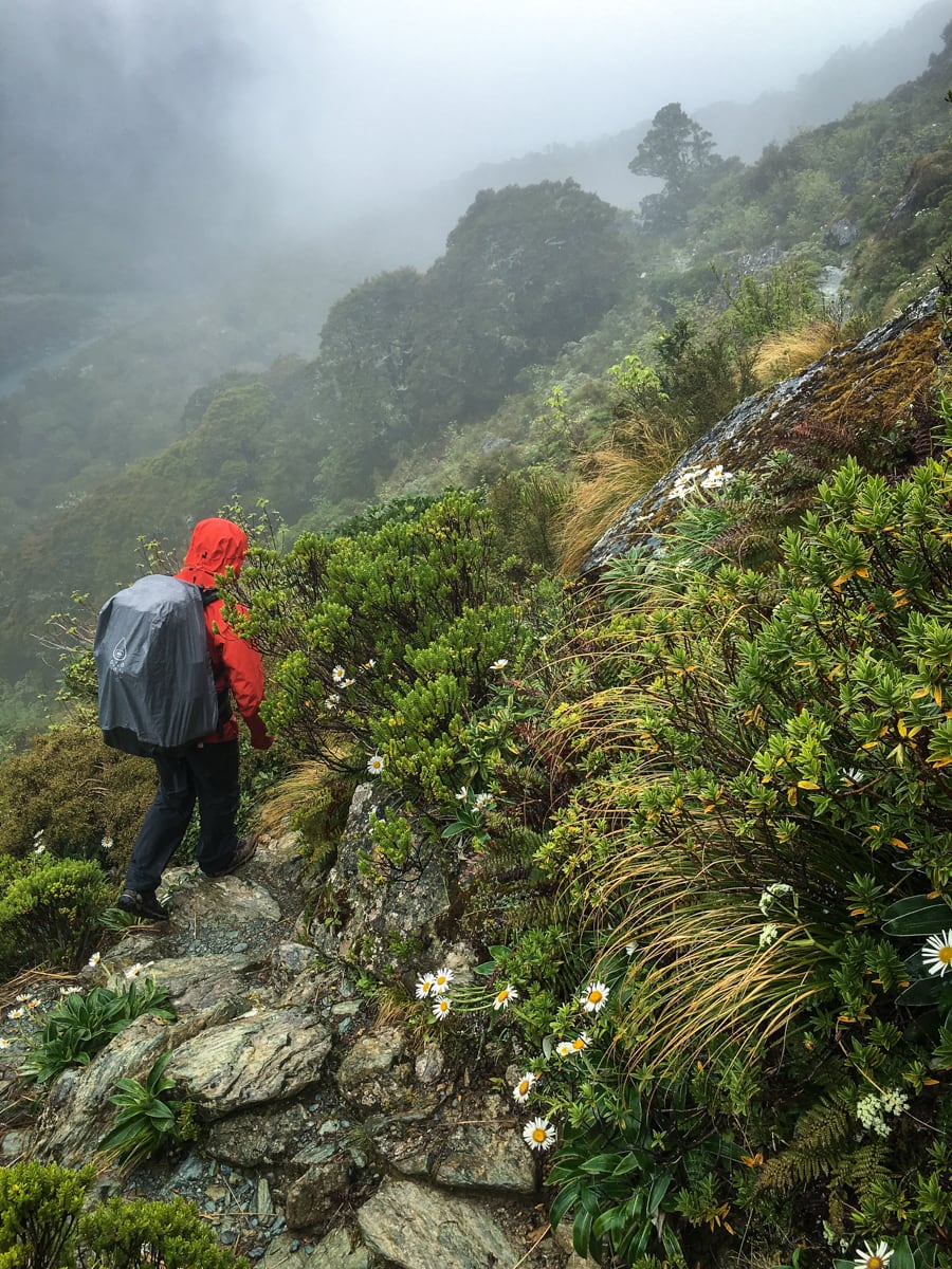
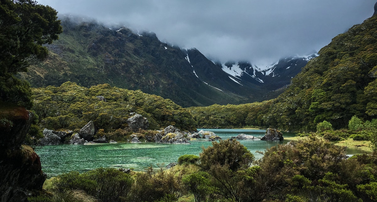
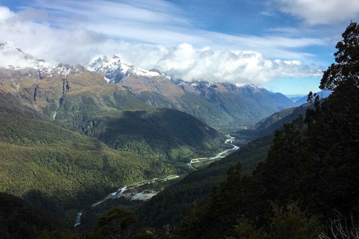
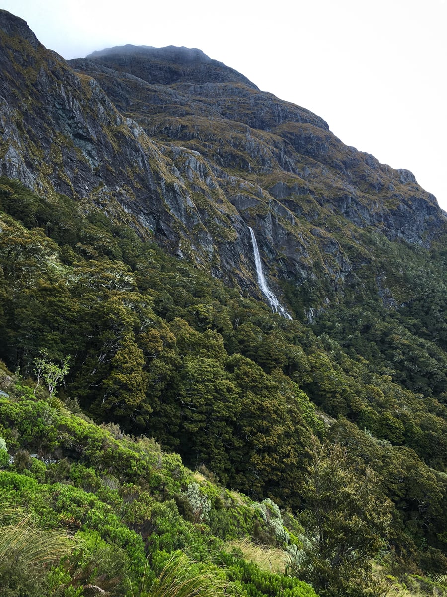
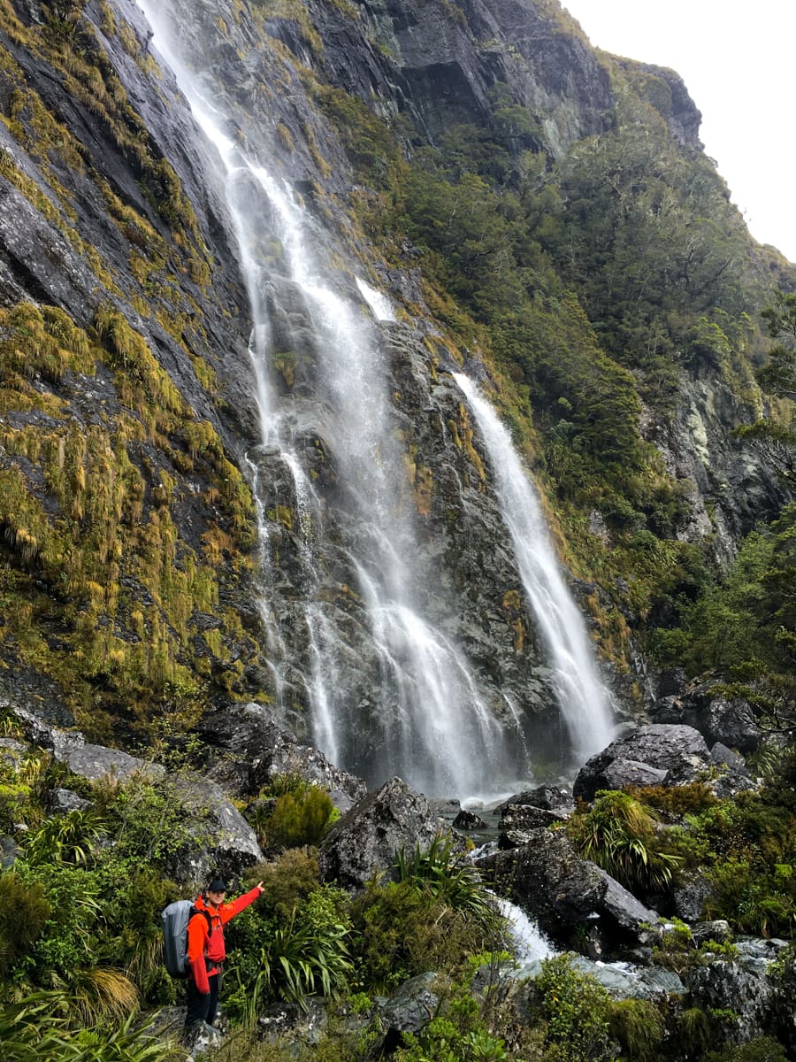
Day 3 took us out of the Mackenzie Basin up and around the mountainside. The clouds were high in the morning so we could see most of the mountains on the opposite side of the Hollyford River valley, giving us an idea of what yesterday’s view might have been like. After passing the bold, 174m high Earland Falls, we returned to our lovely beech forest and made it to the bus pickup spot about 30m early.
Main takeaway: Routeburn is probably beautiful in any weather, but we’re going to try heading back again when the weather is excellent just to be sure.

Wow, guys!! No wonder this one is your favorite. That’s going on my to-do list for next time, right now.
Also: the Return of the Chaffinch shot looks like a surveillance cam still. Have you guys been spying on the birds?!
That’s just preemptory spying – our eventual post from today’s adventures will be more more big brother-esque… Cliff hanger!
The photos on this one are SUPER!!!! I’m very jealous!
Thanks Mom!