Coasting along the Catlins
Funny how in a country the size of New Zealand there are entire regions that, despite reading lots of Lonely Planet chapters, you’re somehow ignorant of for quite a long time. For me, that was the Catlins – the amazing south eastern corner of the South Island between Invercargill and Dunedin. Luckily for us, Elisse had heard of the Catlins, and the new friend that we shared Thanksgiving with, Ute, highly recommended that we visit. We spent a couple of days driving the Catlins coast, and it turns out there’s plenty of cool stuff to see, including one stop in particular that will likely end up being a top ten highlight of this whole trip. So, get ready for a doozy of a post, chronicling our stops in order:
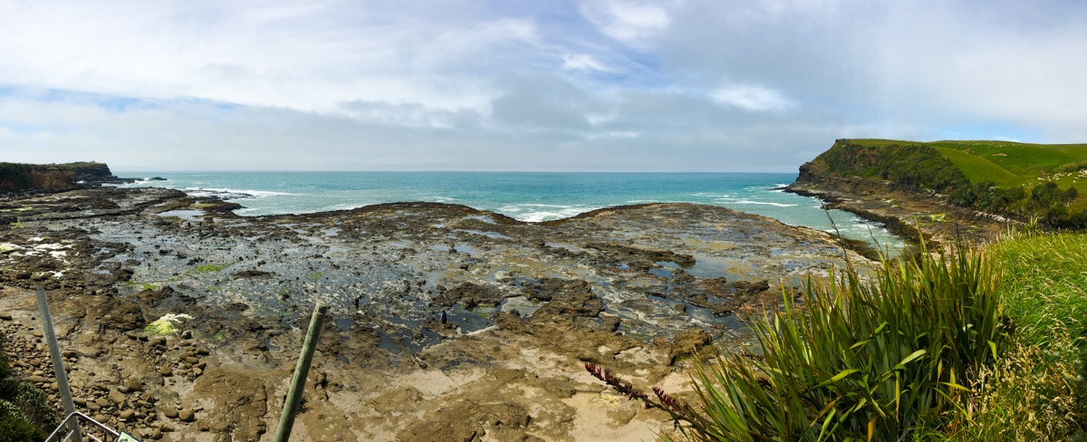
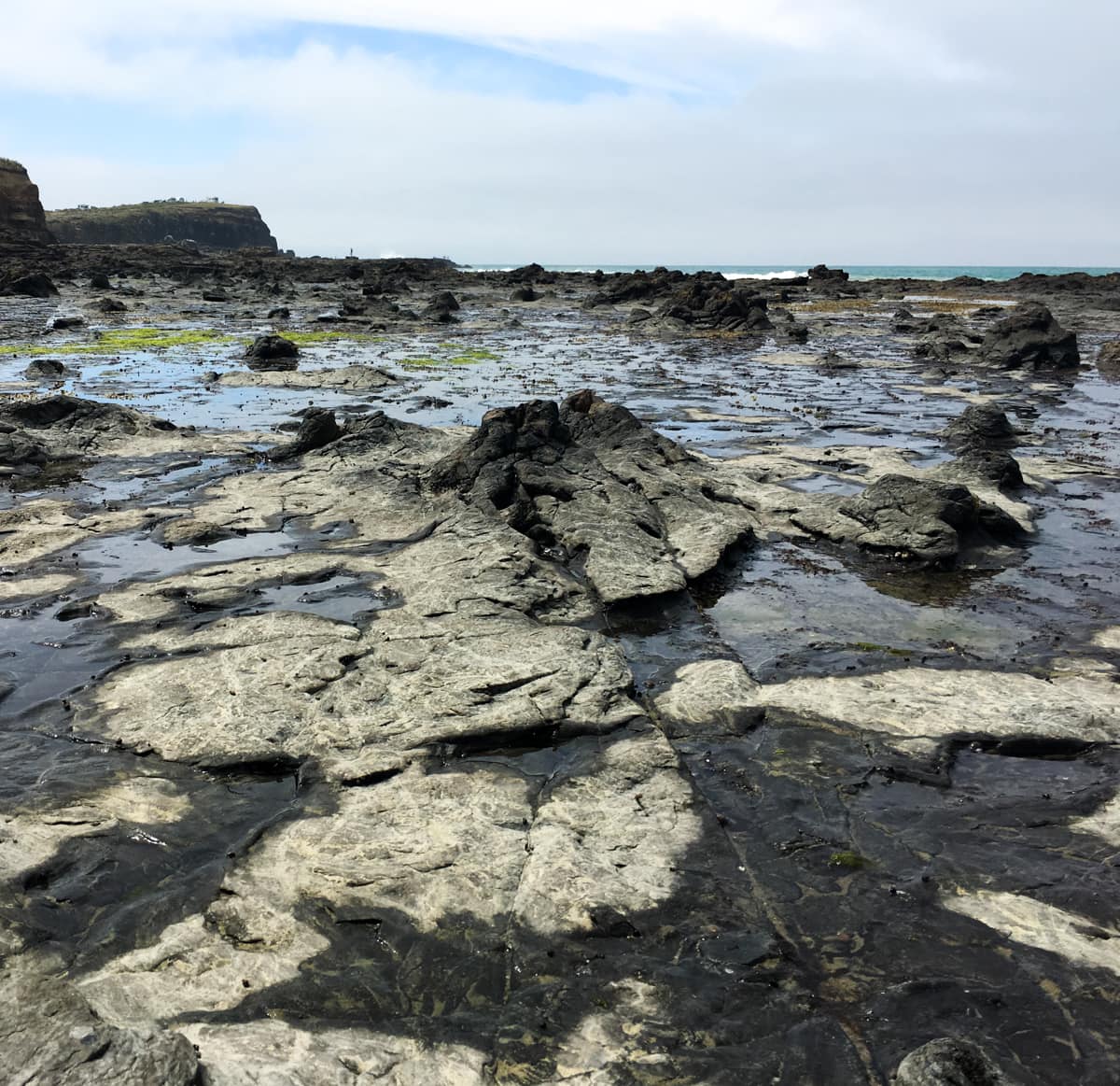
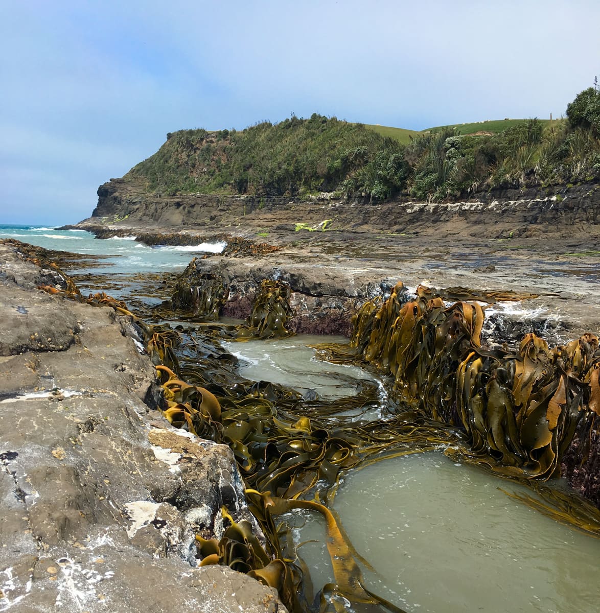
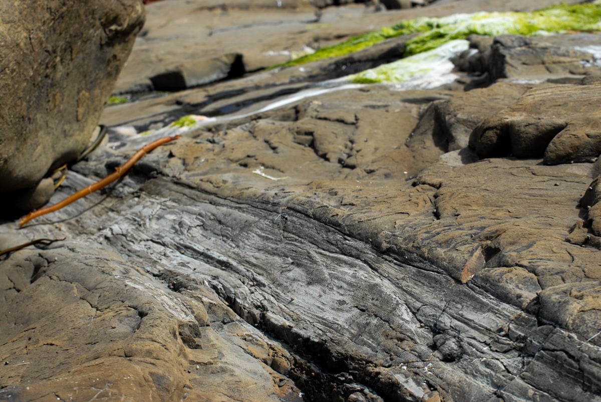
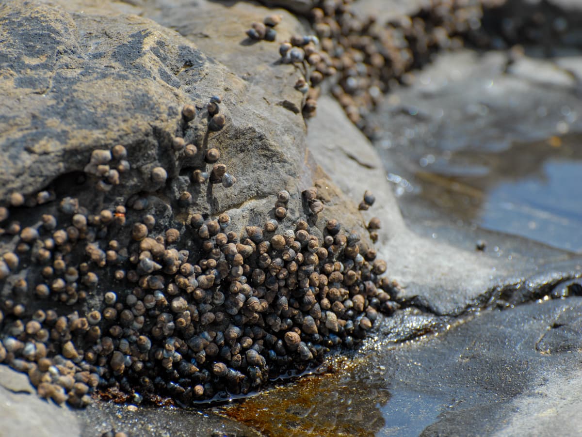
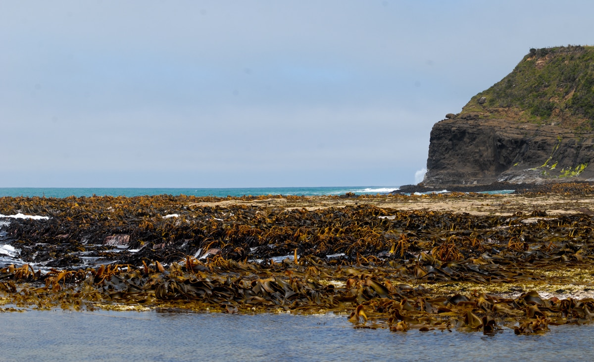
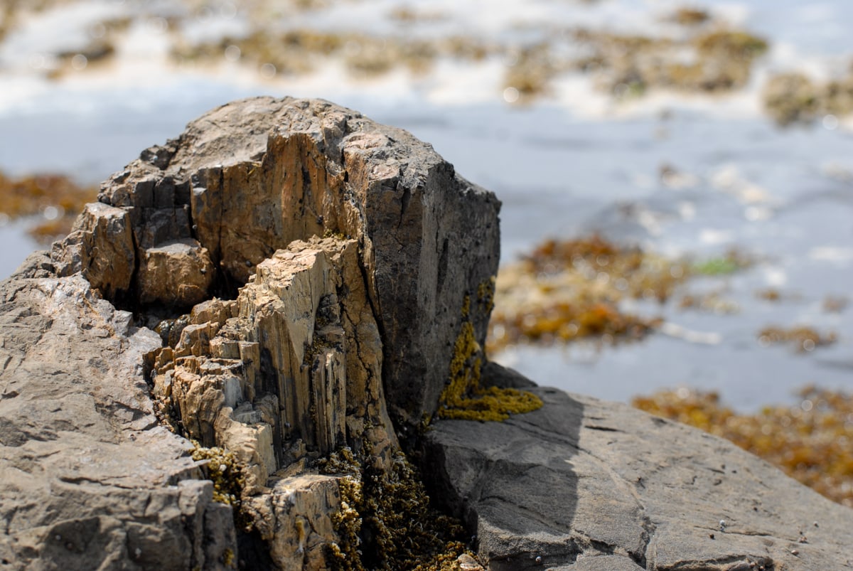
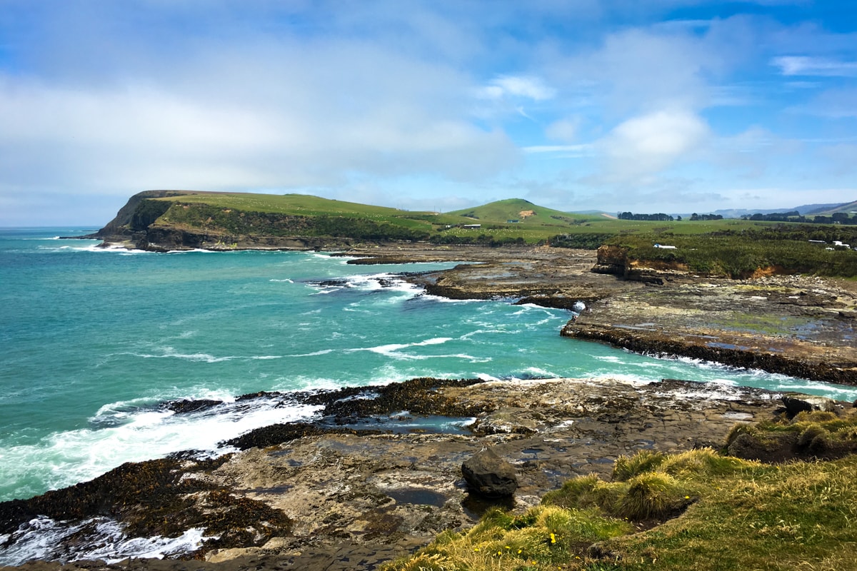
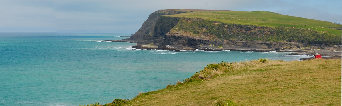
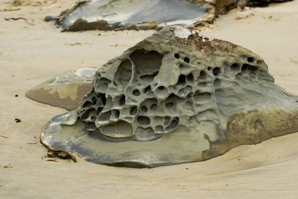
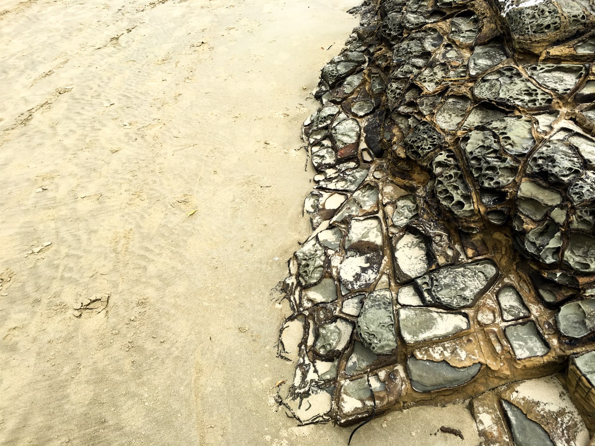
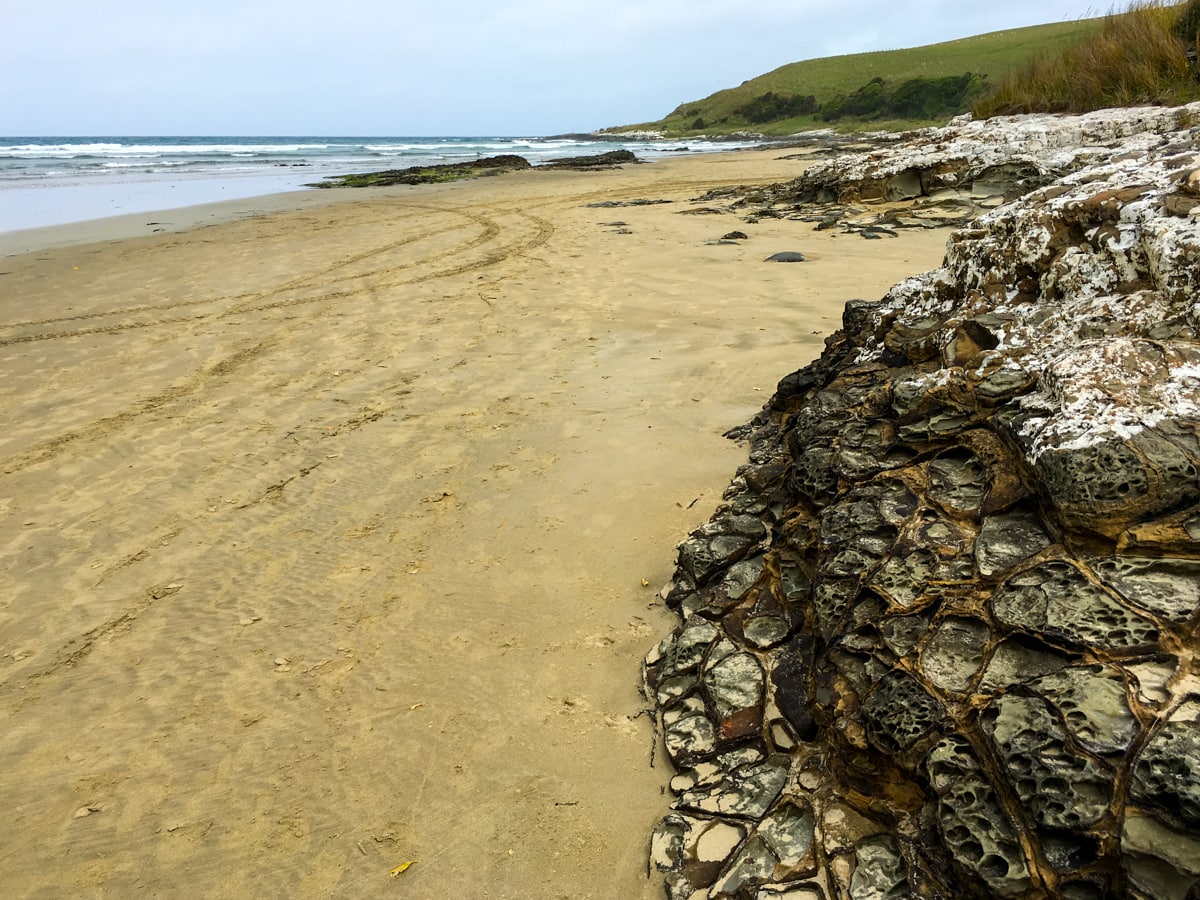
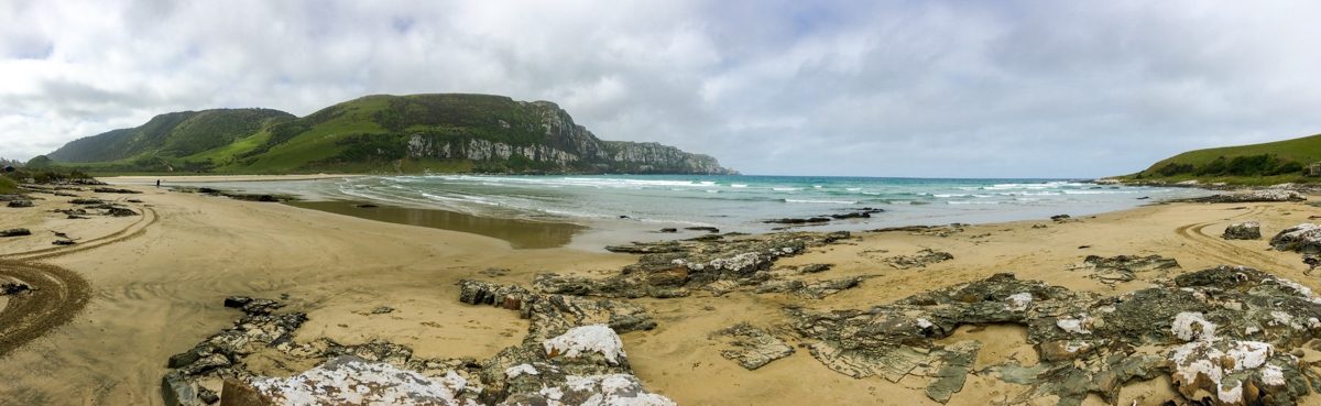
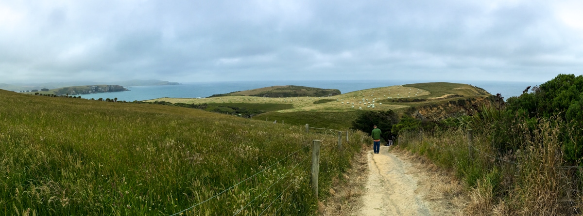
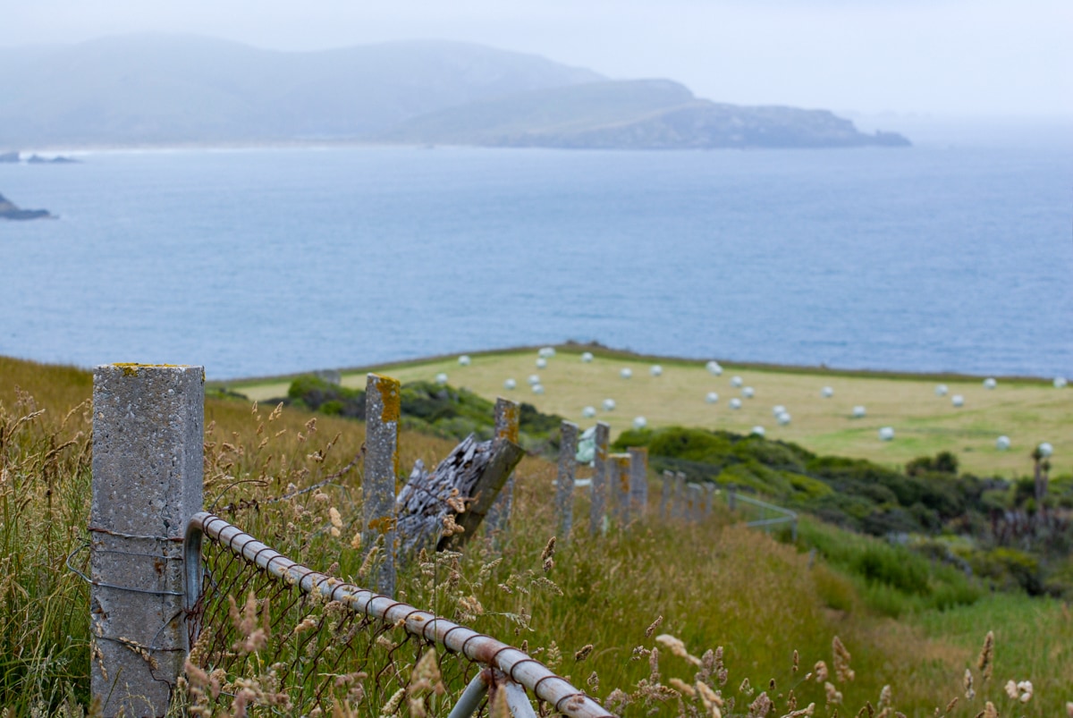
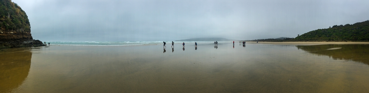
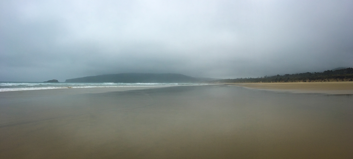
Jurassic Petrified Forest, Curio Bay, and Porpoise Bay – If you skip visiting the NZ mainland’s southernmost point like we did (it’s along the coast on the far side of a sheep pasture in the middle of nowhere, so…), then your first Catlins visit is likely to be the Jurassic Petrified Forest, a collection of petrified trees that are visible at low tide. The Jurassic Forest is situated in Curio Bay, which backs up to Porpoise Bay – so after we stopped at the Forest by the water’s edge, it was just a short drive around Curio Bay and up to a high viewpoint of both bays.
The story of the Forest is worth a quick diversion – many, many years ago when active volcanos filled the land, one erupted creating rivers of debris that knocked over many trees and completely buried them, along with the stumps. The felled trees as well as adjacent ferns and other forest plants ended up being really well preserved when, over time, their organic material was replaced by various types of rock. So now when you walk around the fossilized forest, which from a distance looks like a wide, flat rock shelf, you can see these almost 200 million year old trees, or at least the rock copies of them. Turns out some trees haven’t changed much in millions of years.
The drive up to the viewpoint takes you through a nice campground, which in NZ just means lots of relatively flat grass, perhaps somewhat divided by trees and brush, that you drive onto and define your own little fiefdom for your stay. We happened to be visiting on the day of the annual Clam Dig on the Beach, so there were people everywhere trying to find campsites, parking, and eventually their way down to the beach to join in the fun. Luckily, we were just passing through, and found plenty of parking up top away from the chaos down below.
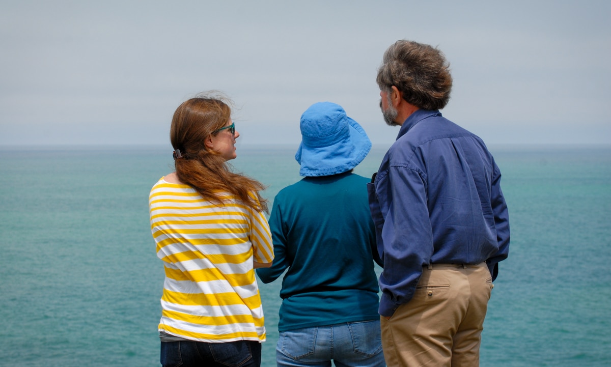
The Southern Scenic Highway brochure promised (or at least indicated) that we would see penguins, porpoises, sea lions, and maybe other animals as well in these bays. We ended up finding the ubiquitous gull, some shags, and some oystercatchers. So the first stop was a tad disappointing in terms of wildlife viewing, but, after saying goodbye to Mike and Ingrid, we valiantly pressed on regardless.
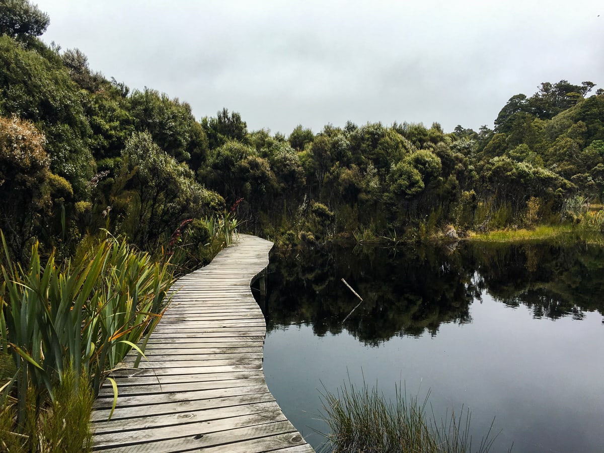
Lake Wilkie, Purakaunui Falls, and Purakaunui Bay
A little further down the road we arrived at Lake Wilkie to find a nature walk (which, in NZ, means a shortish hike with fact plaques along the way). The four sequential plaques on this walk divided the vegetation between the lakeside and the fully grown native NZ forest into four zones, and described the plants in each one. It was a nice lake, if small, and a little cloudy while we were there – but a good walk all the same.
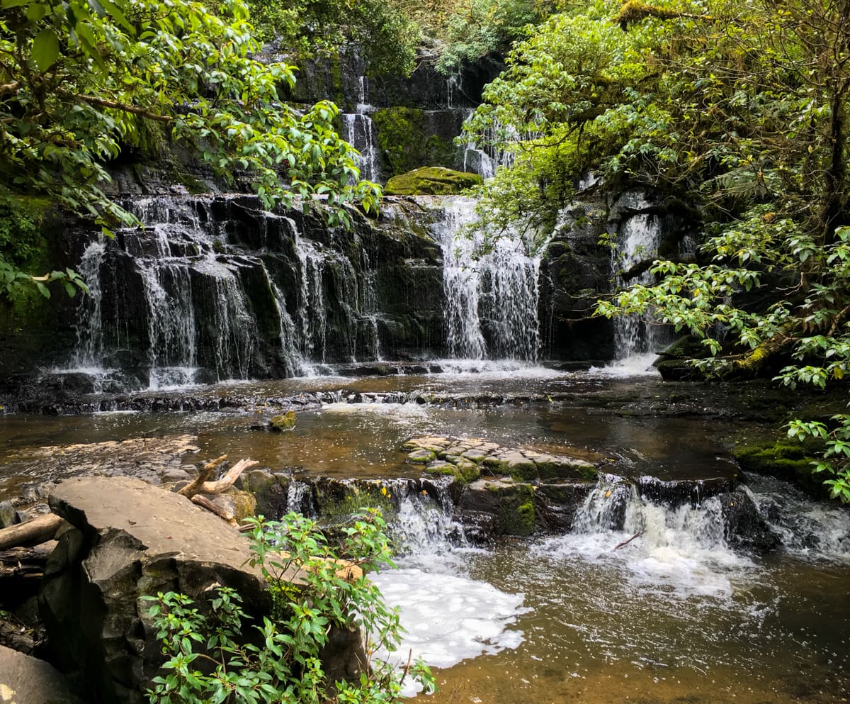
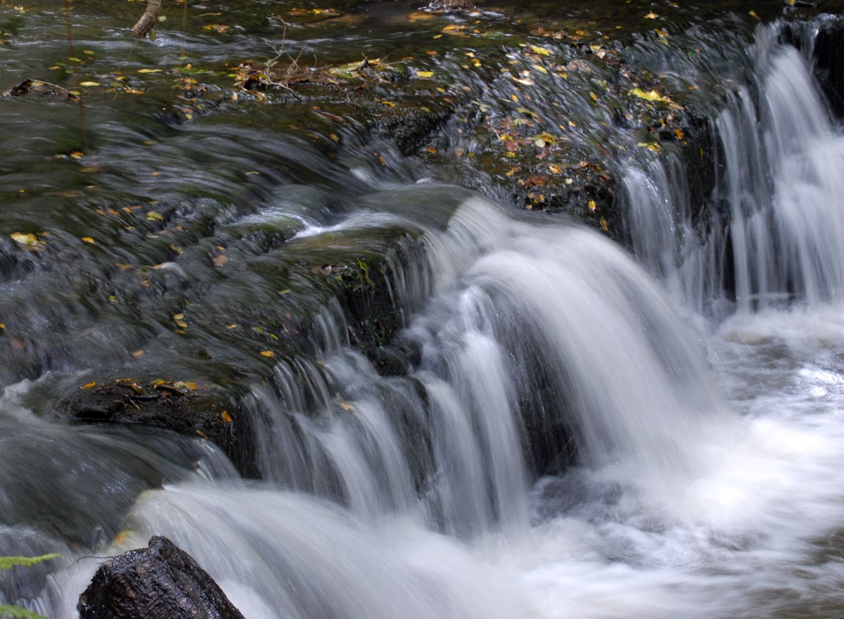
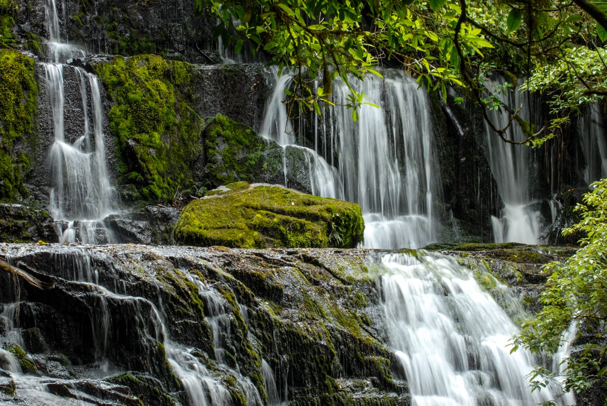
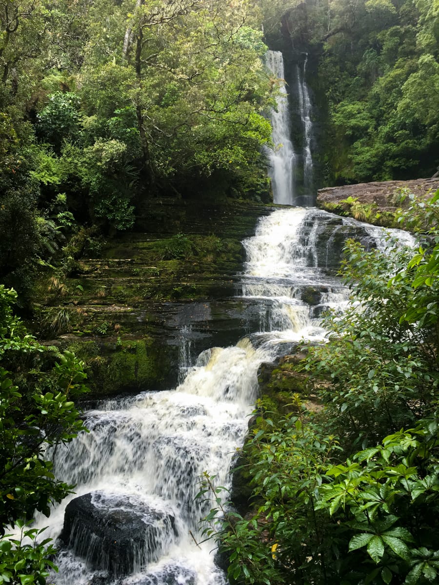
Next up, Purakaunui Falls. Another short walk took us up a riverside trail and then up through some rock features to a viewing platform across from the falls. We need more words to describe waterfalls – as you can see below, it’s not just one falls, but collection of tiers of many individual falls. It’s not the largest or most impressive falls we’ve seen on the trip, but it was really a nice one. And the hike was pretty too.
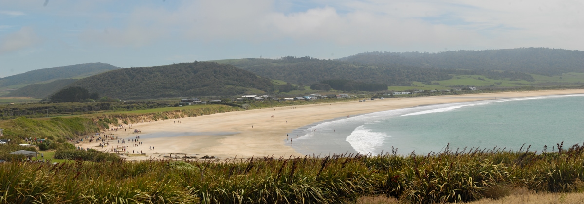
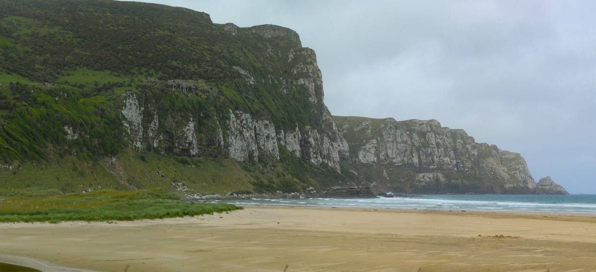
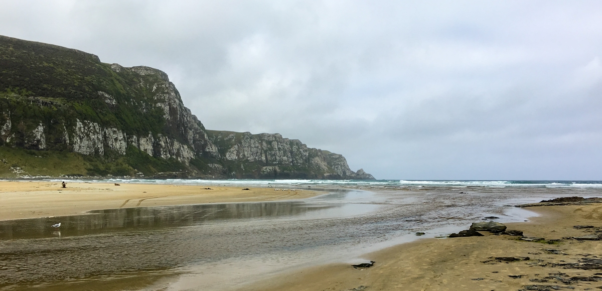
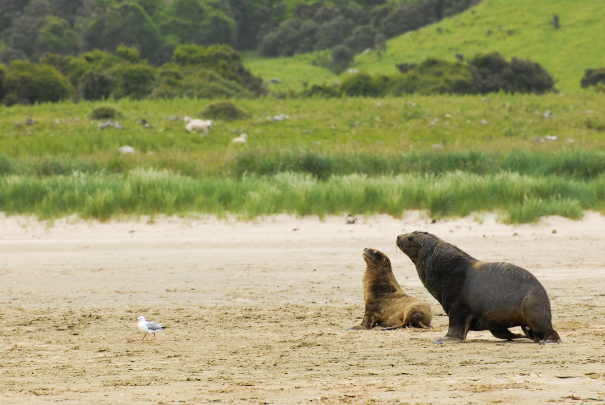
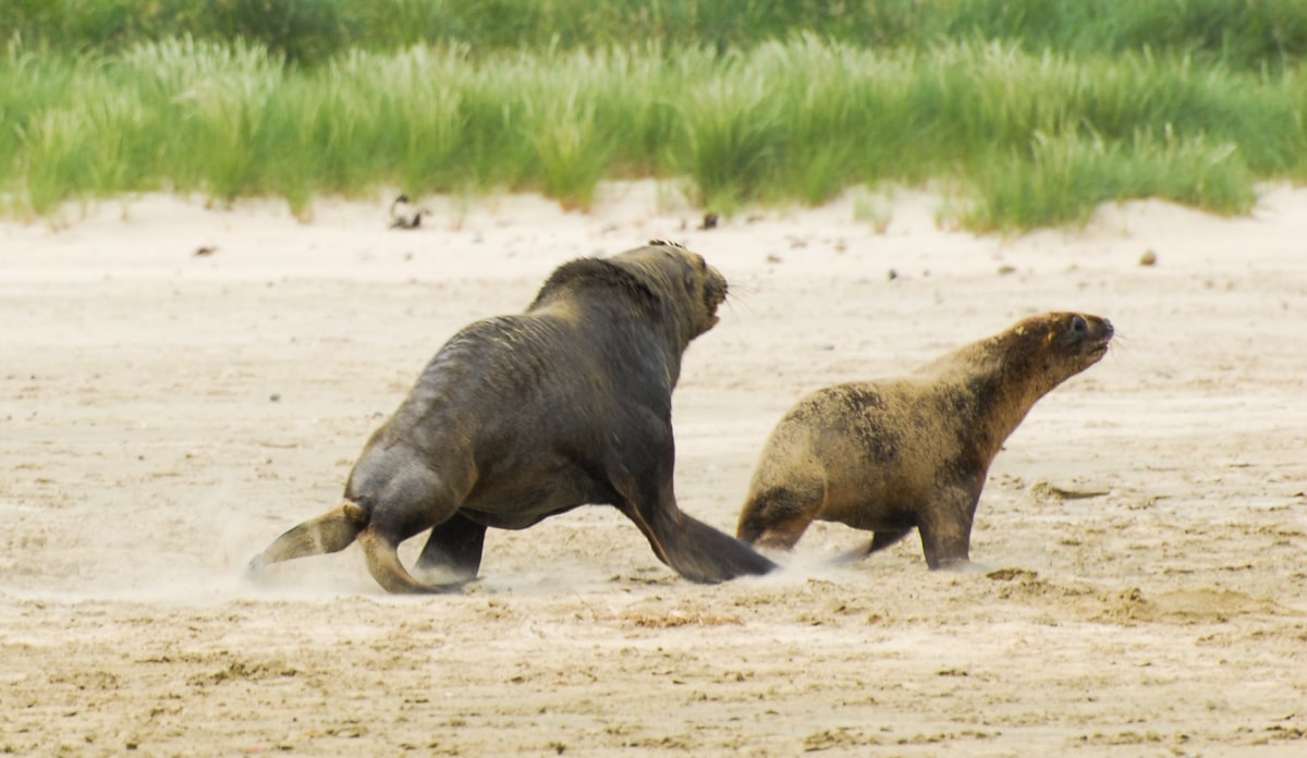
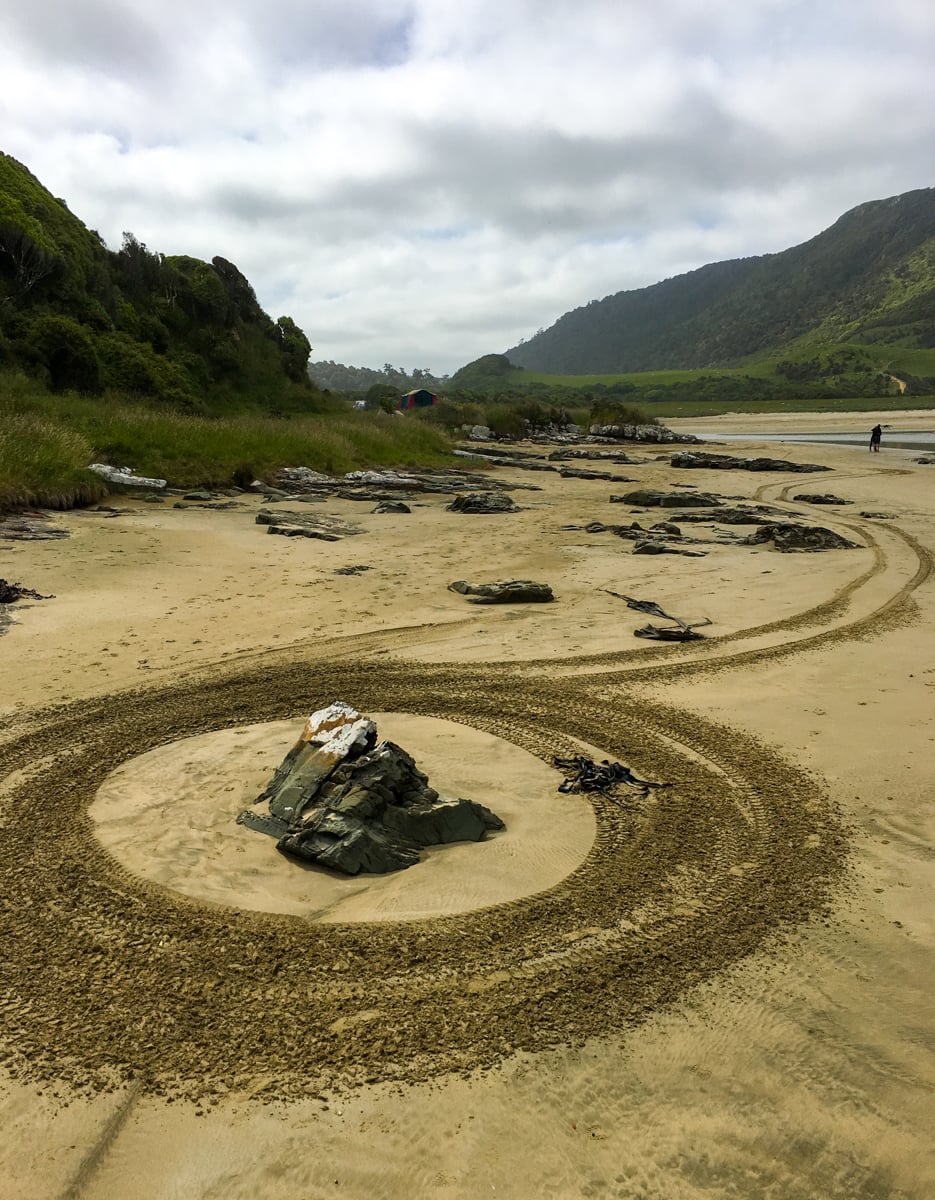
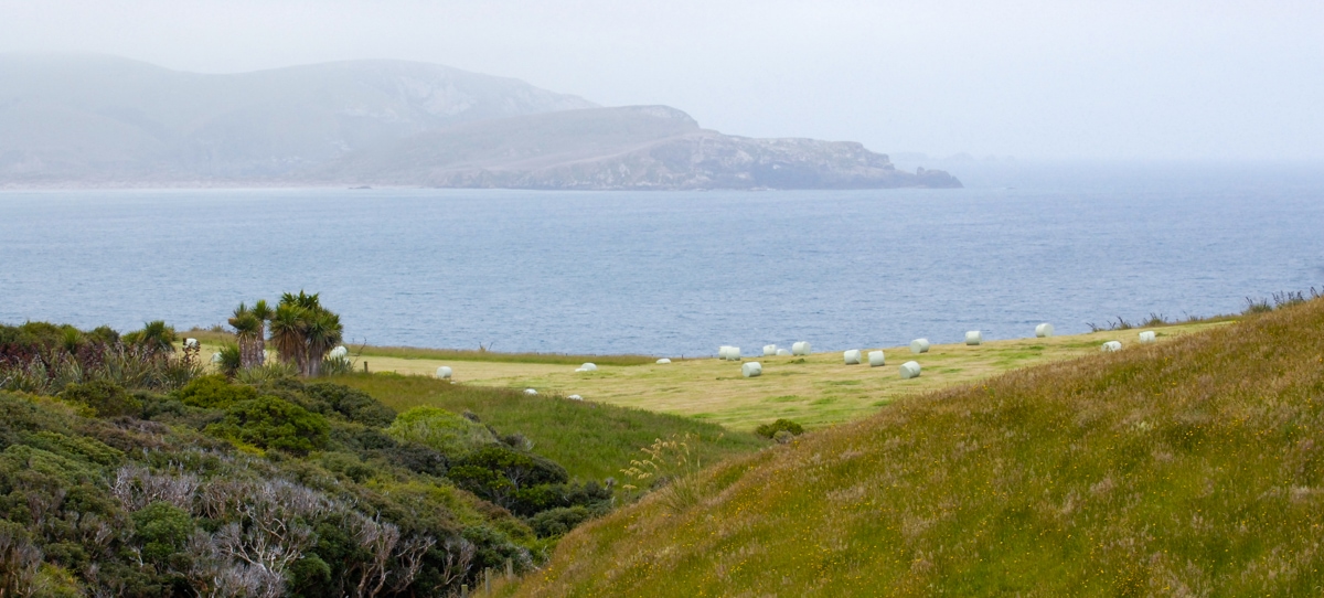
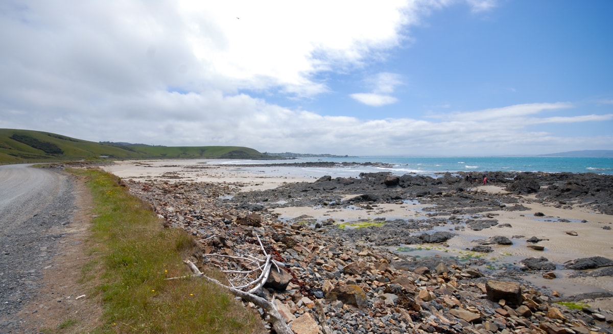
After a bit more driving towards the coast we arrived at Purakaunui Bay. It was beautiful – our favorite beach so far in NZ. If we had more time we would definitely have returned to this Bay just to camp there for a night or two (we had already paid for a different campsite for this night). Huge wide beach (with sand, not rock), a huge camping area (again, typical NZ ‘campsite’) to spread out in, sea cliffs on one side, awesome rock along the beach, and lots of wildlife. 4 or 5 sea lions were being very protective of the beach – charging towards a group of folks who had started hanging out on the sand (they had to abandon their volleyball net for a while). All in all, just a lovely bay that we didn’t want to leave. Please camp here when you visit.
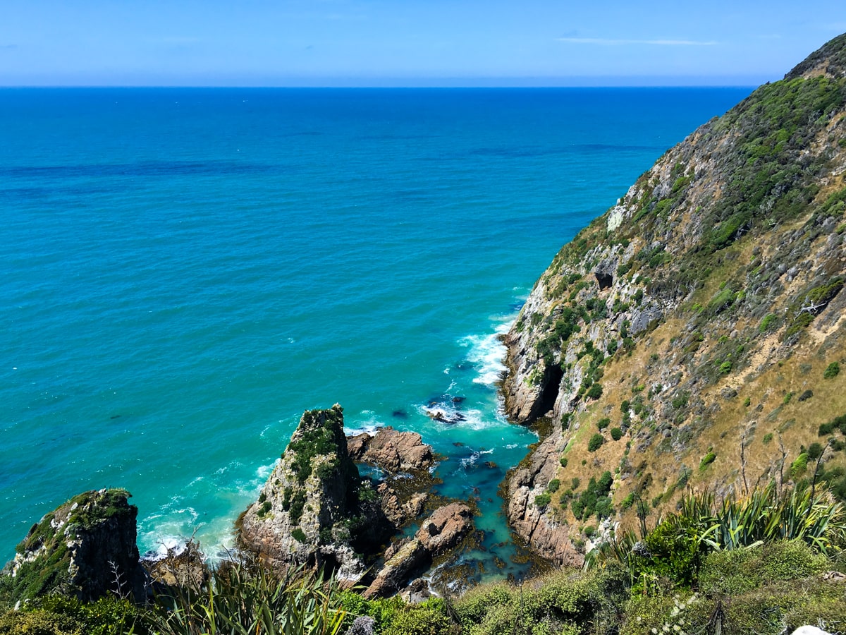
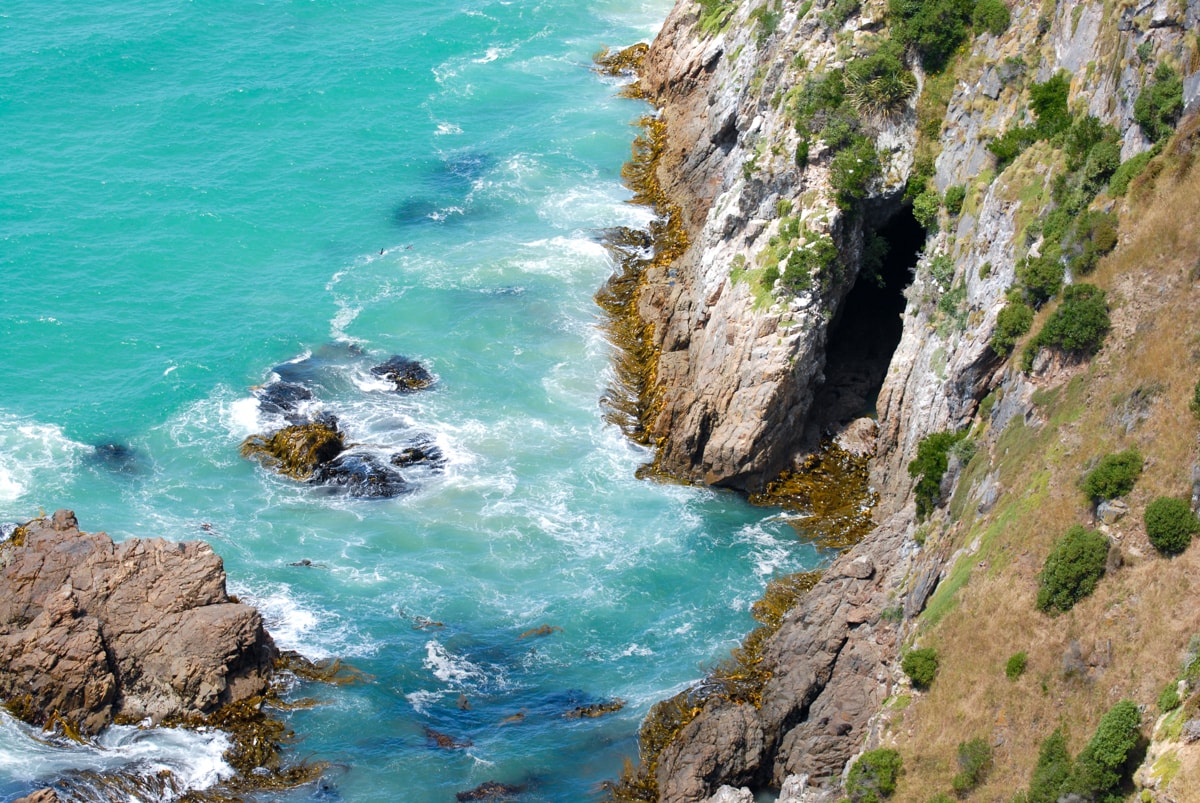
Jack’s Blowhole
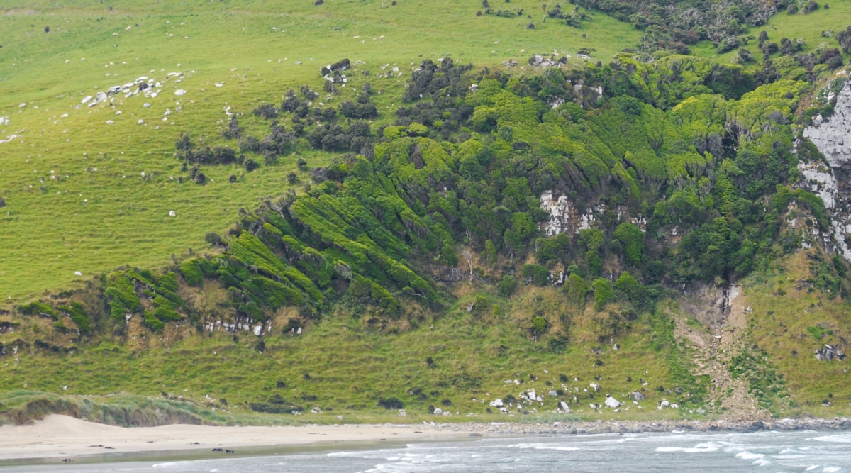
We tried to time our visit to Jack’s Blowhole at high tide, but because of our continual underestimation of driving times, may have been a little later than planned. The blowhole is a 30 minute hike up a hill, around some farmland – it’s pretty funny to see big hay fields growing right up to the edge of coastal cliffs – and back into the bush. Suddenly we came upon a gigantic cavity dropping 55m down to salt water waves at the bottom. We didn’t see any blowhole action, so believe that we might have just missed it. Alas. But, we loved the views along the hike and the habitat in and around the blowhole was really interesting as well.
McLean Falls & Cathedral Caves
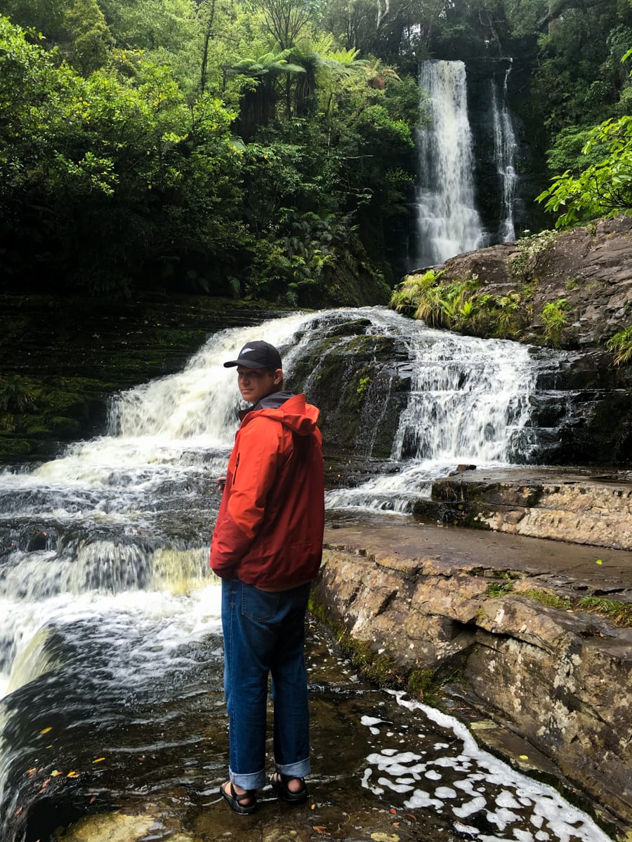
On our second day in the Catlins, our main goal was to visit Cathedral Caves, which we had rearranged our schedule around because the Caves are only accessible during low tide. We arrived a little early (who can sleep in while camping?), so we stopped at McLean Falls right down the highway. A nice walk up to a beautiful waterfall – how very Kiwi.
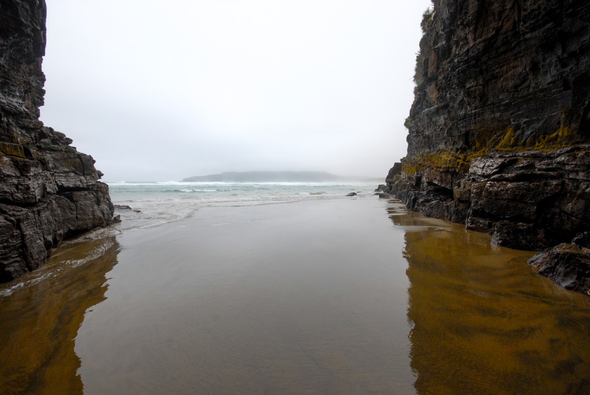
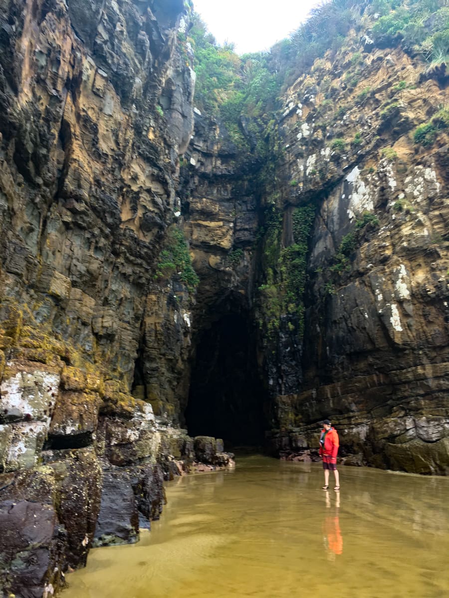
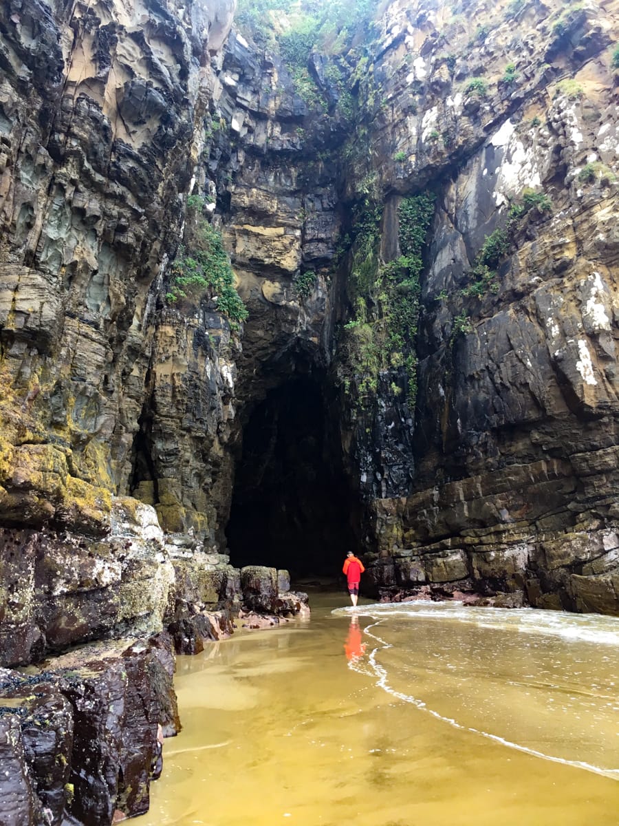
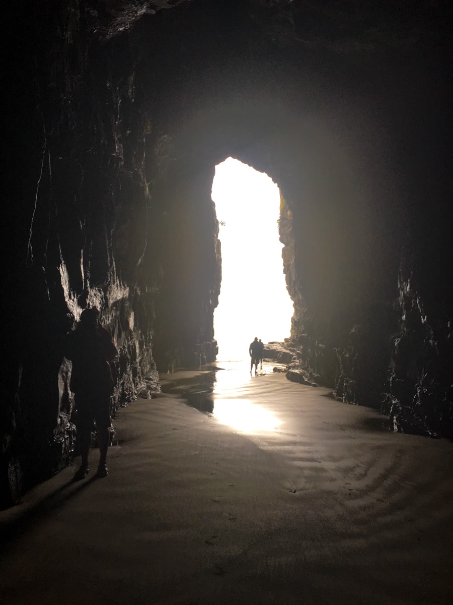
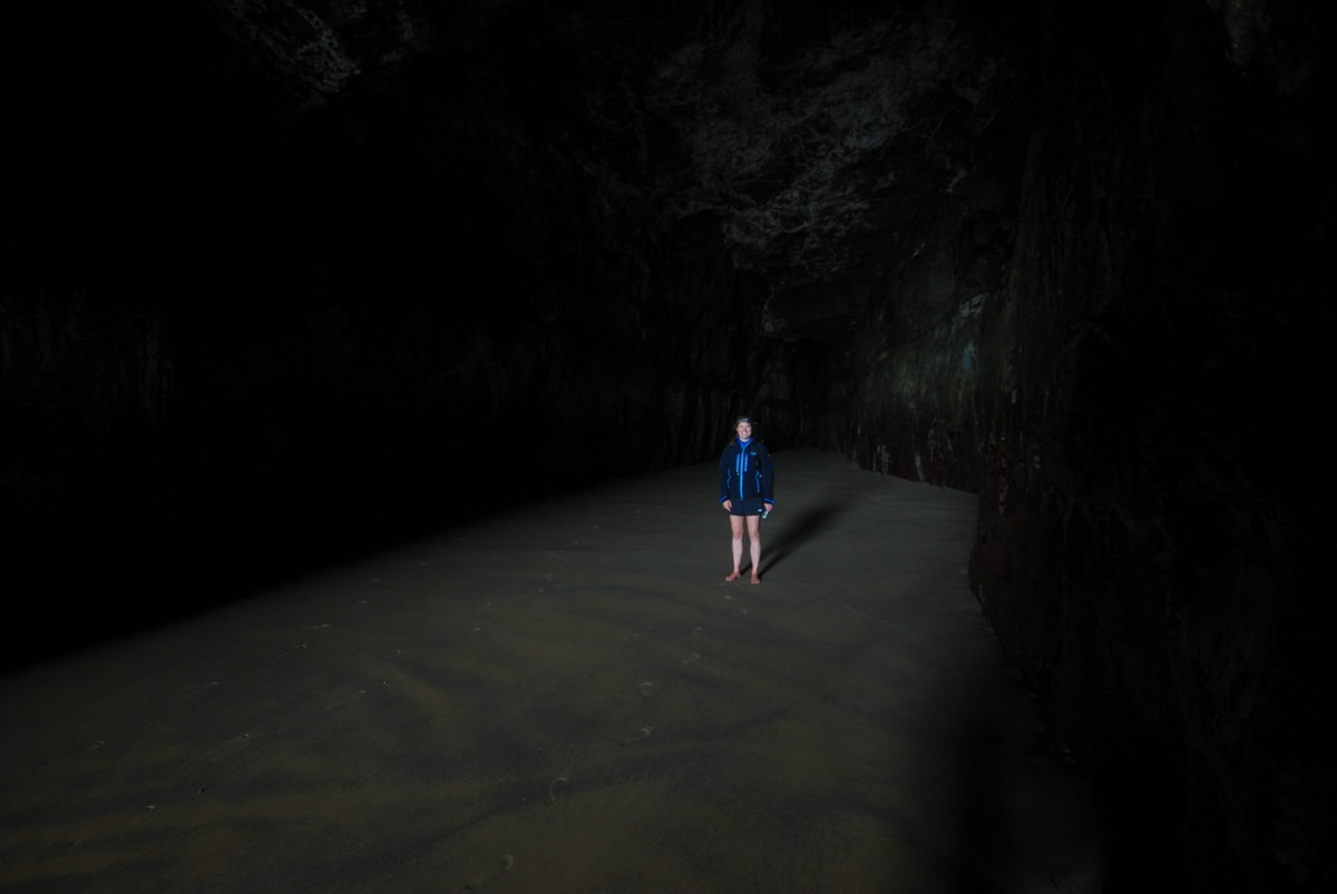
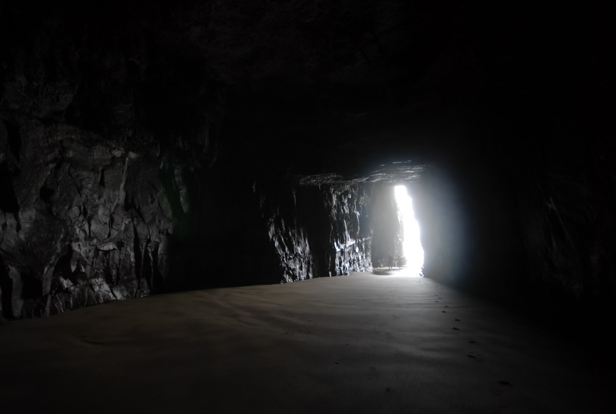
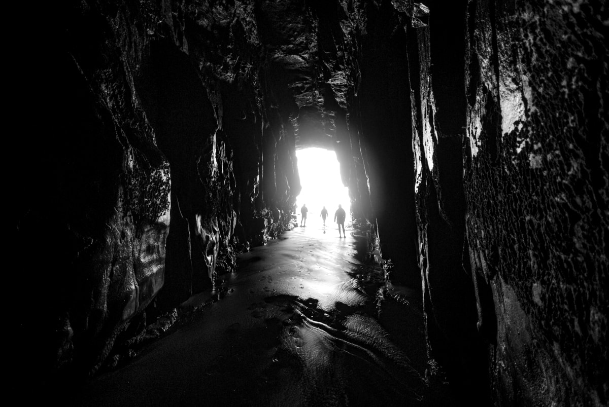
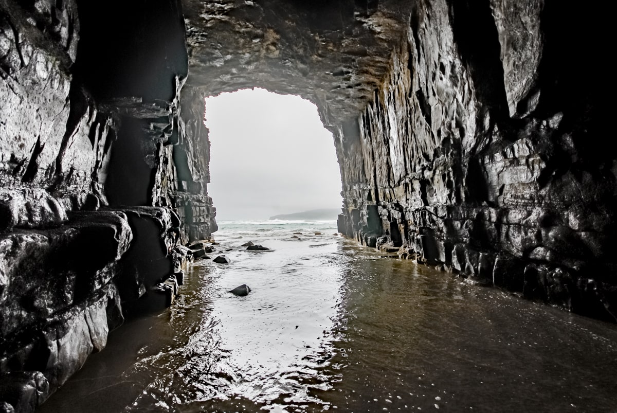
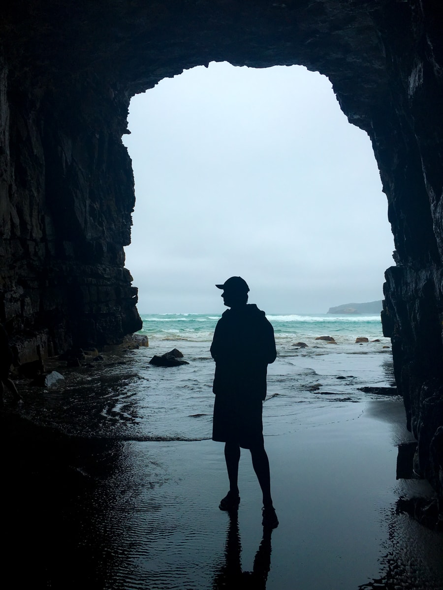
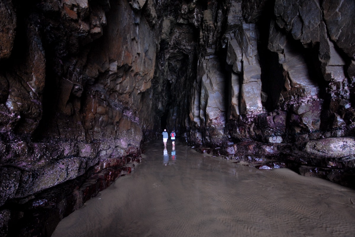
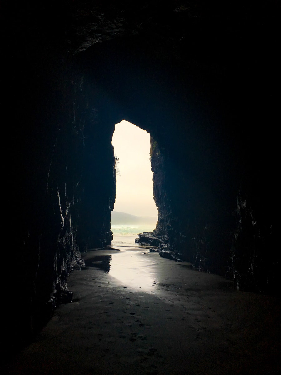
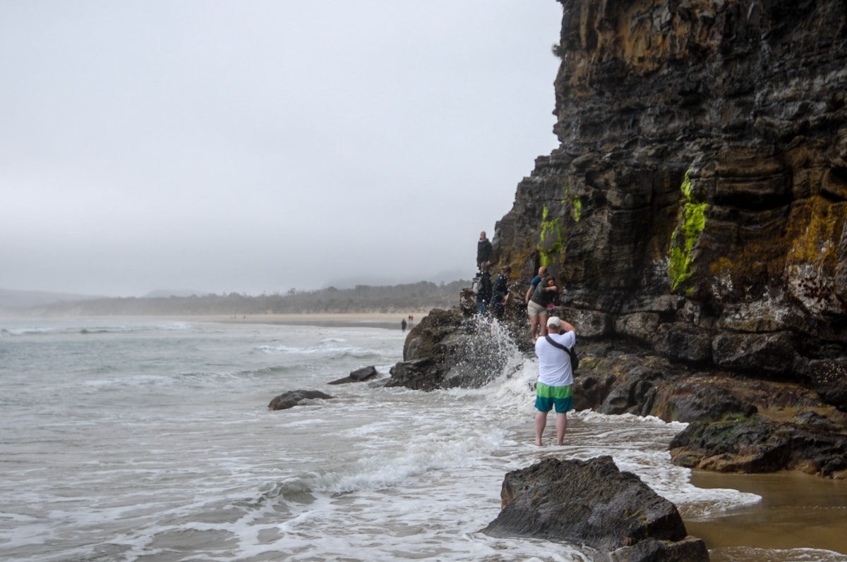
Onto the Caves! We showed up to the car park about two hours before the low tide mark, and so were probably the eighth car in a unusually large feeling lot (150 car capacity?). After learning that we should expect to get wet between the calf and the knee … and maybe up to the waist (because, as we learned later, they’d recently lost a foot of sand off the beach path leading around the sea wall to the Caves), we changed into shorts and sandals and took off down the 1k bush walk down to the coast. With a bit of fast walking and brave rock cliff skirting, we ended up being the second group into the Caves with only wet shins, which allowed us to do some exploring without tons of people around. The Caves are huge, super tall, and get dark quickly as you walk back into them. We both brought headlamps but quickly found that they weren’t much match for the cavernous space we were standing in.
After taking many photos and exploring around a bit, we headed back out, this time opting to wait for a lull in the waves and make a run for it across mostly water-less sand before the waves came crashing back (as opposed to walking above on a rock shelf in the cliff wall). We passed lots of folks on the way back in, and were again happy that we had showed up so early.
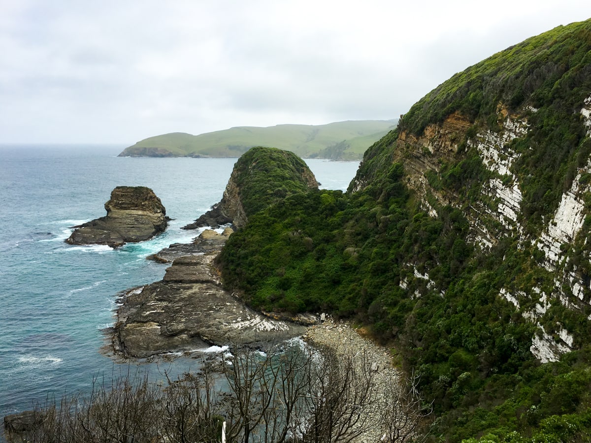
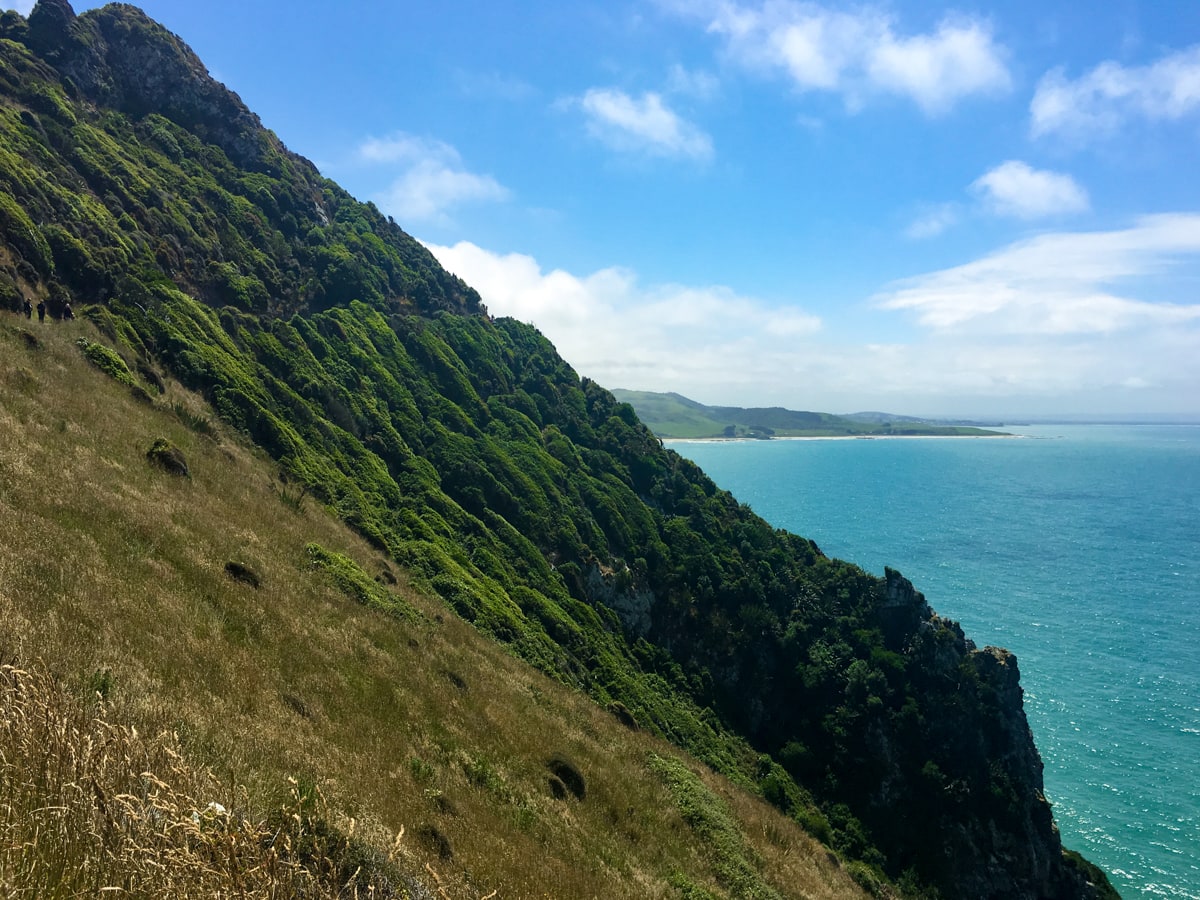
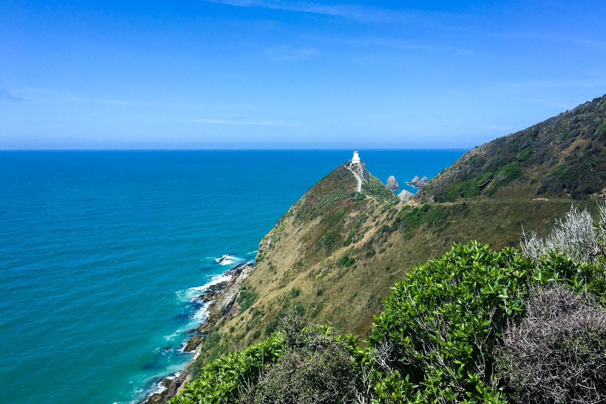
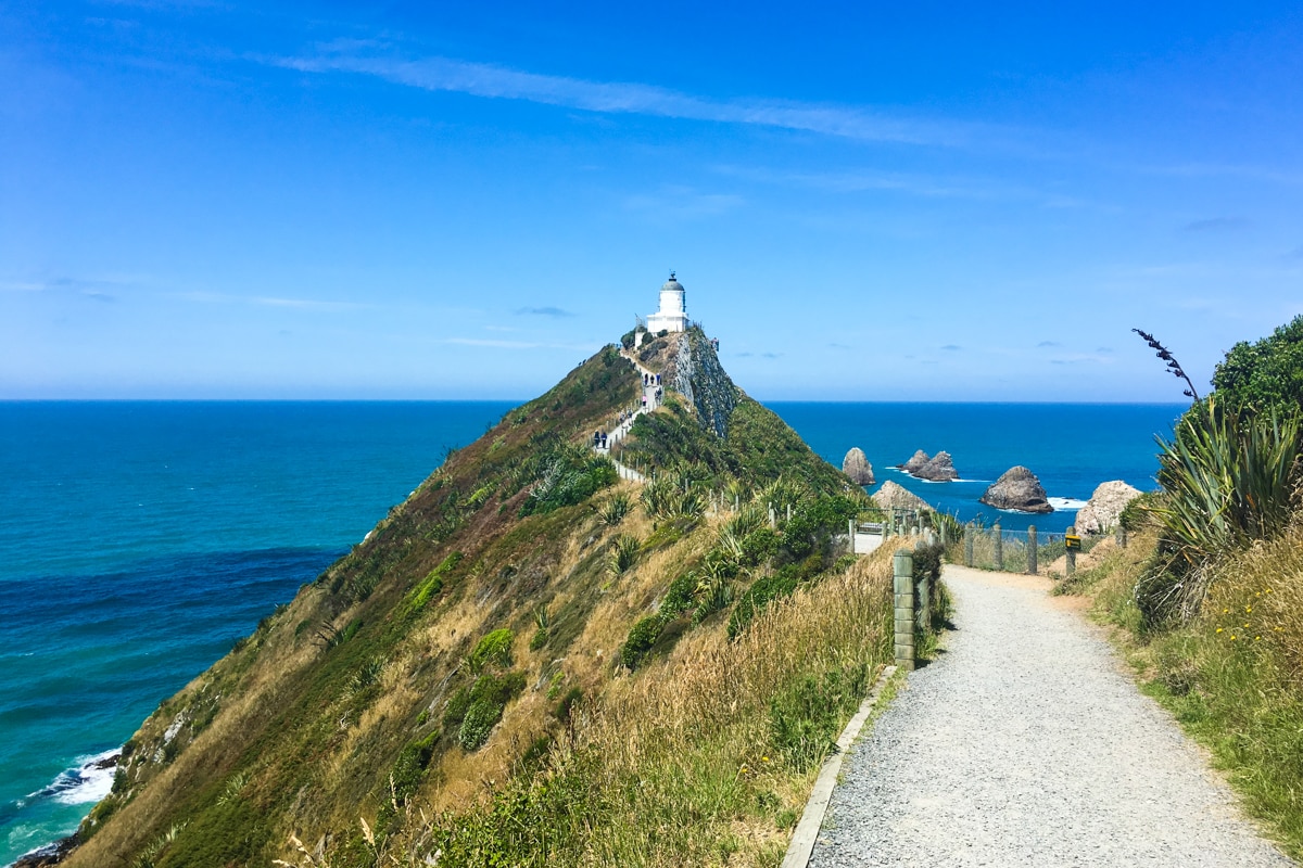
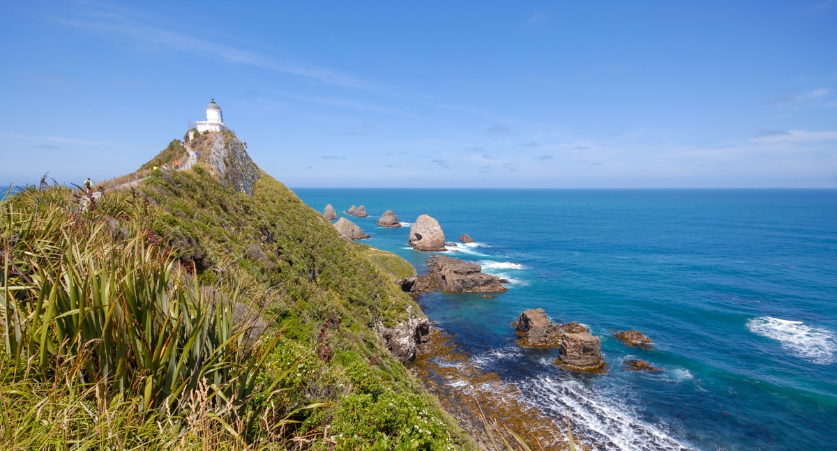
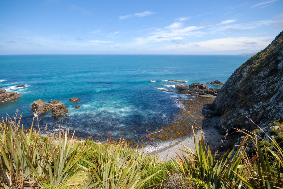
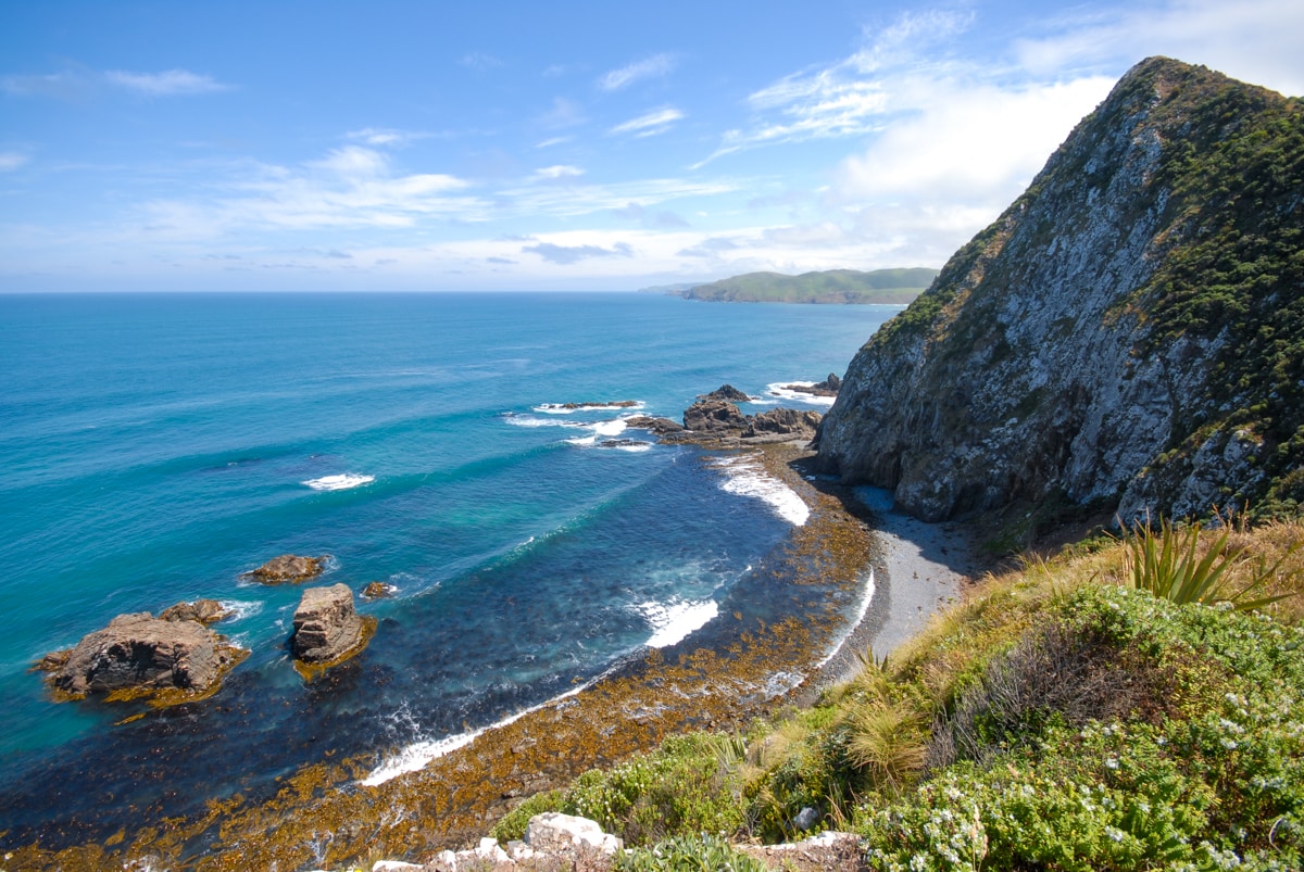
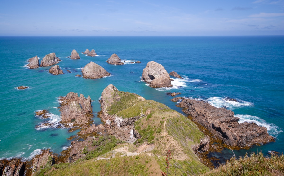
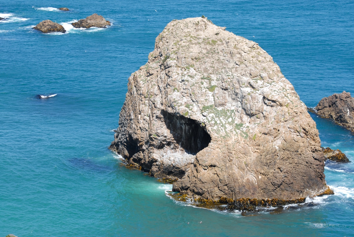
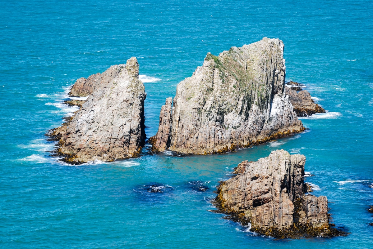
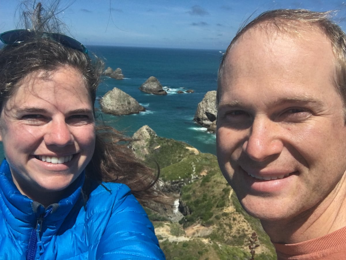
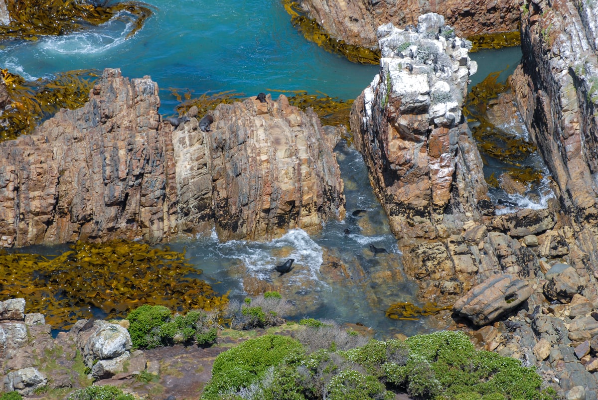
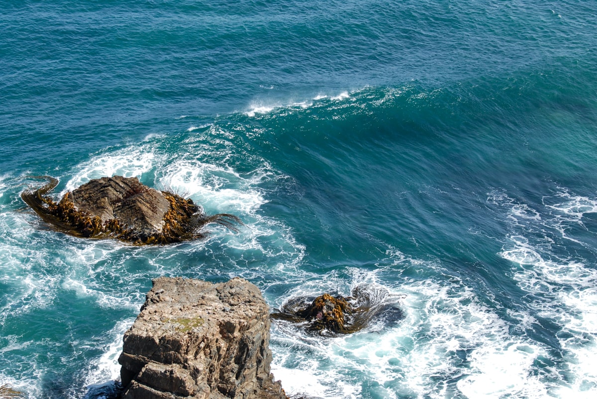
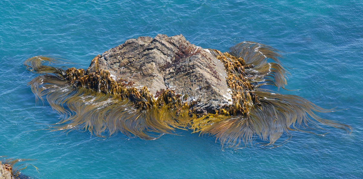
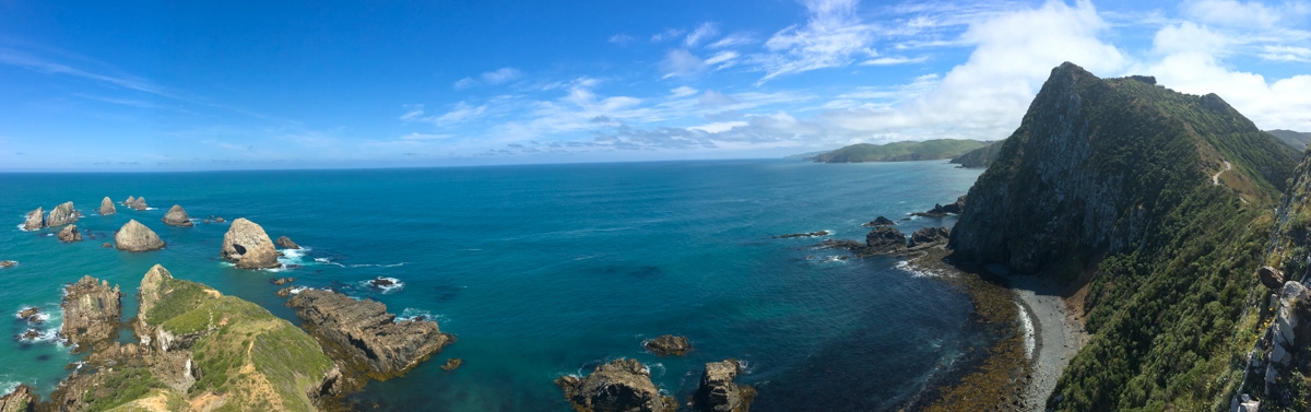
Nugget Point
Our last stop in the Catlins before heading up to Dunedin, Nugget Point was indicated on our map as another location to see fur seals and penguins. Given our previous lack of encounters with the promised wildlife, our hopes weren’t high. But Nugget Point was spectacular. There’s a lighthouse, and it’s pretty, and the road there is nice – but the scenery and wildlife was amazing. So many seals, birds, islands, cliffs, bays, kelp, and all those things all mixed together, plus a couple dolphins mixed in. We didn’t want to ever leave.
And there you have it! The Catlins, Lockbird style.
I think I just used 12% of my hotel’s internet allotment loading this page. Worth it.
Also, well done on the photo challenge – we’ll have to come up with round two!
Thanks! We spent a short bit of time earlier debating whether two different cow breeds counted as two different kinds of animals, but eventually decided on the stricter interpretation. : )
So much cool stuff, so few people! Amazing. That cave looks like a good time, but I don’t see any pics of you guys in waist deep water! Did all of the sand come back?
Hah, we did some scrambling on the rocks above the surf instead. The guy ahead of me definitely was in waist deep. I think they didn’t want to recommend the rock route in general – it was narrow in places.
SO MANY THINGS TO SAY!
1) I was really worried about that photo challenge. Thanks for pulling it off when we failed!
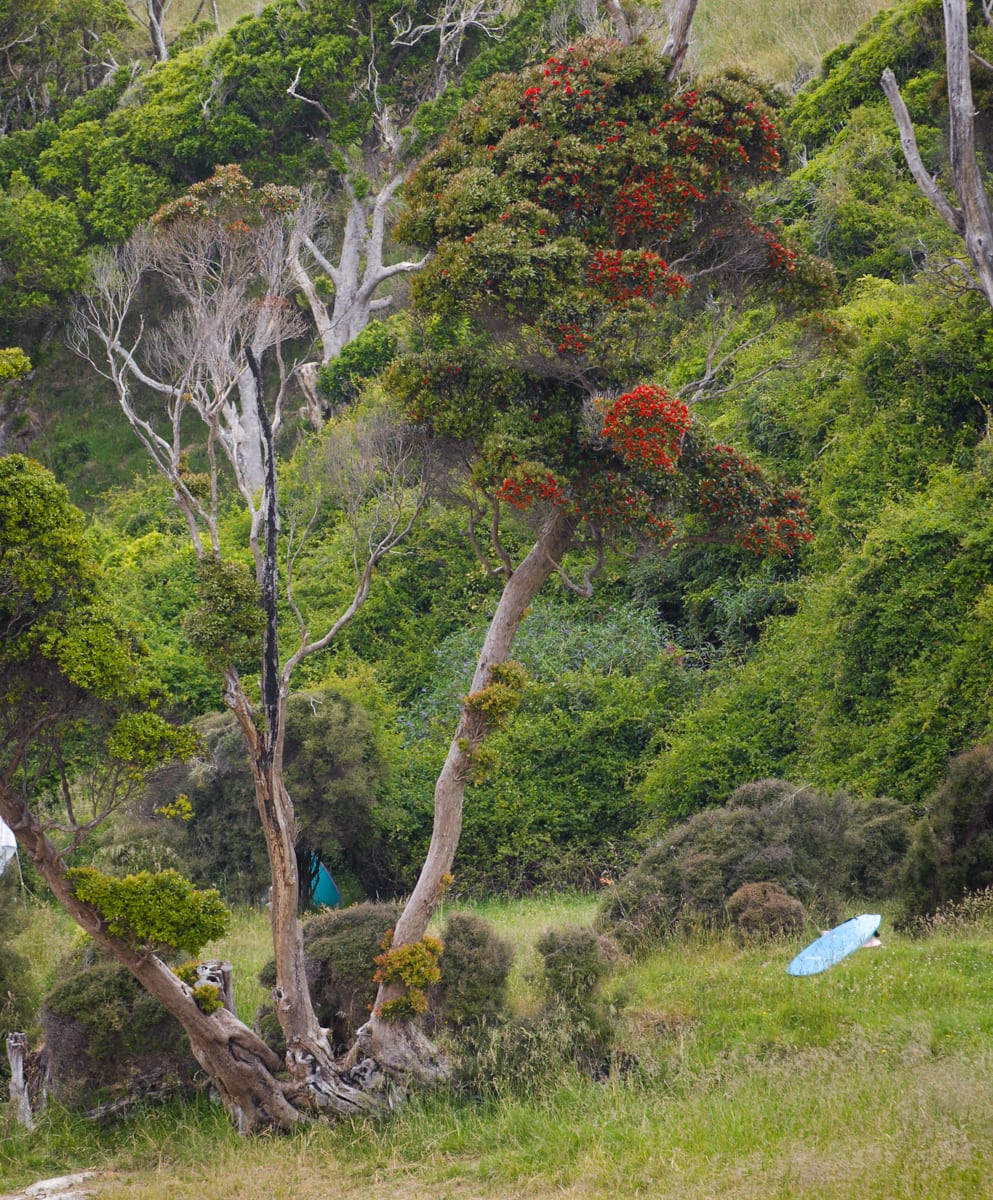
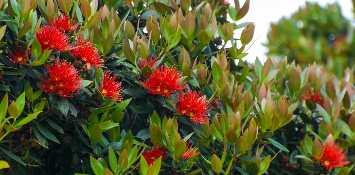
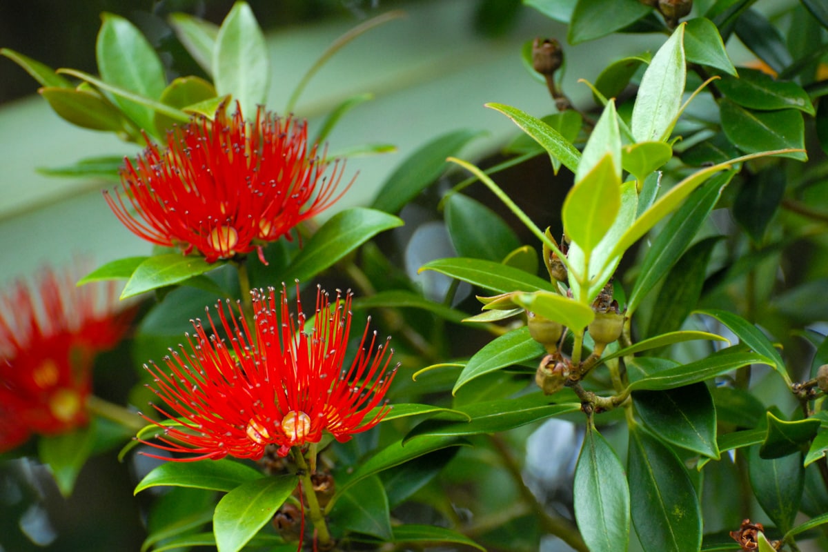
2) I love the pohutukawa and almost bought some christmas stuff with it for home :)
3) I’m glad you guys remembered headlamps this time.
4) I’ve got 13 seals and 12 birds. But it could be 13. I need a bigger picture.
5) Nugget Point looks awesome and I want to go!!
6) I’m glad I have real internet again and can actually look at your posts now. Woo!